 |
|
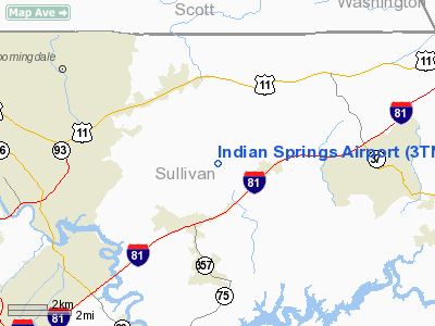
Location & QuickFacts
| FAA Information Effective: | 2008-09-25 |
| Airport Identifier: | 3TN0 |
| Airport Status: | Operational |
| Longitude/Latitude: | 082-25-05.0000W/36-32-07.0000N
-82.418056/36.535278 (Estimated) |
| Elevation: | 1550 ft / 472.44 m (Estimated) |
| Land: | 0 acres |
| From nearest city: | 6 nautical miles E of Kingsport, TN |
| Location: | Sullivan County, TN |
| Magnetic Variation: | 04W (1985) |
Owner & Manager
| Ownership: | Privately owned |
| Owner: | W.d.martin C/o R. Pike |
| Address: | 409 Wicklow Drive
Kingsport, TN 37664 |
| Phone number: | 423-323-9441 |
| Manager: | Richard Pike
LEASEE. |
| Address: | 409 Wicklow Drive
Kingsport, TN 37664 |
| Phone number: | 423-323-9441 |
Airport Operations and Facilities
| Airport Use: | Private
PERSONAL USE. |
| Segmented Circle: | No |
| Control Tower: | No |
| Sectional chart: | Cincinnati |
| Region: | ASO - Southern |
| Boundary ARTCC: | ZTL - Atlanta |
| Tie-in FSS: | BNA - Nashville |
| FSS Toll Free: | 1-800-WX-BRIEF |
Runway Information
Runway 05/23
| Dimension: | 750 x 30 ft / 228.6 x 9.1 m |
| Surface: | TURF, |
| |
Runway 05 |
Runway 23 |
| Traffic Pattern: | Left | Left |
| Obstruction: | 200 ft , 2000.0 ft from runway | |
|
Radio Navigation Aids
| ID |
Type |
Name |
Ch |
Freq |
Var |
Dist |
| BO | NDB | Booie | | 221.00 | 04W | 9.0 nm |
| EZT | NDB | Elizabethton | | 275.00 | 02W | 15.0 nm |
| RVN | NDB | Rogersville | | 329.00 | 04W | 23.0 nm |
| VJ | NDB | Whine | | 236.00 | 05W | 25.6 nm |
| JJO | NDB | Mountain City | | 396.00 | 04W | 29.6 nm |
| DYQ | NDB | Dulaney | | 263.00 | 04W | 33.2 nm |
| LQV | NDB | Long Hollow | | 252.00 | 03W | 33.3 nm |
| BAR | NDB | Hemlock | | 320.00 | 02W | 34.7 nm |
| GZG | VOR/DME | Glade Spring | 039X | 110.20 | 02W | 23.9 nm |
| HMV | VORTAC | Holston Mountain | 093X | 114.60 | 04W | 15.1 nm |
Remarks
- OWNER DESIRES ARPT NOT BE CHARTED.
- PRVDD VFR/PERSONAL USE; AND OPERATIONS ARE CONDUCTED IN ACCORDANCE W/PROCEDURES ESTABLISHED IN AN AGREEMENT BETWEEN LEASEE AND TRI-CITY ATCT.
Images and information placed above are from
http://www.airport-data.com/airport/3TN0/
We thank them for the data!
| General Info
|
| Country |
United States
|
| State |
TENNESSEE
|
| FAA ID |
3TN0
|
| Latitude |
36-32-07.000N
|
| Longitude |
082-25-50.000W
|
| Elevation |
1550 feet
|
| Near City |
KINGSPORT
|
We don't guarantee the information is fresh and accurate. The data may
be wrong or outdated.
For more up-to-date information please refer to other sources.
|
|


