 |
|
Location & QuickFacts
| FAA Information Effective: | 2008-09-25 |
| Airport Identifier: | TN16 |
| Airport Status: | Operational |
| Longitude/Latitude: | 088-27-40.1870W/35-59-40.2250N
-88.461163/35.994507 (Estimated) |
| Elevation: | 400 ft / 121.92 m (Estimated) |
| Land: | 40 acres |
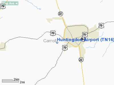
| From nearest city: | 2 nautical miles SW of Huntingdon, TN |
| Location: | Carroll County, TN |
| Magnetic Variation: | 01E (1985) |
Owner & Manager
| Ownership: | Privately owned |
| Owner: | Ernest Vickers |
| Address: | Rt 3 Box 10
Huntingdon, TN 38344 |
| Phone number: | 901-986-3617 |
| Manager: | Doug Vickers |
| Address: | Route 3, Box 10
Huntingdon, TN 38344 |
| Phone number: | 901-986-3617 |
Airport Operations and Facilities
| Airport Use: | Private |
| Wind indicator: | Yes |
| Segmented Circle: | No |
| Control Tower: | No |
| Lighting Schedule: | DUSK-DAWN |
| Landing fee charge: | No |
| Sectional chart: | St Louis |
| Region: | ASO - Southern |
| Boundary ARTCC: | ZME - Memphis |
| Tie-in FSS: | MKL - Jackson |
| FSS on Airport: | No |
| FSS Toll Free: | 1-800-WX-BRIEF |
Airport Services
| Airframe Repair: | NONE |
| Power Plant Repair: | NONE |
Runway Information
Runway 02/20
| Dimension: | 2870 x 100 ft / 874.8 x 30.5 m |
| Surface: | TURF, Fair Condition
ROUGH SURFACE. |
| Edge Lights: | Non-standard lighting system
NSTD LIRL; NO THR LGTS & NSTD SPACING. LIRL OTS INDEFLY. |
| |
Runway 02 |
Runway 20 |
| Traffic Pattern: | Left | Left |
| Obstruction: | 58 ft trees, 325.0 ft from runway, 100 ft left of centerline, 5:1 slope to clear | 28 ft trees, 150.0 ft from runway, 5:1 slope to clear |
|
Radio Navigation Aids
| ID |
Type |
Name |
Ch |
Freq |
Var |
Dist |
| HZD | NDB | Huntingdon | | 217.00 | 00E | 5.7 nm |
| TIQ | NDB | Trainer | | 410.00 | 00E | 15.5 nm |
| TGC | NDB | Gibson | | 378.00 | 01E | 19.3 nm |
| UC | NDB | Obion | | 212.00 | 00E | 31.7 nm |
| AEY | NDB | Waverly | | 329.00 | 00E | 35.7 nm |
| GGK | NDB | Mayfield | | 401.00 | 00E | 42.3 nm |
| SZY | NDB | Sibley | | 386.00 | 01E | 45.6 nm |
| DNT | NDB | Nally Dunston | | 343.00 | 01W | 45.9 nm |
| HHY | NDB | Pinhook | | 346.00 | 01W | 46.2 nm |
| JKS | VOR/DME | Jacks Creek | 031X | 109.40 | 02E | 24.3 nm |
| MKL | VOR/DME | Mc Kellar | 057X | 112.00 | 02E | 32.1 nm |
| DYR | VORTAC | Dyersburg | 115X | 116.80 | 03E | 41.7 nm |
Remarks
- 2' DITCH PARALLEL BOTH SIDES RWY.
- PROVIDED ALL OPERATIONS ARE CONDUCTED IN VFR WEATHER CONDITIONS.
Images and information placed above are from
http://www.airport-data.com/airport/TN16/
We thank them for the data!
| General Info
|
| Country |
United States
|
| State |
TENNESSEE
|
| FAA ID |
TN16
|
| Latitude |
35-59-40.225N
|
| Longitude |
088-27-40.187W
|
| Elevation |
400 feet
|
| Near City |
HUNTINGDON
|
We don't guarantee the information is fresh and accurate. The data may
be wrong or outdated.
For more up-to-date information please refer to other sources.
|
|


