 |
|
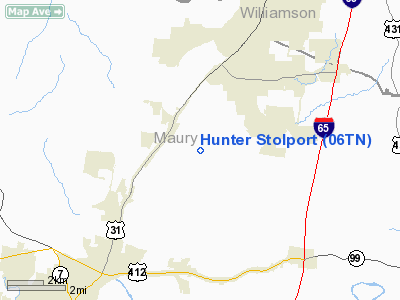
Location & QuickFacts
| FAA Information Effective: | 2008-09-25 |
| Airport Identifier: | 06TN |
| Airport Status: | Operational |
| Longitude/Latitude: | 086-57-25.0110W/35-41-50.2490N
-86.956947/35.697291 (Estimated) |
| Elevation: | 640 ft / 195.07 m (Estimated) |
| Land: | 22 acres |
| From nearest city: | 6 nautical miles NE of Columbia, TN |
| Location: | Maury County, TN |
| Magnetic Variation: | 00W (1985) |
Owner & Manager
| Ownership: | Privately owned |
| Owner: | W. A. Hunter, Jr. |
| Address: | 2816 Hunter Field Lane
Columbia, TN 38401 |
| Phone number: | 615-486-2336 |
| Manager: | W. A. Hunter, Jr.
OTHER CONTACT: WAYNE BOLIN 2820 HUNTER FIELD COLUMBIA, TN 931-486-0496 |
| Address: | 2816 Hunter Field Lane
Nashville, TN 37211 |
| Phone number: | 615-486-2336 |
Airport Operations and Facilities
| Airport Use: | Private |
| Wind indicator: | Yes |
| Segmented Circle: | No |
| Control Tower: | No |
| Landing fee charge: | No |
| Sectional chart: | Atlanta |
| Region: | ASO - Southern |
| Boundary ARTCC: | ZME - Memphis |
| Tie-in FSS: | MKL - Jackson |
| FSS on Airport: | No |
| FSS Toll Free: | 1-800-WX-BRIEF |
Airport Services
| Airframe Repair: | NONE |
| Power Plant Repair: | NONE |
Runway Information
Runway 05/23
| Dimension: | 2000 x 50 ft / 609.6 x 15.2 m |
| Surface: | TURF, Fair Condition |
| |
Runway 05 |
Runway 23 |
| Traffic Pattern: | Left | Left |
| Markings: | Nonstandard, | Nonstandard, |
| Obstruction: | 40 ft trees, 225.0 ft from runway, 100 ft right of centerline, 5:1 slope to clear | 14 ft trees, 100.0 ft from runway, 50 ft left of centerline, 7:1 slope to clear |
|
Radio Navigation Aids
| ID |
Type |
Name |
Ch |
Freq |
Var |
Dist |
| SYI | FAN MARKER | Bomar | | | 01W | 27.2 nm |
| PBC | NDB | Maury County | | 365.00 | 01W | 8.5 nm |
| LUG | NDB | Verona | | 251.00 | 00W | 13.8 nm |
| SWZ | NDB | Sewart | | 391.00 | 02W | 28.6 nm |
| LRT | NDB | Lawrenceburg | | 269.00 | 00E | 31.5 nm |
| FQW | NDB | Walter Hill | | 371.00 | 02W | 32.7 nm |
| GZS | NDB | Giles/dcmsnd | | 375.00 | 00E | 33.2 nm |
| VI | NDB | Opery | | 344.00 | 02W | 33.9 nm |
| DMZ | NDB | Dickson | | 203.00 | 01W | 34.7 nm |
| JHG | NDB | Hohenwald | | 257.00 | 01W | 35.8 nm |
| ULH | NDB | Burwi | | 332.00 | 03W | 37.7 nm |
| TNY | NDB | Kelso | | 358.00 | 01W | 39.5 nm |
| JUE | NDB | Lebanon | | 414.00 | 02W | 43.2 nm |
| ON | NDB | Music | | 279.00 | 03W | 45.2 nm |
| AEY | NDB | Waverly | | 329.00 | 00E | 45.7 nm |
| UXM | VOR | Tullahoma Regional | | 109.65 | 03W | 39.7 nm |
| SYI | VOR/DME | Shelbyville | 027X | 109.00 | 01W | 26.6 nm |
| GHM | VORTAC | Graham | 053X | 111.60 | 03E | 25.5 nm |
| BNA | VORTAC | Nashville | 088X | 114.10 | 02W | 29.6 nm |
| MQY | VOT | Smyrna | | 110.20 | | 28.7 nm |
| BNA | VOT | Nashville Metropoln | | 108.60 | | 29.1 nm |
| HSV | VOT | Huntsville | | 111.00 | | 43.9 nm |
Images and information placed above are from
http://www.airport-data.com/airport/06TN/
We thank them for the data!
| General Info
|
| Country |
United States
|
| State |
TENNESSEE
|
| FAA ID |
06TN
|
| Latitude |
35-41-50.249N
|
| Longitude |
086-57-25.011W
|
| Elevation |
640 feet
|
| Near City |
COLUMBIA
|
We don't guarantee the information is fresh and accurate. The data may
be wrong or outdated.
For more up-to-date information please refer to other sources.
|
|


