 |
|
| Humboldt Municipal Airport |
| IATA: none – ICAO: none – FAA LID: M53 |
| Summary |
| Airport type |
Public |
| Owner |
City of Humboldt |
| Serves |
Humboldt, Tennessee |
| Elevation AMSL |
421 ft / 128 m |
| Coordinates |
35°48′08″N 088°52′30″W / 35.80222°N 88.875°W / 35.80222; -88.875 |
| Runways |
| Direction |
Length |
Surface |
| ft |
m |
| 4/22 |
4,003 |
1,220 |
Asphalt |
| Statistics (1999) |
| Aircraft operations |
10,222 |
| Based aircraft |
19 |
| Source: Federal Aviation Administration |
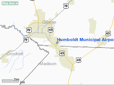
Humboldt Municipal Airport (FAA LID: M53) is a public-use airport located in Gibson County, Tennessee, United States. It is three nautical miles (6 km) southeast of the central business district of the City of Humboldt, which owns the airport. According to the FAA's National Plan of Integrated Airport Systems for 2009–2013, it was classified as a general aviation airport.
Facilities and aircraft
Humboldt Municipal Airport covers an area of 128 acres (52 ha) at an elevation of 421 feet (128 m) above mean sea level. It has one runway designated 4/22 with an asphalt surface measuring 4,003 by 75 feet (1,220 x 23 m).
For the 12-month period ending November 23, 1999, the airport had 10,222 aircraft operations, an average of 28 per day: 98.5% general aviation, 1% air taxi, and 0.5% military. At that time there were 19 aircraft based at this airport: 89.5% single-engine and 10.5% multi-engine.
The above content comes from Wikipedia and is published under free licenses – click here to read more.
Location & QuickFacts
| FAA Information Effective: | 2008-09-25 |
| Airport Identifier: | M53 |
| Airport Status: | Operational |
| Longitude/Latitude: | 088-52-29.8180W/35-48-07.8480N
-88.874949/35.802180 (Estimated) |
| Elevation: | 421 ft / 128.32 m (Surveyed) |
| Land: | 128 acres |
| From nearest city: | 3 nautical miles SE of Humboldt, TN |
| Location: | Gibson County, TN |
| Magnetic Variation: | 01E (1985) |
Owner & Manager
| Ownership: | Publicly owned |
| Owner: | City Of Humboldt |
| Address: | City Hall
Humboldt, TN 38343 |
| Phone number: | 731-784-2511 |
| Manager: | Guy Londe |
| Address: | 4655 Main St
Humbocdt, TN 38343 |
| Phone number: | 731-784-5571 |
Airport Operations and Facilities
| Airport Use: | Open to public |
| Wind indicator: | Yes |
| Segmented Circle: | Yes |
| Control Tower: | No |
| Lighting Schedule: | DUSK-DAWN |
| Beacon Color: | Clear-Green (lighted land airport) |
| Landing fee charge: | No |
| Sectional chart: | Memphis |
| Region: | ASO - Southern |
| Boundary ARTCC: | ZME - Memphis |
| Tie-in FSS: | MKL - Jackson |
| FSS on Airport: | No |
| FSS Toll Free: | 1-800-WX-BRIEF |
| NOTAMs Facility: | MKL (NOTAM-d service avaliable) |
| Federal Agreements: | NGY |
Airport Communications
| CTAF: | 122.800 |
| Unicom: | 122.800 |
Airport Services
| Fuel available: | 100LL |
| Airframe Repair: | MAJOR |
| Power Plant Repair: | MAJOR |
| Bottled Oxygen: | NONE |
| Bulk Oxygen: | NONE |
Runway Information
Runway 04/22
| Dimension: | 4003 x 75 ft / 1220.1 x 22.9 m |
| Surface: | ASPH, Good Condition |
| Weight Limit: | Single wheel: 16000 lbs.
Dual wheel: 26000 lbs. |
| Edge Lights: | Medium
RY 04/22 LIGHTS OTS - PRESET AT STEP 1. |
| |
Runway 04 |
Runway 22 |
| Longitude: | 088-52-46.7590W | 088-52-12.7970W |
| Latitude: | 35-47-53.7410N | 35-48-21.9790N |
| Elevation: | 407.00 ft | 421.00 ft |
| Alignment: | 44 | 127 |
| Traffic Pattern: | Left | Left |
| Markings: | Non-precision instrument, Good Condition | Non-precision instrument, Good Condition |
| VASI: | 2-light PAPI on left side | 2-light PAPI on left side |
| Runway End Identifier: | Yes | Yes |
| Obstruction: | 25 ft trees, 642.0 ft from runway, 97 ft right of centerline, 17:1 slope to clear
+19 FT ROAD AT 320 FT ; 250 FT R OF CNTRLN. | 38 ft trees, 1200.0 ft from runway, 64 ft left of centerline, 26:1 slope to clear |
|
Radio Navigation Aids
| ID |
Type |
Name |
Ch |
Freq |
Var |
Dist |
| TGC | NDB | Gibson | | 378.00 | 01E | 8.0 nm |
| HZD | NDB | Huntingdon | | 217.00 | 00E | 26.3 nm |
| DNT | NDB | Nally Dunston | | 343.00 | 01W | 28.3 nm |
| UC | NDB | Obion | | 212.00 | 00E | 30.3 nm |
| TIQ | NDB | Trainer | | 410.00 | 00E | 35.0 nm |
| BAV | NDB | Hardeman | | 404.00 | 01E | 36.3 nm |
| COO | NDB | Covington | | 326.00 | 02E | 37.0 nm |
| SZY | NDB | Sibley | | 386.00 | 01E | 38.2 nm |
| FYE | NDB | Somerville | | 255.00 | 00E | 43.9 nm |
| HHY | NDB | Pinhook | | 346.00 | 01W | 46.5 nm |
| IUI | NDB | Hicks | | 350.00 | 01E | 47.4 nm |
| MKL | VOR/DME | Mc Kellar | 057X | 112.00 | 02E | 12.1 nm |
| JKS | VOR/DME | Jacks Creek | 031X | 109.40 | 02E | 28.0 nm |
| DYR | VORTAC | Dyersburg | 115X | 116.80 | 03E | 25.2 nm |
Remarks
- RY 04/22 15-30 FT TREES WEST OF RY VIOLATE TRANSITION SLOPE.
- AGRICULTURAL ACFT OPNS ON & INVOF ARPT.
- TWY LGTS VERY LOW INTST.
Images and information placed above are from
http://www.airport-data.com/airport/M53/
We thank them for the data!
| General Info
|
| Country |
United States
|
| State |
TENNESSEE
|
| FAA ID |
M53
|
| Latitude |
35-48-07.848N
|
| Longitude |
088-52-29.818W
|
| Elevation |
421 feet
|
| Near City |
HUMBOLDT
|
We don't guarantee the information is fresh and accurate. The data may
be wrong or outdated.
For more up-to-date information please refer to other sources.
|
|


