 |
|
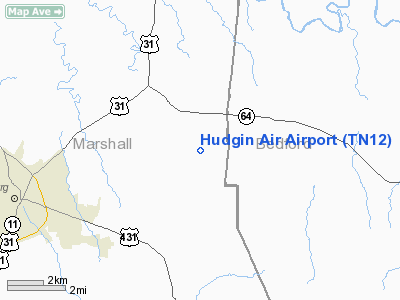
Location & QuickFacts
| FAA Information Effective: | 2008-09-25 |
| Airport Identifier: | TN12 |
| Airport Status: | Operational |
| Longitude/Latitude: | 086-40-48.0000W/35-28-25.0000N
-86.680000/35.473611 (Estimated) |
| Elevation: | 725 ft / 220.98 m (Estimated) |
| Land: | 125 acres |
| From nearest city: | 5 nautical miles NE of Lewisburg, TN |
| Location: | Marshall County, TN |
| Magnetic Variation: | 01W (1995) |
Owner & Manager
| Ownership: | Privately owned |
| Owner: | James P. Hudgin |
| Address: | 2569 Phillips Road
Lewisburg, TN 37091 |
| Phone number: | 931-359-8683 |
| Manager: | James P. Hudgin |
| Address: | 2569 Phillips Road
Lewisburg, TN 37091 |
| Phone number: | 931-359-8683 |
Airport Operations and Facilities
| Airport Use: | Private |
| Wind indicator: | Yes |
| Segmented Circle: | No |
| Control Tower: | No |
| Sectional chart: | Atlanta |
| Region: | ASO - Southern |
| Boundary ARTCC: | ZME - Memphis |
| Tie-in FSS: | MKL - Jackson |
| FSS Toll Free: | 1-800-WX-BRIEF |
Runway Information
Runway 13/31
| Dimension: | 3100 x 75 ft / 944.9 x 22.9 m |
| Surface: | TURF, |
| |
Runway 13 |
Runway 31 |
| Traffic Pattern: | Left | Left |
| Obstruction: | 50 ft | 100 ft tree, 400.0 ft from runway |
|
Radio Navigation Aids
| ID |
Type |
Name |
Ch |
Freq |
Var |
Dist |
| SYI | FAN MARKER | Bomar | | | 01W | 10.5 nm |
| LUG | NDB | Verona | | 251.00 | 00W | 6.6 nm |
| ULH | NDB | Burwi | | 332.00 | 03W | 21.5 nm |
| TNY | NDB | Kelso | | 358.00 | 01W | 21.5 nm |
| PBC | NDB | Maury County | | 365.00 | 01W | 21.7 nm |
| GZS | NDB | Giles/dcmsnd | | 375.00 | 00E | 26.8 nm |
| SWZ | NDB | Sewart | | 391.00 | 02W | 30.9 nm |
| LRT | NDB | Lawrenceburg | | 269.00 | 00E | 31.9 nm |
| FQW | NDB | Walter Hill | | 371.00 | 02W | 33.0 nm |
| BGF | NDB | Boiling Fork | | 263.00 | 02W | 34.9 nm |
| UOS | NDB | Sewanee | | 275.00 | 02E | 41.7 nm |
| CWH | NDB | Capshaw | | 350.00 | 01W | 42.4 nm |
| VI | NDB | Opery | | 344.00 | 02W | 43.9 nm |
| JHG | NDB | Hohenwald | | 257.00 | 01W | 46.5 nm |
| HUA | NDB | Redstone | | 287.00 | 00W | 46.6 nm |
| JUE | NDB | Lebanon | | 414.00 | 02W | 46.7 nm |
| RN | NDB | Warri | | 209.00 | 02W | 47.8 nm |
| UXM | VOR | Tullahoma Regional | | 109.65 | 03W | 22.0 nm |
| SYI | VOR/DME | Shelbyville | 027X | 109.00 | 01W | 12.9 nm |
| BNA | VORTAC | Nashville | 088X | 114.10 | 02W | 39.9 nm |
| RQZ | VORTAC | Rocket | 059X | 112.20 | 02E | 40.7 nm |
| GHM | VORTAC | Graham | 053X | 111.60 | 03E | 43.5 nm |
| HSV | VOT | Huntsville | | 111.00 | | 29.9 nm |
| MQY | VOT | Smyrna | | 110.20 | | 33.1 nm |
| BNA | VOT | Nashville Metropoln | | 108.60 | | 39.3 nm |
Remarks
- 300 FT ANT 2.5 NM NORTH OF ARPT.
Images and information placed above are from
http://www.airport-data.com/airport/TN12/
We thank them for the data!
| General Info
|
| Country |
United States
|
| State |
TENNESSEE
|
| FAA ID |
TN12
|
| Latitude |
35-28-25.000N
|
| Longitude |
086-40-48.000W
|
| Elevation |
725 feet
|
| Near City |
LEWISBURG
|
We don't guarantee the information is fresh and accurate. The data may
be wrong or outdated.
For more up-to-date information please refer to other sources.
|
|


