 |
|
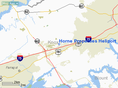
Horne Properties Heliport |
Location & QuickFacts
| FAA Information Effective: | 2008-09-25 |
| Airport Identifier: | 0TN7 |
| Airport Status: | Operational |
| Longitude/Latitude: | 084-05-28.0000W/35-55-25.0000N
-84.091111/35.923611 (Estimated) |
| Elevation: | 975 ft / 297.18 m (Estimated) |
| Land: | 0 acres |
| From nearest city: | 8 nautical miles NE of Knoxville, TN |
| Location: | Knox County, TN |
| Magnetic Variation: | 04W (1995) |
Owner & Manager
| Ownership: | Privately owned |
| Owner: | Horne Properties |
| Address: | 412 N. Cedar Bluff Rd Suite 205
Knoxville, TN 37923 |
| Phone number: | 865-560-1100 |
| Manager: | Horne Properties |
| Address: | 412 N, Cedar Bluff Rd Suite 205
Knoxville, TN 37923 |
| Phone number: | 865-560-1100 |
Airport Operations and Facilities
| Airport Use: | Private |
| Wind indicator: | Yes |
| Segmented Circle: | No |
| Control Tower: | No |
| Lighting Schedule: | 24 HRS |
| Sectional chart: | Atlanta |
| Region: | ASO - Southern |
| Boundary ARTCC: | ZTL - Atlanta |
| Tie-in FSS: | BNA - Nashville |
| FSS Toll Free: | 1-800-WX-BRIEF |
Runway Information
Helipad H1
| Dimension: | 45 x 45 ft / 13.7 x 13.7 m |
| Surface: | CONC, |
| |
Runway H1 |
Runway |
| Traffic Pattern: | Left | Left |
|
Radio Navigation Aids
| ID |
Type |
Name |
Ch |
Freq |
Var |
Dist |
| JAU | NDB | Jacksboro | | 204.00 | 03W | 25.1 nm |
| MNV | NDB | Madisonville | | 361.00 | 04W | 26.8 nm |
| JXT | NDB | Jefferson | | 346.00 | 04W | 32.0 nm |
| MMI | NDB | Mc Minn County | | 242.00 | 03W | 39.2 nm |
| BPO | NDB | Piney Grove | | 403.00 | 05W | 41.5 nm |
| DTE | NDB | Mark Anton | | 394.00 | 02W | 48.8 nm |
| TTQ | NDB | Tomotla | | 335.00 | 01W | 49.0 nm |
| VXV | VORTAC | Volunteer | 111X | 116.40 | 03W | 9.6 nm |
| HCH | VORTAC | Hinch Mountain | 123X | 117.60 | 02W | 44.1 nm |
| TYS | VOT | Knoxville | | 112.00 | | 8.2 nm |
Remarks
- SEE AIRSPACE CASE 79-MEM-004-NRA.
Images and information placed above are from
http://www.airport-data.com/airport/0TN7/
We thank them for the data!
| General Info
|
| Country |
United States
|
| State |
TENNESSEE
|
| FAA ID |
0TN7
|
| Latitude |
35-55-25.000N
|
| Longitude |
084-05-28.000W
|
| Elevation |
975 feet
|
| Near City |
KNOXVILLE
|
We don't guarantee the information is fresh and accurate. The data may
be wrong or outdated.
For more up-to-date information please refer to other sources.
|
|


