 |
|
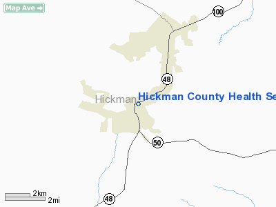
Hickman County Health Services Heliport |
Location & QuickFacts
| FAA Information Effective: | 2008-09-25 |
| Airport Identifier: | TN22 |
| Airport Status: | Operational |
| Longitude/Latitude: | 087-27-49.0000W/35-46-56.0000N
-87.463611/35.782222 (Estimated) |
| Elevation: | 760 ft / 231.65 m (Estimated) |
| Land: | 1 acres |
| From nearest city: | 0 nautical miles NE of Centerville, TN |
| Location: | Hickman County, TN |
| Magnetic Variation: | 01W (1995) |
Owner & Manager
| Ownership: | Privately owned |
| Owner: | Hickman County, Steve Gregory |
| Address: | Hickman County Courthouse
Centerville, TN 37033 |
| Phone number: | 615-729-4271 |
| Manager: | Jack M. Keller, Administrator |
| Address: | Hickman County Health Services, 135 East Swan Street
Centerville, TN 37033 |
| Phone number: | 615-729-4271 |
Airport Operations and Facilities
| Airport Use: | Private |
| Wind indicator: | Yes |
| Segmented Circle: | No |
| Control Tower: | No |
| Sectional chart: | Atlanta |
| Region: | ASO - Southern |
| Boundary ARTCC: | ZME - Memphis |
| Tie-in FSS: | MKL - Jackson |
| FSS Toll Free: | 1-800-WX-BRIEF |
Runway Information
Helipad H1
| Dimension: | 30 x 30 ft / 9.1 x 9.1 m |
| Surface: | CONC, |
| |
Runway H1 |
Runway |
| Traffic Pattern: | Left | Left |
|
Radio Navigation Aids
| ID |
Type |
Name |
Ch |
Freq |
Var |
Dist |
| DMZ | NDB | Dickson | | 203.00 | 01W | 20.8 nm |
| JHG | NDB | Hohenwald | | 257.00 | 01W | 20.9 nm |
| PBC | NDB | Maury County | | 365.00 | 01W | 21.0 nm |
| AEY | NDB | Waverly | | 329.00 | 00E | 24.2 nm |
| LRT | NDB | Lawrenceburg | | 269.00 | 00E | 34.3 nm |
| LUG | NDB | Verona | | 251.00 | 00W | 36.2 nm |
| GZS | NDB | Giles/dcmsnd | | 375.00 | 00E | 42.8 nm |
| ON | NDB | Music | | 279.00 | 03W | 46.1 nm |
| VI | NDB | Opery | | 344.00 | 02W | 46.9 nm |
| HHY | NDB | Pinhook | | 346.00 | 01W | 48.2 nm |
| SWZ | NDB | Sewart | | 391.00 | 02W | 49.8 nm |
| JKS | VOR/DME | Jacks Creek | 031X | 109.40 | 02E | 45.1 nm |
| GHM | VORTAC | Graham | 053X | 111.60 | 03E | 3.2 nm |
| BNA | VORTAC | Nashville | 088X | 114.10 | 02W | 43.5 nm |
| BNA | VOT | Nashville Metropoln | | 108.60 | | 43.3 nm |
| MQY | VOT | Smyrna | | 110.20 | | 48.4 nm |
Remarks
Images and information placed above are from
http://www.airport-data.com/airport/TN22/
We thank them for the data!
| General Info
|
| Country |
United States
|
| State |
TENNESSEE
|
| FAA ID |
TN22
|
| Latitude |
35-46-56.000N
|
| Longitude |
087-27-49.000W
|
| Elevation |
760 feet
|
| Near City |
CENTERVILLE
|
We don't guarantee the information is fresh and accurate. The data may
be wrong or outdated.
For more up-to-date information please refer to other sources.
|
|


