 |
|
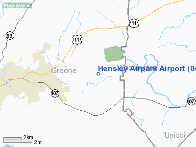
Location & QuickFacts
| FAA Information Effective: | 2008-09-25 |
| Airport Identifier: | 04TN |
| Airport Status: | Operational |
| Longitude/Latitude: | 082-40-44.0000W/36-11-00.0000N
-82.678889/36.183333 (Estimated) |
| Elevation: | 1430 ft / 435.86 m (Estimated) |
| Land: | 7 acres |
| From nearest city: | 2 nautical miles S of Chuckey, TN |
| Location: | Greene County, TN |
| Magnetic Variation: | 05W (1995) |
Owner & Manager
| Ownership: | Privately owned |
| Owner: | Teo Hensley |
| Address: | 1935 Earnest Road
Chuckey, TN 37641 |
| Phone number: | 423-257-5352 |
| Manager: | Ted Hensley |
| Address: | 1935 Earnest Road
Chuckey, TN 37641 |
| Phone number: | 423-620-1614 |
Airport Operations and Facilities
| Airport Use: | Private |
| Wind indicator: | Yes |
| Segmented Circle: | No |
| Control Tower: | No |
| Sectional chart: | Cincinnati |
| Region: | ASO - Southern |
| Boundary ARTCC: | ZTL - Atlanta |
| Tie-in FSS: | BNA - Nashville |
| FSS Toll Free: | 1-800-WX-BRIEF |
Runway Information
Runway 01/19
| Dimension: | 3000 x 50 ft / 914.4 x 15.2 m |
| Surface: | ASPH, |
| |
Runway 01 |
Runway 19 |
| Traffic Pattern: | Left | Left |
|
Radio Navigation Aids
| ID |
Type |
Name |
Ch |
Freq |
Var |
Dist |
| DYQ | NDB | Dulaney | | 263.00 | 04W | 10.7 nm |
| BO | NDB | Booie | | 221.00 | 04W | 15.7 nm |
| RVN | NDB | Rogersville | | 329.00 | 04W | 19.2 nm |
| EZT | NDB | Elizabethton | | 275.00 | 02W | 21.3 nm |
| LQV | NDB | Long Hollow | | 252.00 | 03W | 36.8 nm |
| BAR | NDB | Hemlock | | 320.00 | 02W | 38.8 nm |
| JXT | NDB | Jefferson | | 346.00 | 04W | 38.9 nm |
| JJO | NDB | Mountain City | | 396.00 | 04W | 43.7 nm |
| VJ | NDB | Whine | | 236.00 | 05W | 48.4 nm |
| GZG | VOR/DME | Glade Spring | 039X | 110.20 | 02W | 48.3 nm |
| SOT | VORTAC | Snowbird | 025X | 108.80 | 04W | 29.8 nm |
| HMV | VORTAC | Holston Mountain | 093X | 114.60 | 04W | 30.7 nm |
Remarks
- PPR FOR LNDG.
- PRVDD VFR, PVT USE.
Images and information placed above are from
http://www.airport-data.com/airport/04TN/
We thank them for the data!
| General Info
|
| Country |
United States
|
| State |
TENNESSEE
|
| FAA ID |
04TN
|
| Latitude |
36-11-00.000N
|
| Longitude |
082-40-44.000W
|
| Elevation |
1430 feet
|
| Near City |
CHUCKEY
|
We don't guarantee the information is fresh and accurate. The data may
be wrong or outdated.
For more up-to-date information please refer to other sources.
|
|


