 |
|
Coordinates: 36°20′18″N 088°22′58″W / 36.33833°N 88.38278°W / 36.33833; -88.38278
| Henry County Airport |
| IATA: PHT – ICAO: KPHT – FAA LID: PHT |
| Summary |
| Airport type |
Public |
| Owner |
Henry County |
| Serves |
Paris, Tennessee |
| Elevation AMSL |
580 ft / 177 m |
| Runways |
| Direction |
Length |
Surface |
| ft |
m |
| 2/20 |
5,001 |
1,524 |
Asphalt |
| Statistics (2000) |
| Aircraft operations |
16,445 |
| Source: Federal Aviation Administration |
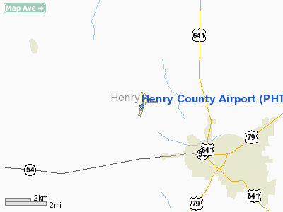
Henry County Airport (IATA: PHT, ICAO: KPHT, FAA LID: PHT) is a county-owned public-use airport located three miles (5 km) northwest of the central business district of Paris, a city in Henry County, Tennessee, United States.
Facilities and aircraft
Henry County Airport covers an area of 250 acres (101 ha) which contains one asphalt paved runway (2/20) measuring 5,001 x 100 ft (1,524 x 30 m). For the 12-month period ending July 11, 2000, the airport had 16,445 aircraft operations, an average of 45 per day: 99.5% general aviation and 0.5% air taxi.
The above content comes from Wikipedia and is published under free licenses – click here to read more.
Location & QuickFacts
| FAA Information Effective: | 2008-09-25 |
| Airport Identifier: | PHT |
| Airport Status: | Operational |
| Longitude/Latitude: | 088-23-04.0000W/36-20-09.4000N
-88.384444/36.335944 (Estimated) |
| Elevation: | 580 ft / 176.78 m (Surveyed) |
| Land: | 250 acres |
| From nearest city: | 3 nautical miles NW of Paris, TN |
| Location: | Henry County, TN |
| Magnetic Variation: | 00E (1995) |
Owner & Manager
| Ownership: | Publicly owned |
| Owner: | Henry County |
| Address: | P.o. Box 7
Paris, TN 38242 |
| Phone number: | 731-642-5212 |
| Manager: | Don Davenport |
| Address: | 1949 Diggs Rd
Paris, TN 38242 |
| Phone number: | 731-644-7933 |
Airport Operations and Facilities
| Airport Use: | Open to public |
| Wind indicator: | Yes |
| Segmented Circle: | Yes |
| Control Tower: | No |
| Lighting Schedule: | DUSK-DAWN
HIRL RY 02/20 PRESET MED INTST; TO INCR INTST & ACTVT ODALS RY 02 - CTAF. |
| Beacon Color: | Clear-Green (lighted land airport) |
| Landing fee charge: | No |
| Sectional chart: | St Louis |
| Region: | ASO - Southern |
| Boundary ARTCC: | ZME - Memphis |
| Tie-in FSS: | MKL - Jackson |
| FSS on Airport: | No |
| FSS Toll Free: | 1-800-WX-BRIEF |
| NOTAMs Facility: | MKL (NOTAM-d service avaliable) |
| Federal Agreements: | NGY |
Airport Communications
| CTAF: | 123.000 |
| Unicom: | 123.000 |
Airport Services
| Fuel available: | 100LLA |
| Airframe Repair: | MAJOR |
| Power Plant Repair: | MAJOR |
| Bottled Oxygen: | NONE |
| Bulk Oxygen: | NONE |
Runway Information
Runway 02/20
| Dimension: | 5001 x 100 ft / 1524.3 x 30.5 m |
| Surface: | ASPH, Good Condition |
| Weight Limit: | Single wheel: 17000 lbs. |
| Edge Lights: | High |
| |
Runway 02 |
Runway 20 |
| Longitude: | 088-23-12.6100W | 088-22-55.3700W |
| Latitude: | 36-19-45.6800N | 36-20-33.1400N |
| Elevation: | 580.00 ft | 568.00 ft |
| Alignment: | 16 | 127 |
| ILS Type: | ILS
| |
| Traffic Pattern: | Left | Left |
| Markings: | Precision instrument, Good Condition | Precision instrument, Good Condition |
| VASI: | 4-light PAPI on left side | 4-light PAPI on left side |
| Approach lights: | ODALS
ODALS OTS INDEFLY. | |
| Runway End Identifier: | Yes
REILS OTS INDEFLY. | Yes |
| Obstruction: | 15 ft trees, 735.0 ft from runway, 4 ft left of centerline, 35:1 slope to clear | 71 ft trees, 1512.0 ft from runway, 311 ft right of centerline, 18:1 slope to clear |
|
Radio Navigation Aids
| ID |
Type |
Name |
Ch |
Freq |
Var |
Dist |
| TIQ | NDB | Trainer | | 410.00 | 00E | 5.4 nm |
| HZD | NDB | Huntingdon | | 217.00 | 00E | 15.4 nm |
| GGK | NDB | Mayfield | | 401.00 | 00E | 23.6 nm |
| UC | NDB | Obion | | 212.00 | 00E | 29.7 nm |
| TGC | NDB | Gibson | | 378.00 | 01E | 33.1 nm |
| AEY | NDB | Waverly | | 329.00 | 00E | 33.9 nm |
| DMZ | NDB | Dickson | | 203.00 | 01W | 47.8 nm |
| HXW | TACAN | Screaming Eagle | 096X | | 01W | 47.6 nm |
| JKS | VOR/DME | Jacks Creek | 031X | 109.40 | 02E | 44.3 nm |
| CNG | VORTAC | Cunningham | 078X | 113.10 | 03E | 45.9 nm |
| DYR | VORTAC | Dyersburg | 115X | 116.80 | 03E | 49.1 nm |
Remarks
- ULTRALIGHTS ARE NOT TO CROSS RY 02/20.
- PARALLEL TWY UNLGTD.
Images and information placed above are from
http://www.airport-data.com/airport/PHT/
We thank them for the data!
| General Info
|
| Country |
United States
|
| State |
TENNESSEE
|
| FAA ID |
PHT
|
| Latitude |
36-20-17.609N
|
| Longitude |
088-22-58.363W
|
| Elevation |
580 feet
|
| Near City |
PARIS
|
We don't guarantee the information is fresh and accurate. The data may
be wrong or outdated.
For more up-to-date information please refer to other sources.
|
|


