 |
|
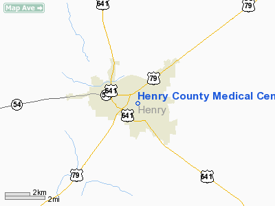
Henry County Medical Center Heliport |
Location & QuickFacts
| FAA Information Effective: | 2008-09-25 |
| Airport Identifier: | TN46 |
| Airport Status: | Operational |
| Longitude/Latitude: | 088-18-10.1550W/36-17-45.2070N
-88.302821/36.295891 (Estimated) |
| Elevation: | 570 ft / 173.74 m (Estimated) |
| Land: | 0 acres |
| From nearest city: | 0 nautical miles N of Paris, TN |
| Location: | Henry County, TN |
| Magnetic Variation: | 01E (1985) |
Owner & Manager
| Ownership: | Privately owned |
| Owner: | Henry County Med Center |
| Address: |
Paris, TN 38242 |
| Phone number: | 731-642-1220 |
| Manager: | Stan Seay
DIRECTOR, MAINTENANCE. |
| Address: |
Paris, TN 38242 |
| Phone number: | 731-644-8456 |
Airport Operations and Facilities
| Airport Use: | Private
MEDICAL. |
| Wind indicator: | Yes |
| Segmented Circle: | No |
| Control Tower: | No |
| Landing fee charge: | No |
| Sectional chart: | Memphis |
| Region: | ASO - Southern |
| Boundary ARTCC: | ZME - Memphis |
| Tie-in FSS: | MKL - Jackson |
| FSS on Airport: | No |
| FSS Toll Free: | 1-800-WX-BRIEF |
Runway Information
Helipad H1
| Dimension: | 90 x 90 ft / 27.4 x 27.4 m |
| Surface: | CONC, |
| |
Runway H1 |
Runway |
| Traffic Pattern: | Left | Left |
|
Radio Navigation Aids
| ID |
Type |
Name |
Ch |
Freq |
Var |
Dist |
| TIQ | NDB | Trainer | | 410.00 | 00E | 6.1 nm |
| HZD | NDB | Huntingdon | | 217.00 | 00E | 14.8 nm |
| GGK | NDB | Mayfield | | 401.00 | 00E | 27.6 nm |
| AEY | NDB | Waverly | | 329.00 | 00E | 29.3 nm |
| UC | NDB | Obion | | 212.00 | 00E | 33.5 nm |
| TGC | NDB | Gibson | | 378.00 | 01E | 34.4 nm |
| DMZ | NDB | Dickson | | 203.00 | 01W | 43.4 nm |
| HXW | TACAN | Screaming Eagle | 096X | | 01W | 45.2 nm |
| JKS | VOR/DME | Jacks Creek | 031X | 109.40 | 02E | 42.0 nm |
| CKV | VOR/DME | Clarksville | 043X | 110.60 | 01W | 47.3 nm |
| GHM | VORTAC | Graham | 053X | 111.60 | 03E | 49.8 nm |
| CNG | VORTAC | Cunningham | 078X | 113.10 | 03E | 50.0 nm |
Remarks
- PVT USE-VFR ONLY; COORD USE WITH GADO MEMPHIS TN.
Images and information placed above are from
http://www.airport-data.com/airport/TN46/
We thank them for the data!
| General Info
|
| Country |
United States
|
| State |
TENNESSEE
|
| FAA ID |
TN46
|
| Latitude |
36-17-45.207N
|
| Longitude |
088-18-10.155W
|
| Elevation |
570 feet
|
| Near City |
PARIS
|
We don't guarantee the information is fresh and accurate. The data may
be wrong or outdated.
For more up-to-date information please refer to other sources.
|
|


