 |
|
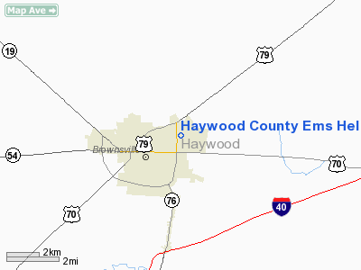
Haywood County Ems Heliport |
Location & QuickFacts
| FAA Information Effective: | 2008-09-25 |
| Airport Identifier: | 99TN |
| Airport Status: | Operational |
| Longitude/Latitude: | 089-14-15.0000W/35-36-10.0000N
-89.237500/35.602778 (Estimated) |
| Elevation: | 350 ft / 106.68 m (Estimated) |
| Land: | 0 acres |
| From nearest city: | 2 nautical miles E of Brownsville, TN |
| Location: | Haywood County, TN |
| Magnetic Variation: | () |
Owner & Manager
| Ownership: | Privately owned |
| Owner: | Haywood County Ems |
| Address: | 1601 Welch Street
Brownsville, TN 38012 |
| Phone number: | 731-772-4979 |
| Manager: | Jimmy Studdard
ALLEN BURNETT 901-522-5321 |
| Address: | 1601 Welch Street
Brownsville, TN 38012 |
| Phone number: | 731-772-4979 |
Airport Operations and Facilities
| Airport Use: | Private
MEDICAL USE. |
| Wind indicator: | Yes |
| Control Tower: | No |
| Sectional chart: | Memphis |
| Region: | ASO - Southern |
| Boundary ARTCC: | ZME - Memphis |
| Tie-in FSS: | MKL - Jackson |
| FSS Toll Free: | 1-800-WX-BRIEF |
Runway Information
Helipad H1
| Dimension: | 50 x 50 ft / 15.2 x 15.2 m |
| Surface: | CONC, |
| |
Runway H1 |
Runway |
| Traffic Pattern: | Left | Left |
|
Radio Navigation Aids
| ID |
Type |
Name |
Ch |
Freq |
Var |
Dist |
| COO | NDB | Covington | | 326.00 | 02E | 17.1 nm |
| DNT | NDB | Nally Dunston | | 343.00 | 01W | 25.0 nm |
| FYE | NDB | Somerville | | 255.00 | 00E | 25.0 nm |
| BAV | NDB | Hardeman | | 404.00 | 01E | 25.2 nm |
| TGC | NDB | Gibson | | 378.00 | 01E | 27.4 nm |
| IUI | NDB | Hicks | | 350.00 | 01E | 35.4 nm |
| BPW | NDB | Osceola | | 239.00 | 02E | 38.3 nm |
| MIG | NDB | Millington | | 232.00 | 04E | 39.2 nm |
| SZY | NDB | Sibley | | 386.00 | 01E | 41.6 nm |
| UC | NDB | Obion | | 212.00 | 00E | 43.4 nm |
| OLV | NDB | Olive Branch | | 275.00 | 01E | 46.2 nm |
| SPQ | NDB | Spain | | 414.00 | 04E | 46.6 nm |
| HZD | NDB | Huntingdon | | 217.00 | 00E | 47.6 nm |
| MXA | NDB | Manila | | 282.00 | 01E | 48.1 nm |
| GOJ | VOR | Gosnell | | 111.80 | 01E | 40.2 nm |
| MKL | VOR/DME | Mc Kellar | 057X | 112.00 | 02E | 16.0 nm |
| JKS | VOR/DME | Jacks Creek | 031X | 109.40 | 02E | 42.9 nm |
| DYR | VORTAC | Dyersburg | 115X | 116.80 | 03E | 25.3 nm |
| MEM | VOT | Memphis Metropolitn | | 111.00 | | 49.3 nm |
Remarks
- PROVIDED VFR OPNS, PRIVATE USE, RADIO ANTENNA IS MOVED AND MARKED AND LIGHTED, TREE EAST SIDE ARE REMOVED, COMPLY WITH TDOT CONDITIONS, AREA IS MARKED AND WIND INDICATOR IS MAINTAINED.
Images and information placed above are from
http://www.airport-data.com/airport/99TN/
We thank them for the data!
| General Info
|
| Country |
United States
|
| State |
TENNESSEE
|
| FAA ID |
99TN
|
| Latitude |
35-19-47.000N
|
| Longitude |
085-57-15.000W
|
| Elevation |
1010 feet
|
| Near City |
HILLSBORO
|
We don't guarantee the information is fresh and accurate. The data may
be wrong or outdated.
For more up-to-date information please refer to other sources.
|
|


