 |
|
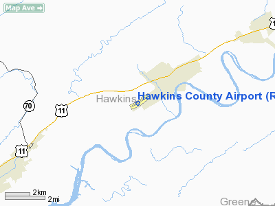
Location & QuickFacts
| FAA Information Effective: | 2008-09-25 |
| Airport Identifier: | RVN |
| Airport Status: | Operational |
| Longitude/Latitude: | 082-53-06.1340W/36-27-27.2850N
-82.885037/36.457579 (Estimated) |
| Elevation: | 1255 ft / 382.52 m (Surveyed) |
| Land: | 56 acres |
| From nearest city: | 6 nautical miles NE of Rogersville, TN |
| Location: | Hawkins County, TN |
| Magnetic Variation: | 04W (1985) |
Owner & Manager
| Ownership: | Publicly owned |
| Owner: | Hawkins County |
| Address: | 150 Washington St
Rogersville, TN 37857
COUNTY COURTHOUSE. |
| Phone number: | 423-272-7359 |
| Manager: | Earl Hayborn |
| Address: | 675 Main St
Surgoinsville, TN 37873 |
| Phone number: | 423-345-0219 |
Airport Operations and Facilities
| Airport Use: | Open to public |
| Wind indicator: | Yes |
| Segmented Circle: | Yes |
| Control Tower: | No |
| Lighting Schedule: | DUSK-DAWN |
| Beacon Color: | Clear-Green (lighted land airport) |
| Landing fee charge: | No |
| Sectional chart: | Cincinnati |
| Region: | ASO - Southern |
| Boundary ARTCC: | ZTL - Atlanta |
| Tie-in FSS: | BNA - Nashville |
| FSS on Airport: | No |
| FSS Toll Free: | 1-800-WX-BRIEF |
| NOTAMs Facility: | BNA (NOTAM-d service avaliable) |
| Federal Agreements: | NGY |
Airport Communications
| CTAF: | 122.800 |
| Unicom: | 122.800 |
Airport Services
| Fuel available: | 100LL |
| Airframe Repair: | MAJOR |
| Power Plant Repair: | MAJOR |
| Bottled Oxygen: | NONE |
| Bulk Oxygen: | NONE |
Runway Information
Runway 07/25
| Dimension: | 3502 x 75 ft / 1067.4 x 22.9 m |
| Surface: | ASPH, Good Condition |
| Weight Limit: | Single wheel: 25000 lbs. |
| Edge Lights: | Medium |
| |
Runway 07 |
Runway 25 |
| Longitude: | 082-53-25.4060W | 082-52-46.8610W |
| Latitude: | 36-27-19.7100N | 36-27-34.8590N |
| Elevation: | 1255.00 ft | 1230.00 ft |
| Alignment: | 64 | 127 |
| Traffic Pattern: | Left | Left |
| Markings: | Basic, Fair Condition | Basic, Fair Condition |
| VASI: | 4-light PAPI on left side | 4-light PAPI on left side |
| Runway End Identifier: | Yes | Yes |
| Centerline Lights: | No | No |
| Touchdown Lights: | No | No |
| Obstruction: | 55 ft trees, 650.0 ft from runway, 263 ft right of centerline, 8:1 slope to clear | 31 ft tree, 470.0 ft from runway, 239 ft left of centerline, 8:1 slope to clear |
|
Radio Navigation Aids
| ID |
Type |
Name |
Ch |
Freq |
Var |
Dist |
| RVN | NDB | Rogersville | | 329.00 | 04W | 0.1 nm |
| LQV | NDB | Long Hollow | | 252.00 | 03W | 17.6 nm |
| BO | NDB | Booie | | 221.00 | 04W | 19.1 nm |
| DYQ | NDB | Dulaney | | 263.00 | 04W | 19.3 nm |
| EZT | NDB | Elizabethton | | 275.00 | 02W | 30.9 nm |
| JXT | NDB | Jefferson | | 346.00 | 04W | 35.4 nm |
| VJ | NDB | Whine | | 236.00 | 05W | 48.1 nm |
| GZG | VOR/DME | Glade Spring | 039X | 110.20 | 02W | 44.7 nm |
| HMV | VORTAC | Holston Mountain | 093X | 114.60 | 04W | 36.5 nm |
| SOT | VORTAC | Snowbird | 025X | 108.80 | 04W | 40.9 nm |
Remarks
- RWY 07 MTN RIDGES SOUTHEAST OF APT; 3118' WITHIN 9 MILES.
- DEER ON & INVOF ARPT.
Images and information placed above are from
http://www.airport-data.com/airport/RVN/
We thank them for the data!
| General Info
|
| Country |
United States
|
| State |
TENNESSEE
|
| FAA ID |
RVN
|
| Latitude |
36-27-27.285N
|
| Longitude |
082-53-06.134W
|
| Elevation |
1255 feet
|
| Near City |
ROGERSVILLE
|
We don't guarantee the information is fresh and accurate. The data may
be wrong or outdated.
For more up-to-date information please refer to other sources.
|
|


