 |
|
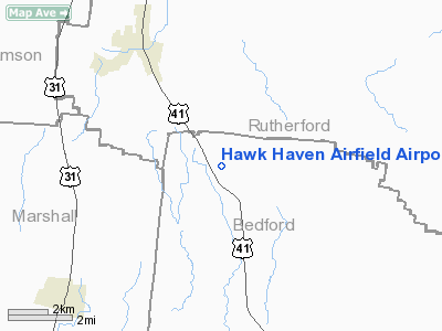
Hawk Haven Airfield Airport |
Location & QuickFacts
| FAA Information Effective: | 2008-09-25 |
| Airport Identifier: | TN07 |
| Airport Status: | Operational |
| Longitude/Latitude: | 086-36-23.0000W/35-41-14.0000N
-86.606389/35.687222 (Estimated) |
| Elevation: | 775 ft / 236.22 m (Estimated) |
| Land: | 5 acres |
| From nearest city: | 4 nautical miles SE of Eagleville, TN |
| Location: | Bedford County, TN |
| Magnetic Variation: | 02W (1995) |
Owner & Manager
| Ownership: | Privately owned |
| Owner: | Robert J. Petrie |
| Address: | 101 Taylor Road
Rockvale, TN 37153 |
| Phone number: | 615-274-3278 |
| Manager: | Robert J. Petrie |
| Address: | 101 Taylor Road
Rockvale, TN 37183 |
| Phone number: | 615-274-3278 |
Airport Operations and Facilities
| Airport Use: | Private |
| Wind indicator: | Yes |
| Segmented Circle: | No |
| Control Tower: | No |
| Sectional chart: | Atlanta |
| Region: | ASO - Southern |
| Boundary ARTCC: | ZME - Memphis |
| Tie-in FSS: | BNA - Nashville |
| FSS Toll Free: | 1-800-WX-BRIEF |
Runway Information
Runway 17/35
| Dimension: | 2400 x 40 ft / 731.5 x 12.2 m |
| Surface: | TURF, |
| |
Runway 17 |
Runway 35 |
| Traffic Pattern: | Left | Right |
|
Radio Navigation Aids
| ID |
Type |
Name |
Ch |
Freq |
Var |
Dist |
| SYI | FAN MARKER | Bomar | | | 01W | 14.0 nm |
| LUG | NDB | Verona | | 251.00 | 00W | 15.0 nm |
| SWZ | NDB | Sewart | | 391.00 | 02W | 17.6 nm |
| FQW | NDB | Walter Hill | | 371.00 | 02W | 20.1 nm |
| ULH | NDB | Burwi | | 332.00 | 03W | 22.4 nm |
| PBC | NDB | Maury County | | 365.00 | 01W | 24.2 nm |
| VI | NDB | Opery | | 344.00 | 02W | 31.1 nm |
| TNY | NDB | Kelso | | 358.00 | 01W | 33.4 nm |
| JUE | NDB | Lebanon | | 414.00 | 02W | 33.5 nm |
| GZS | NDB | Giles/dcmsnd | | 375.00 | 00E | 39.1 nm |
| BGF | NDB | Boiling Fork | | 263.00 | 02W | 40.4 nm |
| RN | NDB | Warri | | 209.00 | 02W | 41.3 nm |
| LRT | NDB | Lawrenceburg | | 269.00 | 00E | 42.0 nm |
| SKN | NDB | Hurricane | | 256.00 | 02W | 42.8 nm |
| UOS | NDB | Sewanee | | 275.00 | 02E | 45.3 nm |
| DMZ | NDB | Dickson | | 203.00 | 01W | 48.1 nm |
| ON | NDB | Music | | 279.00 | 03W | 49.5 nm |
| UXM | VOR | Tullahoma Regional | | 109.65 | 03W | 25.5 nm |
| SYI | VOR/DME | Shelbyville | 027X | 109.00 | 01W | 11.1 nm |
| BNA | VORTAC | Nashville | 088X | 114.10 | 02W | 27.3 nm |
| GHM | VORTAC | Graham | 053X | 111.60 | 03E | 42.2 nm |
| MQY | VOT | Smyrna | | 110.20 | | 19.8 nm |
| BNA | VOT | Nashville Metropoln | | 108.60 | | 26.7 nm |
| HSV | VOT | Huntsville | | 111.00 | | 43.2 nm |
Remarks
- EXTENSIVE GLIDER ACTVTY 0.5 NM W OF ARPT; MONITOR FREQ 123.5.
- PRVDD TFC PATS RESTRICTED TO EAST OF RY, OPERL AGREEMENT WITH PACKETT ARPT.
Images and information placed above are from
http://www.airport-data.com/airport/TN07/
We thank them for the data!
| General Info
|
| Country |
United States
|
| State |
TENNESSEE
|
| FAA ID |
TN07
|
| Latitude |
35-41-14.000N
|
| Longitude |
086-36-23.000W
|
| Elevation |
775 feet
|
| Near City |
EAGLEVILLE
|
We don't guarantee the information is fresh and accurate. The data may
be wrong or outdated.
For more up-to-date information please refer to other sources.
|
|


