 |
|
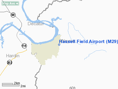
Location & QuickFacts
| FAA Information Effective: | 2008-09-25 |
| Airport Identifier: | M29 |
| Airport Status: | Operational |
| Longitude/Latitude: | 087-58-03.1020W/35-23-06.2710N
-87.967528/35.385075 (Estimated) |
| Elevation: | 401 ft / 122.22 m (Surveyed) |
| Land: | 44 acres |
| From nearest city: | 1 nautical miles E of Clifton, TN |
| Location: | Wayne County, TN |
| Magnetic Variation: | 01E (1985) |
Owner & Manager
| Ownership: | Publicly owned |
| Owner: | City Of Clifton |
| Address: | City Hall
Clifton, TN 38425 |
| Phone number: | 931-676-3370 |
| Manager: | Clifton Arpt Authority |
| Address: | Box 192
Clifton, TN 38425
PHYSICAL ADDRESS IS 199 HASSELL DRIVE, CLIFTON, TN 38425 |
| Phone number: | 931-676-3370 |
Airport Operations and Facilities
| Airport Use: | Open to public |
| Wind indicator: | Yes |
| Segmented Circle: | Yes |
| Control Tower: | No |
| Lighting Schedule: | DUSK-DAWN |
| Beacon Color: | Clear-Green (lighted land airport)
BCN OTS INDEFLY. |
| Landing fee charge: | No |
| Sectional chart: | Atlanta |
| Region: | ASO - Southern |
| Boundary ARTCC: | ZME - Memphis |
| Tie-in FSS: | MKL - Jackson |
| FSS on Airport: | No |
| FSS Toll Free: | 1-800-WX-BRIEF |
| NOTAMs Facility: | MKL (NOTAM-d service avaliable) |
| Federal Agreements: | N |
Airport Communications
Airport Services
| Airframe Repair: | NONE |
| Power Plant Repair: | NONE |
Runway Information
Runway 02/20
| Dimension: | 4600 x 75 ft / 1402.1 x 22.9 m |
| Surface: | ASPH, Poor Condition
EXTENSIVE CRACKING WITH VEGETATION. |
| Weight Limit: | Single wheel: 30000 lbs. |
| Edge Lights: | Medium
RY 02/20 MIRL OTS INDEFLY. |
| |
Runway 02 |
Runway 20 |
| Elevation: | 395.00 ft | 401.00 ft |
| Traffic Pattern: | Left | Left |
| Markings: | Basic, Poor Condition
RY 02/20 MKGS FADED & OBSCURED BY VEGETATION. | Basic, Poor Condition |
| Displaced threshold: | 0.00 ft | 1108.00 ft |
| VASI: | 2-box SAVASI on left side
RY 02 SAVASI OTS INDEFLY. | 2-box SAVASI on left side
RY 20 SAVASI OTS INDEFLY. |
| Runway End Identifier: | Yes
RY 02 REIL OTS INDEFLY. | Yes
RY 20 REIL OTS INDEFLY. |
| Obstruction: | 41 ft tree, 708.0 ft from runway, 165 ft right of centerline, 12:1 slope to clear | 108 ft trees, 1350.0 ft from runway, 114 ft right of centerline, 10:1 slope to clear
RY 20 APCH RATIO 22:1 TO DSPLCD THLD. |
|
Radio Navigation Aids
| ID |
Type |
Name |
Ch |
Freq |
Var |
Dist |
| HHY | NDB | Pinhook | | 346.00 | 01W | 14.0 nm |
| JHG | NDB | Hohenwald | | 257.00 | 01W | 17.2 nm |
| SZY | NDB | Sibley | | 386.00 | 01E | 28.3 nm |
| LRT | NDB | Lawrenceburg | | 269.00 | 00E | 35.8 nm |
| PBC | NDB | Maury County | | 365.00 | 01W | 44.9 nm |
| AEY | NDB | Waverly | | 329.00 | 00E | 45.3 nm |
| GZS | NDB | Giles/dcmsnd | | 375.00 | 00E | 46.8 nm |
| HZD | NDB | Huntingdon | | 217.00 | 00E | 48.8 nm |
| JKS | VOR/DME | Jacks Creek | 031X | 109.40 | 02E | 23.1 nm |
| MKL | VOR/DME | Mc Kellar | 057X | 112.00 | 02E | 48.0 nm |
| GHM | VORTAC | Graham | 053X | 111.60 | 03E | 36.9 nm |
| MSL | VORTAC | Muscle Shoals | 112X | 116.50 | 01E | 47.0 nm |
Remarks
- WATERFOWL INVOF ARPT.
- NUMEROUS SMALL CRACKS IN RY.
Images and information placed above are from
http://www.airport-data.com/airport/M29/
We thank them for the data!
| General Info
|
| Country |
United States
|
| State |
TENNESSEE
|
| FAA ID |
M29
|
| Latitude |
35-23-06.271N
|
| Longitude |
087-58-03.102W
|
| Elevation |
401 feet
|
| Near City |
CLIFTON
|
We don't guarantee the information is fresh and accurate. The data may
be wrong or outdated.
For more up-to-date information please refer to other sources.
|
|


