 |
|
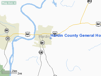
Hardin County General Hospital Heliport |
Location & QuickFacts
| FAA Information Effective: | 2008-09-25 |
| Airport Identifier: | 5TN6 |
| Airport Status: | Operational |
| Longitude/Latitude: | 088-13-09.1300W/35-13-05.2920N
-88.219203/35.218137 (Estimated) |
| Elevation: | 450 ft / 137.16 m (Estimated) |
| Land: | 0 acres |
| From nearest city: | 8 nautical miles E of Savannah, TN |
| Location: | Hardin County, TN |
| Magnetic Variation: | 00E (1990) |
Owner & Manager
| Ownership: | Privately owned |
| Owner: | Hardin Co General Hospital |
| Address: | 2006 Wayne Road
Savannah, TN 38372 |
| Phone number: | 901-925-4954 |
| Manager: | Johnny P May
OTHER CONTACT: CHARLOTTE BURNS 731-926-8000 |
| Address: | 2006 Wayne Road
Savannah, TN 38372 |
| Phone number: | 901-925-4954 |
Airport Operations and Facilities
| Airport Use: | Private
MEDICAL USE. |
| Segmented Circle: | No |
| Control Tower: | No |
| Sectional chart: | Memphis |
| Region: | ASO - Southern |
| Boundary ARTCC: | ZME - Memphis |
| Tie-in FSS: | MKL - Jackson |
| FSS Toll Free: | 1-800-WX-BRIEF |
Runway Information
Helipad H1
| Dimension: | 150 x 75 ft / 45.7 x 22.9 m |
| Surface: | ASPH, |
| |
Runway H1 |
Runway |
| Traffic Pattern: | Left | Left |
|
Radio Navigation Aids
| ID |
Type |
Name |
Ch |
Freq |
Var |
Dist |
| HHY | NDB | Pinhook | | 346.00 | 01W | 2.3 nm |
| SZY | NDB | Sibley | | 386.00 | 01E | 14.6 nm |
| JHG | NDB | Hohenwald | | 257.00 | 01W | 32.4 nm |
| BAV | NDB | Hardeman | | 404.00 | 01E | 40.4 nm |
| LRT | NDB | Lawrenceburg | | 269.00 | 00E | 47.1 nm |
| JKS | VOR/DME | Jacks Creek | 031X | 109.40 | 02E | 23.9 nm |
| MKL | VOR/DME | Mc Kellar | 057X | 112.00 | 02E | 41.0 nm |
| MSL | VORTAC | Muscle Shoals | 112X | 116.50 | 01E | 47.2 nm |
Remarks
- PRVDD VFR; PVT USE; TKOF/LDG AREA MKD; WIND IND IS MAINTAINED; APCH/DEP RTE OPS FM 080 DEG TO 100 DEG & FM 255 DEG TO 275 DEG.
Images and information placed above are from
http://www.airport-data.com/airport/5TN6/
We thank them for the data!
| General Info
|
| Country |
United States
|
| State |
TENNESSEE
|
| FAA ID |
5TN6
|
| Latitude |
35-13-05.292N
|
| Longitude |
088-13-09.130W
|
| Elevation |
450 feet
|
| Near City |
SAVANNAH
|
We don't guarantee the information is fresh and accurate. The data may
be wrong or outdated.
For more up-to-date information please refer to other sources.
|
|


