 |
|
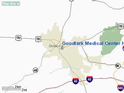
Goodlark Medical Center Heliport |
Location & QuickFacts
| FAA Information Effective: | 2008-09-25 |
| Airport Identifier: | 7TN6 |
| Airport Status: | Operational |
| Longitude/Latitude: | 087-22-30.0000W/36-04-30.0000N
-87.375000/36.075000 (Estimated) |
| Elevation: | 845 ft / 257.56 m (Estimated) |
| Land: | 0 acres |
| From nearest city: | 0 nautical miles E of Dickson, TN |
| Location: | Dickson County, TN |
| Magnetic Variation: | 01W (1995) |
Owner & Manager
| Ownership: | Privately owned |
| Owner: | Goodlark Medical Center |
| Address: | 111 Hwy 70 East
Dickson, TN 37055 |
| Phone number: | 615-446-0446 |
| Manager: | Tim Shelton
PLANT OPERATIONS. |
| Address: | 111 Hwy 70 East
Dickson, TN 37055 |
| Phone number: | 615-441-2372 |
Airport Operations and Facilities
| Airport Use: | Private
MEDICAL. |
| Wind indicator: | Yes |
| Segmented Circle: | No |
| Control Tower: | No |
| Lighting Schedule: | DUSK-DAWN |
| Sectional chart: | Memphis |
| Region: | ASO - Southern |
| Boundary ARTCC: | ZME - Memphis |
| Tie-in FSS: | MKL - Jackson |
| FSS on Airport: | No |
| FSS Toll Free: | 1-800-WX-BRIEF |
Runway Information
Helipad H1
| Dimension: | 50 x 48 ft / 15.2 x 14.6 m |
| Surface: | CONC,
ROOFTOP. |
| |
Runway H1 |
Runway |
| Traffic Pattern: | Left | Left |
|
Radio Navigation Aids
| ID |
Type |
Name |
Ch |
Freq |
Var |
Dist |
| DMZ | NDB | Dickson | | 203.00 | 01W | 4.2 nm |
| AEY | NDB | Waverly | | 329.00 | 00E | 18.0 nm |
| ON | NDB | Music | | 279.00 | 03W | 29.1 nm |
| PBC | NDB | Maury County | | 365.00 | 01W | 31.3 nm |
| PED | NDB | Needmore | | 221.00 | 01W | 35.5 nm |
| VI | NDB | Opery | | 344.00 | 02W | 35.9 nm |
| JHG | NDB | Hohenwald | | 257.00 | 01W | 38.9 nm |
| FK | NDB | Airbe | | 273.00 | 01W | 39.8 nm |
| LUG | NDB | Verona | | 251.00 | 00W | 44.2 nm |
| SWZ | NDB | Sewart | | 391.00 | 02W | 44.9 nm |
| HIX | NDB | Honey Grove | | 356.00 | 01W | 48.5 nm |
| FQW | NDB | Walter Hill | | 371.00 | 02W | 49.3 nm |
| HXW | TACAN | Screaming Eagle | 096X | | 01W | 36.6 nm |
| CKV | VOR/DME | Clarksville | 043X | 110.60 | 01W | 32.9 nm |
| GHM | VORTAC | Graham | 053X | 111.60 | 03E | 15.0 nm |
| BNA | VORTAC | Nashville | 088X | 114.10 | 02W | 33.7 nm |
| BNA | VOT | Nashville Metropoln | | 108.60 | | 33.8 nm |
| MQY | VOT | Smyrna | | 110.20 | | 42.3 nm |
Remarks
- VFR; PRIVATE USE; APCH/DEP 360 CLKWS 180; AREA IS MKD; LGTD WINDSOCK; RED & WHITE LGTS ON BLDG; CHAIN LINK SAFETY NET; PERIODIC INSPECTION OF FLOOD LGTS.
Images and information placed above are from
http://www.airport-data.com/airport/7TN6/
We thank them for the data!
| General Info
|
| Country |
United States
|
| State |
TENNESSEE
|
| FAA ID |
7TN6
|
| Latitude |
36-04-30.000N
|
| Longitude |
087-22-30.000W
|
| Elevation |
845 feet
|
| Near City |
DICKSON
|
We don't guarantee the information is fresh and accurate. The data may
be wrong or outdated.
For more up-to-date information please refer to other sources.
|
|


