 |
|
Location & QuickFacts
| FAA Information Effective: | 2008-09-25 |
| Airport Identifier: | 51TN |
| Airport Status: | Operational |
| Longitude/Latitude: | 086-58-37.0000W/35-31-59.0000N
-86.976944/35.533056 (Estimated) |
| Elevation: | 750 ft / 228.60 m (Estimated) |
| Land: | 0 acres |
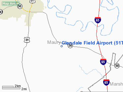
| From nearest city: | 6 nautical miles SE of Columbia, TN |
| Location: | Maury County, TN |
| Magnetic Variation: | () |
Owner & Manager
| Ownership: | Privately owned |
| Owner: | Glendale Flyers Club Llc |
| Address: | 1551 John Finney Road
Columbia, TN 38401 |
| Phone number: | 931-381-6574 |
| Manager: | S. Delk Kennedy |
| Address: | 1551 John Finney Road
Columbia, TN 38401 |
| Phone number: | 931-381-6574 |
Airport Operations and Facilities
| Airport Use: | Private |
| Wind indicator: | Yes |
| Control Tower: | No |
| Sectional chart: | Atlanta |
| Region: | ASO - Southern |
| Boundary ARTCC: | ZME - Memphis |
| Tie-in FSS: | MKL - Jackson |
| FSS Toll Free: | 1-800-WX-BRIEF |
Runway Information
Runway 15/33
| Dimension: | 2000 x 50 ft / 609.6 x 15.2 m |
| Surface: | TURF, |
| |
Runway 15 |
Runway 33 |
| Traffic Pattern: | Left | Left |
|
Radio Navigation Aids
| ID |
Type |
Name |
Ch |
Freq |
Var |
Dist |
| SYI | FAN MARKER | Bomar | | | 01W | 25.2 nm |
| PBC | NDB | Maury County | | 365.00 | 01W | 7.2 nm |
| LUG | NDB | Verona | | 251.00 | 00W | 8.4 nm |
| LRT | NDB | Lawrenceburg | | 269.00 | 00E | 22.7 nm |
| GZS | NDB | Giles/dcmsnd | | 375.00 | 00E | 23.3 nm |
| TNY | NDB | Kelso | | 358.00 | 01W | 32.1 nm |
| JHG | NDB | Hohenwald | | 257.00 | 01W | 32.3 nm |
| SWZ | NDB | Sewart | | 391.00 | 02W | 35.7 nm |
| ULH | NDB | Burwi | | 332.00 | 03W | 36.2 nm |
| FQW | NDB | Walter Hill | | 371.00 | 02W | 39.2 nm |
| DMZ | NDB | Dickson | | 203.00 | 01W | 42.1 nm |
| VI | NDB | Opery | | 344.00 | 02W | 43.3 nm |
| CWH | NDB | Capshaw | | 350.00 | 01W | 46.7 nm |
| BGF | NDB | Boiling Fork | | 263.00 | 02W | 49.4 nm |
| UXM | VOR | Tullahoma Regional | | 109.65 | 03W | 37.0 nm |
| SYI | VOR/DME | Shelbyville | 027X | 109.00 | 01W | 26.4 nm |
| GHM | VORTAC | Graham | 053X | 111.60 | 03E | 29.4 nm |
| BNA | VORTAC | Nashville | 088X | 114.10 | 02W | 39.0 nm |
| RQZ | VORTAC | Rocket | 059X | 112.20 | 02E | 47.3 nm |
| HSV | VOT | Huntsville | | 111.00 | | 34.6 nm |
| MQY | VOT | Smyrna | | 110.20 | | 36.5 nm |
| BNA | VOT | Nashville Metropoln | | 108.60 | | 38.5 nm |
Remarks
- CELL TWR APPROXIMATELY 1.25 NM NW OF ARPT.
- PRVDD VFR OPN & PVT USE.
Images and information placed above are from
http://www.airport-data.com/airport/51TN/
We thank them for the data!
|
|


