 |
|
Location & QuickFacts
| FAA Information Effective: | 2008-09-25 |
| Airport Identifier: | TN36 |
| Airport Status: | Operational |
| Longitude/Latitude: | 089-33-04.2720W/35-45-43.2770N
-89.551187/35.762021 (Estimated) |
| Elevation: | 350 ft / 106.68 m (Estimated) |
| Land: | 0 acres |
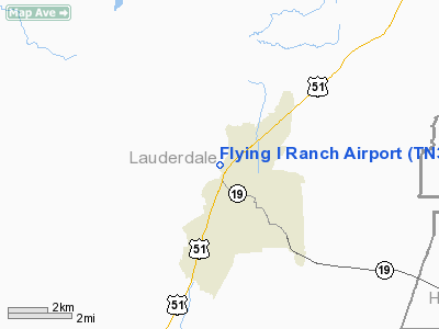
| From nearest city: | 2 nautical miles NW of Ripley, TN |
| Location: | Lauderdale County, TN |
| Magnetic Variation: | 02E (1985) |
Owner & Manager
| Ownership: | Privately owned |
| Owner: | Dan Irvin |
| Address: | 245 Lake Drive
Ripley, TN 38063-1139 |
| Phone number: | 901-635-7949 |
| Manager: | Dan Irvin |
| Address: | 245 Lake Drive
Ripley, TN 38063-1139 |
| Phone number: | 901-635-7949 |
Airport Operations and Facilities
| Airport Use: | Private |
| Wind indicator: | No |
| Segmented Circle: | No |
| Control Tower: | No |
| Landing fee charge: | No |
| Sectional chart: | Memphis |
| Region: | ASO - Southern |
| Boundary ARTCC: | ZME - Memphis |
| Tie-in FSS: | MKL - Jackson |
| FSS on Airport: | No |
| FSS Toll Free: | 1-800-WX-BRIEF |
Runway Information
Runway 01/19
| Dimension: | 2700 x 100 ft / 823.0 x 30.5 m |
| Surface: | TURF, |
| |
Runway 01 |
Runway 19 |
| Traffic Pattern: | Left | Left |
|
Radio Navigation Aids
| ID |
Type |
Name |
Ch |
Freq |
Var |
Dist |
| COO | NDB | Covington | | 326.00 | 02E | 10.5 nm |
| DNT | NDB | Nally Dunston | | 343.00 | 01W | 15.7 nm |
| IUI | NDB | Hicks | | 350.00 | 01E | 17.4 nm |
| BPW | NDB | Osceola | | 239.00 | 02E | 22.9 nm |
| MXA | NDB | Manila | | 282.00 | 01E | 30.5 nm |
| FYE | NDB | Somerville | | 255.00 | 00E | 34.3 nm |
| MIG | NDB | Millington | | 232.00 | 04E | 34.5 nm |
| TGC | NDB | Gibson | | 378.00 | 01E | 35.7 nm |
| TKX | NDB | Kennett | | 358.00 | 00E | 36.7 nm |
| BAV | NDB | Hardeman | | 404.00 | 01E | 41.3 nm |
| SPQ | NDB | Spain | | 414.00 | 04E | 41.7 nm |
| UC | NDB | Obion | | 212.00 | 00E | 42.0 nm |
| OLV | NDB | Olive Branch | | 275.00 | 01E | 48.4 nm |
| ME | NDB | Elvis | | 287.00 | 01E | 49.2 nm |
| GOJ | VOR | Gosnell | | 111.80 | 01E | 22.1 nm |
| MKL | VOR/DME | Mc Kellar | 057X | 112.00 | 02E | 32.7 nm |
| DYR | VORTAC | Dyersburg | 115X | 116.80 | 03E | 19.2 nm |
| MEM | VORTAC | Memphis | 122X | 117.50 | 01E | 49.6 nm |
| MEM | VOT | Memphis Metropolitn | | 111.00 | | 47.7 nm |
Remarks
Images and information placed above are from
http://www.airport-data.com/airport/TN36/
We thank them for the data!
| General Info
|
| Country |
United States
|
| State |
TENNESSEE
|
| FAA ID |
TN36
|
| Latitude |
35-45-43.277N
|
| Longitude |
089-33-04.272W
|
| Elevation |
350 feet
|
| Near City |
RIPLEY
|
We don't guarantee the information is fresh and accurate. The data may
be wrong or outdated.
For more up-to-date information please refer to other sources.
|
|


