 |
|
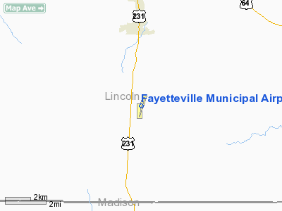
Fayetteville Muni Airport |
Location & QuickFacts
| FAA Information Effective: | 2008-09-25 |
| Airport Identifier: | FYM |
| Airport Status: | Operational |
| Longitude/Latitude: | 086-33-50.4370W/35-03-34.9230N
-86.564010/35.059701 (Estimated) |
| Elevation: | 984 ft / 299.92 m (Surveyed) |
| Land: | 113 acres |
| From nearest city: | 6 nautical miles S of Fayetteville, TN |
| Location: | Lincoln County, TN |
| Magnetic Variation: | 01W (1990) |
Owner & Manager
| Ownership: | Publicly owned |
| Owner: | Fayetteville-lincoln Arpt Auth
FAYETTEVILLE-LINCOLN COUNTY REGIONAL AIRPORT AUTHORITY. |
| Address: | 37 Airport Road
Fayetteville, TN 37334 |
| Phone number: | 931-433-1960 |
| Manager: | Mark Cobb |
| Address: | 37 Airport Rd
Fayetteville, TN 37334 |
| Phone number: | 931-433-1960 |
Airport Operations and Facilities
| Airport Use: | Open to public |
| Wind indicator: | Yes |
| Segmented Circle: | Yes |
| Control Tower: | No |
| Lighting Schedule: | DUSK-DAWN
ACTVT MIRL RY 02/20 AND ODALS RY 20 - CTAF. |
| Beacon Color: | Clear-Green (lighted land airport) |
| Landing fee charge: | No |
| Sectional chart: | Atlanta |
| Region: | ASO - Southern |
| Boundary ARTCC: | ZME - Memphis |
| Tie-in FSS: | MKL - Jackson |
| FSS on Airport: | No |
| FSS Toll Free: | 1-800-WX-BRIEF |
| NOTAMs Facility: | MKL (NOTAM-d service avaliable) |
| Federal Agreements: | NGY |
Airport Communications
| CTAF: | 122.800 |
| Unicom: | 122.800 |
Airport Services
| Fuel available: | 100LLA |
| Airframe Repair: | MAJOR |
| Power Plant Repair: | MAJOR |
| Bottled Oxygen: | HIGH/LOW |
| Bulk Oxygen: | NONE |
Runway Information
Runway 02/20
| Dimension: | 5900 x 100 ft / 1798.3 x 30.5 m |
| Surface: | ASPH, Good Condition |
| Weight Limit: | Single wheel: 21000 lbs.
Dual wheel: 31000 lbs. |
| Edge Lights: | Medium |
| |
Runway 02 |
Runway 20 |
| Longitude: | 086-33-58.9320W | 086-33-41.9410W |
| Latitude: | 35-03-06.5910N | 35-04-03.2540N |
| Elevation: | 960.00 ft | 983.00 ft |
| Alignment: | 14 | 127 |
| ILS Type: | | SDF
|
| Traffic Pattern: | Left | Left |
| Markings: | Non-precision instrument, Good Condition | Non-precision instrument, Good Condition |
| Crossing Height: | 31.00 ft | 0.00 ft |
| Displaced threshold: | 400.00 ft | 0.00 ft |
| VASI: | 4-light PAPI on left side | 4-light PAPI on right side |
| Visual Glide Angle: | 3.75° | 0.00° |
| Approach lights: | | ODALS |
| Runway End Identifier: | Yes | Yes |
| Obstruction: | 64 ft trees, 1947.0 ft from runway, 297 ft left of centerline, 27:1 slope to clear | 90 ft trees, 2709.0 ft from runway, 494 ft right of centerline, 27:1 slope to clear |
|
Radio Navigation Aids
| ID |
Type |
Name |
Ch |
Freq |
Var |
Dist |
| SYI | FAN MARKER | Bomar | | | 01W | 26.0 nm |
| TNY | NDB | Kelso | | 358.00 | 01W | 4.6 nm |
| CWH | NDB | Capshaw | | 350.00 | 01W | 20.2 nm |
| HUA | NDB | Redstone | | 287.00 | 00W | 22.6 nm |
| GZS | NDB | Giles/dcmsnd | | 375.00 | 00E | 24.9 nm |
| BGF | NDB | Boiling Fork | | 263.00 | 02W | 25.4 nm |
| ULH | NDB | Burwi | | 332.00 | 03W | 28.9 nm |
| LUG | NDB | Verona | | 251.00 | 00W | 29.1 nm |
| UOS | NDB | Sewanee | | 275.00 | 02E | 34.0 nm |
| LRT | NDB | Lawrenceburg | | 269.00 | 00E | 35.8 nm |
| PBC | NDB | Maury County | | 365.00 | 01W | 41.9 nm |
| CPP | NDB | Cole Spring | | 230.00 | 01W | 43.5 nm |
| APT | NDB | Jasper | | 382.00 | 02W | 48.2 nm |
| UXM | VOR | Tullahoma Regional | | 109.65 | 03W | 24.8 nm |
| SYI | VOR/DME | Shelbyville | 027X | 109.00 | 01W | 30.8 nm |
| DCU | VOR/DME | Decatur | 075X | 112.80 | 01W | 30.9 nm |
| RQZ | VORTAC | Rocket | 059X | 112.20 | 02E | 16.1 nm |
| HSV | VOT | Huntsville | | 111.00 | | 11.3 nm |
Remarks
- GCO AVBL ON FREQ 121.725 KEY 4 TIMES HSV CLEARANCE DELIVERY; KEY 6 TIMES MKL AFSS CLEARANCE DELIVERY.
Images and information placed above are from
http://www.airport-data.com/airport/FYM/
We thank them for the data!
| General Info
|
| Country |
United States
|
| State |
TENNESSEE
|
| FAA ID |
FYM
|
| Latitude |
35-03-30.106N
|
| Longitude |
086-33-51.881W
|
| Elevation |
984 feet
|
| Near City |
FAYETTEVILLE
|
We don't guarantee the information is fresh and accurate. The data may
be wrong or outdated.
For more up-to-date information please refer to other sources.
|
|


