 |
|
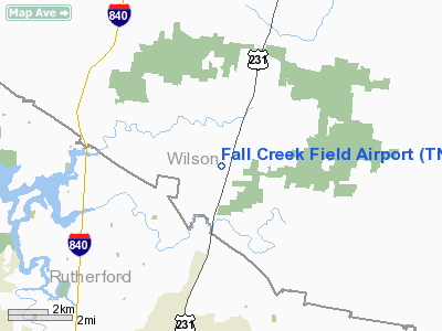
Location & QuickFacts
| FAA Information Effective: | 2008-09-25 |
| Airport Identifier: | TN96 |
| Airport Status: | Operational |
| Longitude/Latitude: | 086-21-29.9690W/36-02-28.2190N
-86.358325/36.041172 (Estimated) |
| Elevation: | 675 ft / 205.74 m (Estimated) |
| Land: | 9 acres |
| From nearest city: | 11 nautical miles NE of Lebanon, TN |
| Location: | Wilson County, TN |
| Magnetic Variation: | 01W (1985) |
Owner & Manager
| Ownership: | Privately owned |
| Owner: | Fall Creek Field, Inc. |
| Address: | 205 Gwynn Rd, Hangar 4
Lebanon, TN 37090 |
| Phone number: | 615-443-9350 |
| Manager: | Michael Kennedy |
| Address: | 205 Gwynn Rd, Hangar 4
Lebanon, TN 37090 |
| Phone number: | 615-443-9350 |
Airport Operations and Facilities
| Airport Use: | Private |
| Wind indicator: | Yes |
| Segmented Circle: | No |
| Control Tower: | No |
| Lighting Schedule: | RDO-CTL
ACTVT LIRL RY 18/36 - 122.7. |
| Landing fee charge: | No |
| Sectional chart: | Atlanta |
| Region: | ASO - Southern |
| Boundary ARTCC: | ZME - Memphis |
| Tie-in FSS: | BNA - Nashville |
| FSS on Airport: | No |
| FSS Toll Free: | 1-800-WX-BRIEF |
Airport Communications
Runway Information
Runway 18/36
| Dimension: | 2700 x 80 ft / 823.0 x 24.4 m |
| Surface: | TURF, Good Condition |
| Edge Lights: | Low |
| |
Runway 18 |
Runway 36 |
| Traffic Pattern: | Left | Left |
| Displaced threshold: | 0.00 ft | 600.00 ft |
| Obstruction: | | 50 ft trees, 200.0 ft from runway |
|
Radio Navigation Aids
| ID |
Type |
Name |
Ch |
Freq |
Var |
Dist |
| SYI | FAN MARKER | Bomar | | | 01W | 33.9 nm |
| FQW | NDB | Walter Hill | | 371.00 | 02W | 4.9 nm |
| SWZ | NDB | Sewart | | 391.00 | 02W | 7.2 nm |
| JUE | NDB | Lebanon | | 414.00 | 02W | 9.3 nm |
| VI | NDB | Opery | | 344.00 | 02W | 17.3 nm |
| SKN | NDB | Hurricane | | 256.00 | 02W | 27.0 nm |
| LFB | NDB | Lafayette | | 245.00 | 02W | 31.9 nm |
| RN | NDB | Warri | | 209.00 | 02W | 33.7 nm |
| ULH | NDB | Burwi | | 332.00 | 03W | 35.3 nm |
| HEM | NDB | Huchn | | 233.00 | 02W | 37.7 nm |
| LUG | NDB | Verona | | 251.00 | 00W | 39.3 nm |
| ON | NDB | Music | | 279.00 | 03W | 39.4 nm |
| PED | NDB | Needmore | | 221.00 | 01W | 40.3 nm |
| PBC | NDB | Maury County | | 365.00 | 01W | 44.2 nm |
| UXM | VOR | Tullahoma Regional | | 109.65 | 03W | 40.1 nm |
| SYI | VOR/DME | Shelbyville | 027X | 109.00 | 01W | 29.1 nm |
| BNA | VORTAC | Nashville | 088X | 114.10 | 02W | 16.9 nm |
| MQY | VOT | Smyrna | | 110.20 | | 7.6 nm |
| BNA | VOT | Nashville Metropoln | | 108.60 | | 16.5 nm |
Remarks
Images and information placed above are from
http://www.airport-data.com/airport/TN96/
We thank them for the data!
| General Info
|
| Country |
United States
|
| State |
TENNESSEE
|
| FAA ID |
TN96
|
| Latitude |
36-02-28.219N
|
| Longitude |
086-21-29.969W
|
| Elevation |
675 feet
|
| Near City |
LEBANON
|
We don't guarantee the information is fresh and accurate. The data may
be wrong or outdated.
For more up-to-date information please refer to other sources.
|
|


