 |
|
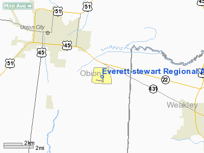
Everett-stewart Rgnl Airport |
Location & QuickFacts
| FAA Information Effective: | 2008-09-25 |
| Airport Identifier: | UCY |
| Airport Status: | Operational |
| Longitude/Latitude: | 088-59-07.5150W/36-22-54.4500N
-88.985421/36.381792 (Estimated) |
| Elevation: | 335 ft / 102.11 m (Surveyed) |
| Land: | 857 acres |
| From nearest city: | 4 nautical miles SE of Union City, TN |
| Location: | Obion County, TN |
| Magnetic Variation: | 00E (2000) |
Owner & Manager
| Ownership: | Publicly owned |
| Owner: | Obion County |
| Address: | County Courthouse
Union City, TN 38261 |
| Phone number: | 731-885-9611 |
| Manager: | Alford Howell |
| Address: | Po Box 184
Union City, TN 38261 |
| Phone number: | 731-885-1221 |
Airport Operations and Facilities
| Airport Use: | Open to public |
| Wind indicator: | Yes |
| Segmented Circle: | Yes |
| Control Tower: | No |
| Lighting Schedule: | DUSK-DAWN
ACTVT ODALS RY 01 - CTAF. |
| Beacon Color: | Clear-Green (lighted land airport) |
| Landing fee charge: | No |
| Sectional chart: | St Louis |
| Region: | ASO - Southern |
| Boundary ARTCC: | ZME - Memphis |
| Tie-in FSS: | MKL - Jackson |
| FSS on Airport: | No |
| FSS Toll Free: | 1-800-WX-BRIEF |
| NOTAMs Facility: | MKL (NOTAM-d service avaliable) |
| Federal Agreements: | NGRY |
Airport Communications
| CTAF: | 122.700 |
| Unicom: | 122.700 |
Airport Services
| Fuel available: | 100LLA |
| Airframe Repair: | MAJOR |
| Power Plant Repair: | MAJOR |
| Bottled Oxygen: | NONE |
| Bulk Oxygen: | NONE |
Runway Information
Runway 01/19
| Dimension: | 5000 x 100 ft / 1524.0 x 30.5 m |
| Surface: | ASPH, Good Condition |
| Weight Limit: | Single wheel: 45000 lbs.
Dual wheel: 60000 lbs. |
| Edge Lights: | Medium |
| |
Runway 01 |
Runway 19 |
| Longitude: | 088-59-10.9100W | 088-59-04.1200W |
| Latitude: | 36-22-29.8800N | 36-23-19.0200N |
| Elevation: | 335.00 ft | 309.00 ft |
| Alignment: | 6 | 127 |
| ILS Type: | ILS
| |
| Traffic Pattern: | Left | Left |
| Markings: | Non-precision instrument, Good Condition | Non-precision instrument, Good Condition |
| Crossing Height: | 27.00 ft | 27.00 ft |
| VASI: | 4-light PAPI on left side | 4-light PAPI on left side |
| Visual Glide Angle: | 3.00° | 3.00° |
| Approach lights: | ODALS | |
| Runway End Identifier: | Yes | Yes |
| Obstruction: | 55 ft silo, 2759.0 ft from runway, 115 ft left of centerline, 46:1 slope to clear | 23 ft tree, 1200.0 ft from runway, 2 ft right of centerline, 43:1 slope to clear |
|
Radio Navigation Aids
| ID |
Type |
Name |
Ch |
Freq |
Var |
Dist |
| UC | NDB | Obion | | 212.00 | 00E | 5.1 nm |
| GGK | NDB | Mayfield | | 401.00 | 00E | 26.6 nm |
| TGC | NDB | Gibson | | 378.00 | 01E | 27.7 nm |
| TIQ | NDB | Trainer | | 410.00 | 00E | 28.7 nm |
| HZD | NDB | Huntingdon | | 217.00 | 00E | 30.7 nm |
| DNT | NDB | Nally Dunston | | 343.00 | 01W | 30.9 nm |
| CHQ | NDB | Charleston | | 208.00 | 01E | 33.1 nm |
| CIR | NDB | Cairo | | 397.00 | 00E | 42.4 nm |
| BDD | NDB | Bellgrade | | 254.00 | 00E | 48.3 nm |
| IUI | NDB | Hicks | | 350.00 | 01E | 49.1 nm |
| MKL | VOR/DME | Mc Kellar | 057X | 112.00 | 02E | 46.9 nm |
| DYR | VORTAC | Dyersburg | 115X | 116.80 | 03E | 27.1 nm |
| CNG | VORTAC | Cunningham | 078X | 113.10 | 03E | 38.4 nm |
| MAW | VORTAC | Malden | 049X | 111.20 | 03E | 46.0 nm |
Remarks
- AEROBATIC ACTVTY INVOF ARPT.
Images and information placed above are from
http://www.airport-data.com/airport/UCY/
We thank them for the data!
| General Info
|
| Country |
United States
|
| State |
TENNESSEE
|
| FAA ID |
UCY
|
| Latitude |
36-22-54.450N
|
| Longitude |
088-59-07.515W
|
| Elevation |
335 feet
|
| Near City |
UNION CITY
|
We don't guarantee the information is fresh and accurate. The data may
be wrong or outdated.
For more up-to-date information please refer to other sources.
|
|


