 |
|
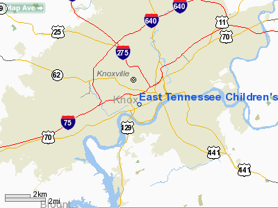
East Tennessee Children's Hospital Heliport |
Location & QuickFacts
| FAA Information Effective: | 2008-09-25 |
| Airport Identifier: | 0TN9 |
| Airport Status: | Operational |
| Longitude/Latitude: | 083-56-17.6630W/35-57-22.2960N
-83.938240/35.956193 (Estimated) |
| Elevation: | 1003 ft / 305.71 m (Estimated) |
| Land: | 0 acres |
| From nearest city: | 0 nautical miles S of Knoxville, TN |
| Location: | Knox County, TN |
| Magnetic Variation: | 03W (1980) |
Owner & Manager
| Ownership: | Privately owned |
| Owner: | East Tn. Children's Hospital |
| Address: | 2018 West Clinch Ave
Knoxville, TN 37916 |
| Phone number: | 865-541-8000 |
| Manager: | Rudy Mc Kinley |
| Address: | 2018 West Clinch Ave
Knoxville, TN 37916 |
| Phone number: | 865-541-8111 |
Airport Operations and Facilities
| Airport Use: | Private
MEDICAL. |
| Wind indicator: | Yes |
| Segmented Circle: | No |
| Control Tower: | No |
| Lighting Schedule: | PHONE REQ
FOR PERIMETER LGTS AND FLOOD LGTS CALL 615-541-8000. |
| Sectional chart: | Atlanta |
| Region: | ASO - Southern |
| Boundary ARTCC: | ZTL - Atlanta |
| Tie-in FSS: | BNA - Nashville |
| FSS on Airport: | No |
| FSS Toll Free: | 1-800-WX-BRIEF |
Runway Information
Helipad H1
| Dimension: | 46 x 46 ft / 14.0 x 14.0 m |
| Surface: | CONC, Good Condition
ROOFTOP HELI. |
| |
Runway H1 |
Runway |
| Traffic Pattern: | Left | Left |
|
Radio Navigation Aids
| ID |
Type |
Name |
Ch |
Freq |
Var |
Dist |
| JXT | NDB | Jefferson | | 346.00 | 04W | 24.3 nm |
| JAU | NDB | Jacksboro | | 204.00 | 03W | 25.4 nm |
| MNV | NDB | Madisonville | | 361.00 | 04W | 32.9 nm |
| BPO | NDB | Piney Grove | | 403.00 | 05W | 43.7 nm |
| MMI | NDB | Mc Minn County | | 242.00 | 03W | 45.5 nm |
| VXV | VORTAC | Volunteer | 111X | 116.40 | 03W | 3.7 nm |
| SOT | VORTAC | Snowbird | 025X | 108.80 | 04W | 44.3 nm |
| TYS | VOT | Knoxville | | 112.00 | | 9.0 nm |
Remarks
Images and information placed above are from
http://www.airport-data.com/airport/0TN9/
We thank them for the data!
| General Info
|
| Country |
United States
|
| State |
TENNESSEE
|
| FAA ID |
0TN9
|
| Latitude |
35-57-22.296N
|
| Longitude |
083-56-17.663W
|
| Elevation |
1003 feet
|
| Near City |
KNOXVILLE
|
We don't guarantee the information is fresh and accurate. The data may
be wrong or outdated.
For more up-to-date information please refer to other sources.
|
|


