 |
|
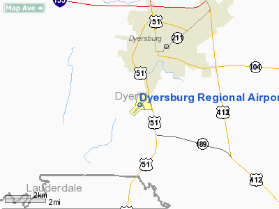
| Dyersburg Regional Airport |
| IATA: none – ICAO: KDYR – FAA LID: DYR |
| Summary |
| Airport type |
Public |
| Owner |
City of Dyersburg |
| Serves |
Dyersburg, Tennessee |
| Elevation AMSL |
338 ft / 103 m |
| Coordinates |
35°59′53″N 089°24′24″W / 35.99806°N 89.40667°W / 35.99806; -89.40667 |
| Runways |
| Direction |
Length |
Surface |
| ft |
m |
| 4/22 |
5,698 |
1,737 |
Asphalt |
| 16/34 |
4,000 |
1,219 |
Asphalt |
| Statistics (1996) |
| Aircraft operations |
19,400 |
| Based aircraft |
22 |
| Sources: Tennessee DOT, FAA |
Dyersburg Regional Airport (ICAO: KDYR, FAA LID: DYR) is a city-owned public use airport located two nautical miles (3.7 km) south of the central business district of Dyersburg, a city in Dyer County, Tennessee, United States. It was formerly known as Dyersburg Municipal Airport.
Although most U.S. airports use the same three-letter location identifier for the FAA and IATA, this airport is assigned DYR by the FAA but has no designation from the IATA (which assigned DYR to Anadyr Airport in Anadyr, Russia).
Facilities and aircraft
Dyersburg Regional Airport covers an area of 275 acres (111 ha) at an elevation of 338 feet (103 m) above mean sea level. It has two asphalt paved runways: 4/22 is 5,698 by 100 feet (1,737 x 30 m) and 16/34 is 4,000 by 75 feet.
For the 12-month period ending April 12, 1996, the airport had 19,400 aircraft operations, an average of 53 per day: 94% general aviation and 3% air taxi and 3% military. At that time there were 22 aircraft based at this airport: 77% single-engine and 23% multi-engine.
The above content comes from Wikipedia and is published under free licenses – click here to read more.
Location & QuickFacts
| FAA Information Effective: | 2008-09-25 |
| Airport Identifier: | DYR |
| Airport Status: | Operational |
| Longitude/Latitude: | 089-24-23.7230W/35-59-52.7230N
-89.406590/35.997979 (Estimated) |
| Elevation: | 338 ft / 103.02 m (Surveyed) |
| Land: | 275 acres |
| From nearest city: | 2 nautical miles S of Dyersburg, TN |
| Location: | Dyer County, TN |
| Magnetic Variation: | 01W (2005) |
Owner & Manager
| Ownership: | Publicly owned |
| Owner: | City Of Dyersburg |
| Address: | City Hall
Dyersburg, TN 38024 |
| Phone number: | 731-286-7600 |
| Manager: | Joey Spindler |
| Address: | 315 Airport Road
Dyersburg, TN 38024 |
| Phone number: | 731-287-8181 |
Airport Operations and Facilities
| Airport Use: | Open to public |
| Wind indicator: | Yes |
| Segmented Circle: | Yes |
| Control Tower: | No |
| Lighting Schedule: | DUSK-DAWN |
| Beacon Color: | Clear-Green (lighted land airport) |
| Landing fee charge: | No |
| Sectional chart: | St Louis |
| Region: | ASO - Southern |
| Boundary ARTCC: | ZME - Memphis |
| Tie-in FSS: | MKL - Jackson |
| FSS on Airport: | No |
| FSS Toll Free: | 1-800-WX-BRIEF |
| NOTAMs Facility: | DYR (NOTAM-d service avaliable) |
| Federal Agreements: | NGY3 |
Airport Communications
| CTAF: | 123.050 |
| Unicom: | 123.050 |
Airport Services
| Fuel available: | 100LLA |
| Airframe Repair: | MAJOR |
| Power Plant Repair: | MAJOR |
| Bottled Oxygen: | NONE |
| Bulk Oxygen: | NONE |
Runway Information
Runway 04/22
| Dimension: | 5698 x 100 ft / 1736.8 x 30.5 m |
| Surface: | ASPH, Good Condition |
| Weight Limit: | Single wheel: 55000 lbs.
Dual wheel: 80000 lbs.
Dual tandem wheel: 140000 lbs. |
| Edge Lights: | Medium |
| |
Runway 04 |
Runway 22 |
| Longitude: | 089-24-50.0200W | 089-24-04.9500W |
| Latitude: | 35-59-25.5800N | 36-00-08.4000N |
| Elevation: | 296.00 ft | 335.00 ft |
| Alignment: | 40 | 127 |
| Traffic Pattern: | Left | Left |
| Markings: | Non-precision instrument, Good Condition | Non-precision instrument, Good Condition |
| Displaced threshold: | 0.00 ft | 694.00 ft |
| VASI: | 4-light PAPI on left side | 4-light PAPI on left side |
| Runway End Identifier: | Yes
REILS OTS INDEFLY. | Yes
REILS OTS INDEFLY. |
| Obstruction: | 47 ft tree, 1892.0 ft from runway, 173 ft right of centerline, 36:1 slope to clear | 16 ft tree, 320.0 ft from runway, 53 ft left of centerline, 7:1 slope to clear |
|
Runway 16/34
| Dimension: | 4000 x 75 ft / 1219.2 x 22.9 m |
| Surface: | ASPH, Good Condition |
| Weight Limit: | Single wheel: 50000 lbs.
Dual wheel: 75000 lbs.
Dual tandem wheel: 135000 lbs. |
| |
Runway 16 |
Runway 34 |
| Longitude: | 089-24-26.0700W | 089-24-10.6600W |
| Latitude: | 36-00-19.6500N | 35-59-42.1300N |
| Elevation: | 338.00 ft | 326.00 ft |
| Alignment: | 127 | 127 |
| Traffic Pattern: | Left | Left |
| Markings: | Basic, Good Condition | Basic, Good Condition |
| Obstruction: | , 50:1 slope to clear | 48 ft tree, 840.0 ft from runway, 125 ft left of centerline, 13:1 slope to clear |
|
Radio Navigation Aids
| ID |
Type |
Name |
Ch |
Freq |
Var |
Dist |
| DNT | NDB | Nally Dunston | | 343.00 | 01W | 0.2 nm |
| IUI | NDB | Hicks | | 350.00 | 01E | 21.1 nm |
| COO | NDB | Covington | | 326.00 | 02E | 26.1 nm |
| UC | NDB | Obion | | 212.00 | 00E | 26.9 nm |
| TGC | NDB | Gibson | | 378.00 | 01E | 27.3 nm |
| TKX | NDB | Kennett | | 358.00 | 00E | 33.7 nm |
| BPW | NDB | Osceola | | 239.00 | 02E | 34.8 nm |
| MXA | NDB | Manila | | 282.00 | 01E | 37.1 nm |
| HZD | NDB | Huntingdon | | 217.00 | 00E | 46.0 nm |
| FYE | NDB | Somerville | | 255.00 | 00E | 47.6 nm |
| GOJ | VOR | Gosnell | | 111.80 | 01E | 26.2 nm |
| MKL | VOR/DME | Mc Kellar | 057X | 112.00 | 02E | 33.9 nm |
| DYR | VORTAC | Dyersburg | 115X | 116.80 | 03E | 4.5 nm |
| MAW | VORTAC | Malden | 049X | 111.20 | 03E | 41.5 nm |
Images and information placed above are from
http://www.airport-data.com/airport/DYR/
We thank them for the data!
| General Info
|
| Country |
United States
|
| State |
TENNESSEE
|
| FAA ID |
DYR
|
| Latitude |
35-59-54.625N
|
| Longitude |
089-24-21.900W
|
| Elevation |
338 feet
|
| Near City |
DYERSBURG
|
We don't guarantee the information is fresh and accurate. The data may
be wrong or outdated.
For more up-to-date information please refer to other sources.
|
|


