 |
|
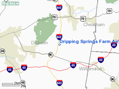
Dripping Springs Farm Airport |
Location & QuickFacts
| FAA Information Effective: | 2008-09-25 |
| Airport Identifier: | 6TN9 |
| Airport Status: | Operational |
| Longitude/Latitude: | 087-14-50.0000W/36-03-41.0000N
-87.247222/36.061389 (Estimated) |
| Elevation: | 728 ft / 221.89 m (Surveyed) |
| Land: | 250 acres |
| From nearest city: | 3 nautical miles E of Burns, TN |
| Location: | Dickson County, TN |
| Magnetic Variation: | 01W (1990) |
Owner & Manager
| Ownership: | Privately owned |
| Owner: | Mr & Mrs Joe B Wyatt |
| Address: | Po Box 280
Burns, TN 37029 |
| Phone number: | 615-797-2436 |
| Address: |
|
Airport Operations and Facilities
| Airport Use: | Private |
| Segmented Circle: | No |
| Control Tower: | No |
| Sectional chart: | St Louis |
| Region: | ASO - Southern |
| Boundary ARTCC: | ZME - Memphis |
| Tie-in FSS: | MKL - Jackson |
| FSS Toll Free: | 1-800-WX-BRIEF |
Runway Information
Runway 14/32
| Dimension: | 1400 x 60 ft / 426.7 x 18.3 m |
| Surface: | TURF, |
| |
Runway 14 |
Runway 32 |
| Traffic Pattern: | Left | Right |
|
Radio Navigation Aids
| ID |
Type |
Name |
Ch |
Freq |
Var |
Dist |
| DMZ | NDB | Dickson | | 203.00 | 01W | 9.8 nm |
| AEY | NDB | Waverly | | 329.00 | 00E | 24.2 nm |
| ON | NDB | Music | | 279.00 | 03W | 26.3 nm |
| PBC | NDB | Maury County | | 365.00 | 01W | 28.3 nm |
| VI | NDB | Opery | | 344.00 | 02W | 30.1 nm |
| PED | NDB | Needmore | | 221.00 | 01W | 32.7 nm |
| SWZ | NDB | Sewart | | 391.00 | 02W | 38.6 nm |
| LUG | NDB | Verona | | 251.00 | 00W | 39.9 nm |
| JHG | NDB | Hohenwald | | 257.00 | 01W | 40.6 nm |
| FK | NDB | Airbe | | 273.00 | 01W | 41.4 nm |
| FQW | NDB | Walter Hill | | 371.00 | 02W | 43.0 nm |
| JUE | NDB | Lebanon | | 414.00 | 02W | 46.0 nm |
| HIX | NDB | Honey Grove | | 356.00 | 01W | 49.4 nm |
| LRT | NDB | Lawrenceburg | | 269.00 | 00E | 49.6 nm |
| HXW | TACAN | Screaming Eagle | 096X | | 01W | 38.8 nm |
| CKV | VOR/DME | Clarksville | 043X | 110.60 | 01W | 34.6 nm |
| SYI | VOR/DME | Shelbyville | 027X | 109.00 | 01W | 49.5 nm |
| GHM | VORTAC | Graham | 053X | 111.60 | 03E | 16.9 nm |
| BNA | VORTAC | Nashville | 088X | 114.10 | 02W | 27.7 nm |
| BNA | VOT | Nashville Metropoln | | 108.60 | | 27.7 nm |
| MQY | VOT | Smyrna | | 110.20 | | 36.1 nm |
Remarks
Images and information placed above are from
http://www.airport-data.com/airport/6TN9/
We thank them for the data!
| General Info
|
| Country |
United States
|
| State |
TENNESSEE
|
| FAA ID |
6TN9
|
| Latitude |
36-03-41.000N
|
| Longitude |
087-14-50.000W
|
| Elevation |
728 feet
|
| Near City |
BURNS
|
We don't guarantee the information is fresh and accurate. The data may
be wrong or outdated.
For more up-to-date information please refer to other sources.
|
|


