 |
|
Location & QuickFacts
| FAA Information Effective: | 2008-09-25 |
| Airport Identifier: | 9TN8 |
| Airport Status: | Operational |
| Longitude/Latitude: | 086-41-55.0000W/36-18-48.0000N
-86.698611/36.313333 (Estimated) |
| Elevation: | 736 ft / 224.33 m (Estimated) |
| Land: | 0 acres |
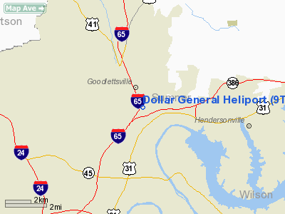
| From nearest city: | 4 nautical miles SE of Goodlettsville, TN |
| Location: | Davidson County, TN |
| Magnetic Variation: | 02W (1995) |
Owner & Manager
| Ownership: | Privately owned |
| Owner: | Dollar General Corporation |
| Address: | 501 North Chase Drive
Goodlettsville, TN 37072 |
| Phone number: | 615-263-6000 |
| Manager: | Dollar General Corporation |
| Address: | 501 North Chase Drive
Goodlettsville, TN 37072 |
| Phone number: | 615-263-6000 |
Airport Operations and Facilities
| Airport Use: | Private |
| Wind indicator: | Yes |
| Segmented Circle: | No |
| Control Tower: | No |
| Lighting Schedule: | RDO-CTL
ACTVT PERIMETER LGTS & LGTD WINDCONE - 123.075. |
| Sectional chart: | Atlanta |
| Region: | ASO - Southern |
| Boundary ARTCC: | ZME - Memphis |
| Tie-in FSS: | BNA - Nashville |
| FSS Toll Free: | 1-800-WX-BRIEF |
Runway Information
Helipad H1
| Dimension: | 40 x 40 ft / 12.2 x 12.2 m |
| Surface: | MATS, |
| |
Runway H1 |
Runway |
| Traffic Pattern: | Left | Left |
|
Radio Navigation Aids
| ID |
Type |
Name |
Ch |
Freq |
Var |
Dist |
| VI | NDB | Opery | | 344.00 | 02W | 6.9 nm |
| ON | NDB | Music | | 279.00 | 03W | 16.4 nm |
| PED | NDB | Needmore | | 221.00 | 01W | 17.1 nm |
| JUE | NDB | Lebanon | | 414.00 | 02W | 20.0 nm |
| SWZ | NDB | Sewart | | 391.00 | 02W | 24.3 nm |
| FQW | NDB | Walter Hill | | 371.00 | 02W | 26.5 nm |
| LFB | NDB | Lafayette | | 245.00 | 02W | 33.1 nm |
| DMZ | NDB | Dickson | | 203.00 | 01W | 37.3 nm |
| FK | NDB | Airbe | | 273.00 | 01W | 42.9 nm |
| HIX | NDB | Honey Grove | | 356.00 | 01W | 46.0 nm |
| PBC | NDB | Maury County | | 365.00 | 01W | 46.5 nm |
| SKN | NDB | Hurricane | | 256.00 | 02W | 47.5 nm |
| LUG | NDB | Verona | | 251.00 | 00W | 49.2 nm |
| HXW | TACAN | Screaming Eagle | 096X | | 01W | 44.2 nm |
| CKV | VOR/DME | Clarksville | 043X | 110.60 | 01W | 39.2 nm |
| SYI | VOR/DME | Shelbyville | 027X | 109.00 | 01W | 46.9 nm |
| BNA | VORTAC | Nashville | 088X | 114.10 | 02W | 10.6 nm |
| BWG | VORTAC | Bowling Green | 126X | 117.90 | 02E | 39.0 nm |
| GHM | VORTAC | Graham | 053X | 111.60 | 03E | 46.6 nm |
| BNA | VOT | Nashville Metropoln | | 108.60 | | 11.2 nm |
| MQY | VOT | Smyrna | | 110.20 | | 20.6 nm |
Remarks
- WATER TOWER 486 NORTHEAST & POWER LINES 555 FT SOUTHEAST OF HELIPAD.
- PRVDD ALL APCH/DEP FROM 260-180 DEGS CLKWS, AREA MKD, WIND INDICATOR IS MAINTAINED.
Images and information placed above are from
http://www.airport-data.com/airport/9TN8/
We thank them for the data!
| General Info
|
| Country |
United States
|
| State |
TENNESSEE
|
| FAA ID |
9TN8
|
| Latitude |
36-18-48.000N
|
| Longitude |
086-41-55.000W
|
| Elevation |
736 feet
|
| Near City |
GOODLETTSVILLE
|
We don't guarantee the information is fresh and accurate. The data may
be wrong or outdated.
For more up-to-date information please refer to other sources.
|
|


