 |
|
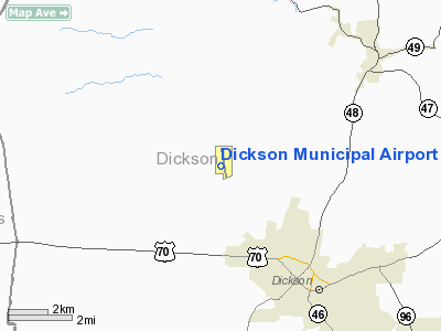
Location & QuickFacts
| FAA Information Effective: | 2008-09-25 |
| Airport Identifier: | M02 |
| Airport Status: | Operational |
| Longitude/Latitude: | 087-25-47.4400W/36-07-40.6295N
-87.429844/36.127953 (Estimated) |
| Elevation: | 892 ft / 271.88 m (Surveyed) |
| Land: | 362 acres |
| From nearest city: | 3 nautical miles N of Dickson, TN |
| Location: | Dickson County, TN |
| Magnetic Variation: | 01W (1995) |
Owner & Manager
| Ownership: | Publicly owned |
| Owner: | Dickson County Arpt Authority
CHARLES HAMPTON, ARPT AUTHORITY CHAIRMAN. |
| Address: | P.o.box 901
Dickson, TN 37056 |
| Phone number: | 615-446-6611 |
| Manager: | Larry L. Hansen & Jeffrey L. Tipton |
| Address: | 2370 Sylvia Rd
Dickson, TN 37056 |
| Phone number: | 615-446-5962
FAX 615-446-6265. |
Airport Operations and Facilities
| Airport Use: | Open to public |
| Wind indicator: | Yes |
| Segmented Circle: | Yes |
| Control Tower: | No |
| Lighting Schedule: | DUSK-DAWN |
| Beacon Color: | Clear-Green (lighted land airport) |
| Landing fee charge: | No |
| Sectional chart: | St Louis |
| Region: | ASO - Southern |
| Boundary ARTCC: | ZME - Memphis |
| Tie-in FSS: | MKL - Jackson |
| FSS on Airport: | No |
| FSS Toll Free: | 1-800-WX-BRIEF |
| NOTAMs Facility: | MKL (NOTAM-d service avaliable) |
| Federal Agreements: | N1 |
Airport Communications
| CTAF: | 122.800 |
| Unicom: | 122.800 |
Airport Services
| Fuel available: | 100LLA |
| Airframe Repair: | MAJOR |
| Power Plant Repair: | MAJOR |
| Bottled Oxygen: | NONE |
| Bulk Oxygen: | NONE |
Runway Information
Runway 17/35
| Dimension: | 5001 x 75 ft / 1524.3 x 22.9 m |
| Surface: | ASPH, Good Condition |
| Weight Limit: | Single wheel: 16000 lbs.
Dual wheel: 26000 lbs. |
| Edge Lights: | Medium |
| |
Runway 17 |
Runway 35 |
| Longitude: | 087-25-51.5790W | 087-25-43.3010W |
| Latitude: | 36-08-05.1450N | 36-07-16.1140N |
| Elevation: | 892.00 ft | 868.00 ft |
| Alignment: | 127 | 127 |
| Traffic Pattern: | Left | Left |
| Markings: | Non-precision instrument, Good Condition | Non-precision instrument, Good Condition |
| VASI: | 2-light PAPI on left side | 2-light PAPI on left side |
| Runway End Identifier: | Yes | Yes
RY 35 REIL OTS INDEFLY. |
| Obstruction: | 44 ft trees, 1056.0 ft from runway, 55 ft left of centerline, 19:1 slope to clear | 70 ft trees, 1209.0 ft from runway, 308 ft left of centerline, 14:1 slope to clear |
|
Radio Navigation Aids
| ID |
Type |
Name |
Ch |
Freq |
Var |
Dist |
| DMZ | NDB | Dickson | | 203.00 | 01W | 0.1 nm |
| AEY | NDB | Waverly | | 329.00 | 00E | 15.1 nm |
| ON | NDB | Music | | 279.00 | 03W | 28.6 nm |
| PED | NDB | Needmore | | 221.00 | 01W | 34.9 nm |
| PBC | NDB | Maury County | | 365.00 | 01W | 35.3 nm |
| FK | NDB | Airbe | | 273.00 | 01W | 36.6 nm |
| VI | NDB | Opery | | 344.00 | 02W | 38.0 nm |
| JHG | NDB | Hohenwald | | 257.00 | 01W | 41.2 nm |
| HIX | NDB | Honey Grove | | 356.00 | 01W | 45.5 nm |
| SWZ | NDB | Sewart | | 391.00 | 02W | 48.1 nm |
| LUG | NDB | Verona | | 251.00 | 00W | 48.3 nm |
| TIQ | NDB | Trainer | | 410.00 | 00E | 48.4 nm |
| HXW | TACAN | Screaming Eagle | 096X | | 01W | 33.1 nm |
| CKV | VOR/DME | Clarksville | 043X | 110.60 | 01W | 29.7 nm |
| GHM | VORTAC | Graham | 053X | 111.60 | 03E | 17.7 nm |
| BNA | VORTAC | Nashville | 088X | 114.10 | 02W | 36.2 nm |
| BNA | VOT | Nashville Metropoln | | 108.60 | | 36.3 nm |
| MQY | VOT | Smyrna | | 110.20 | | 45.4 nm |
Remarks
Images and information placed above are from
http://www.airport-data.com/airport/M02/
We thank them for the data!
| General Info
|
| Country |
United States
|
| State |
TENNESSEE
|
| FAA ID |
M02
|
| Latitude |
36-07-45.542N
|
| Longitude |
087-25-48.254W
|
| Elevation |
892 feet
|
| Near City |
DICKSON
|
We don't guarantee the information is fresh and accurate. The data may
be wrong or outdated.
For more up-to-date information please refer to other sources.
|
|


