 |
|
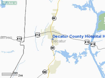
Decatur County Hospital Heliport |
Location & QuickFacts
| FAA Information Effective: | 2008-09-25 |
| Airport Identifier: | 6TN5 |
| Airport Status: | Operational |
| Longitude/Latitude: | 088-07-20.0000W/35-38-10.0000N
-88.122222/35.636111 (Estimated) |
| Elevation: | 520 ft / 158.50 m (Estimated) |
| Land: | 50 acres |
| From nearest city: | 3 nautical miles NE of Parsons, TN |
| Location: | Decatur County, TN |
| Magnetic Variation: | 00E (1990) |
Owner & Manager
| Ownership: | Publicly owned |
| Owner: | Decatur County |
| Address: | 1200 Tn Ave S
Parsons, TN 38363 |
| Phone number: | 901-847-3031 |
| Manager: | Larry Lindsey |
| Address: | 1200 Tn Ave S
Parsons, TN 38363 |
| Phone number: | 901-847-3031 |
Airport Operations and Facilities
| Airport Use: | Private |
| Wind indicator: | Yes |
| Segmented Circle: | No |
| Control Tower: | No |
| Sectional chart: | Memphis |
| Region: | ASO - Southern |
| Boundary ARTCC: | ZME - Memphis |
| Tie-in FSS: | MKL - Jackson |
| FSS on Airport: | No |
| FSS Toll Free: | 1-800-WX-BRIEF |
Runway Information
Helipad H1
| Dimension: | 50 x 50 ft / 15.2 x 15.2 m |
| Surface: | ASPH, |
| |
Runway H1 |
Runway |
| Traffic Pattern: | Left | Left |
|
Radio Navigation Aids
| ID |
Type |
Name |
Ch |
Freq |
Var |
Dist |
| HHY | NDB | Pinhook | | 346.00 | 01W | 23.3 nm |
| JHG | NDB | Hohenwald | | 257.00 | 01W | 26.2 nm |
| SZY | NDB | Sibley | | 386.00 | 01E | 30.8 nm |
| HZD | NDB | Huntingdon | | 217.00 | 00E | 32.0 nm |
| AEY | NDB | Waverly | | 329.00 | 00E | 34.3 nm |
| TIQ | NDB | Trainer | | 410.00 | 00E | 39.5 nm |
| TGC | NDB | Gibson | | 378.00 | 01E | 39.8 nm |
| DMZ | NDB | Dickson | | 203.00 | 01W | 44.7 nm |
| LRT | NDB | Lawrenceburg | | 269.00 | 00E | 48.6 nm |
| JKS | VOR/DME | Jacks Creek | 031X | 109.40 | 02E | 11.8 nm |
| MKL | VOR/DME | Mc Kellar | 057X | 112.00 | 02E | 38.6 nm |
| GHM | VORTAC | Graham | 053X | 111.60 | 03E | 34.8 nm |
Remarks
- VFR; PRIVATE USE; OPNS CONDUCTED FROM 70 DEGS TO 90 DEGS & FROM 300 DEGS TO 320 DEGS; AREA IS MARKED; WIND INDICATOR MAINTAINED; LETTER OF AGREEMENT WITH SCOTT FIELD ARPT.
Images and information placed above are from
http://www.airport-data.com/airport/6TN5/
We thank them for the data!
| General Info
|
| Country |
United States
|
| State |
TENNESSEE
|
| FAA ID |
6TN5
|
| Latitude |
35-38-10.000N
|
| Longitude |
088-07-20.000W
|
| Elevation |
520 feet
|
| Near City |
PARSONS
|
We don't guarantee the information is fresh and accurate. The data may
be wrong or outdated.
For more up-to-date information please refer to other sources.
|
|


