 |
|
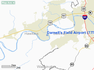
Location & QuickFacts
| FAA Information Effective: | 2008-09-25 |
| Airport Identifier: | 77TN |
| Airport Status: | Operational |
| Longitude/Latitude: | 082-40-54.0000W/36-30-33.0000N
-82.681667/36.509167 (Estimated) |
| Elevation: | 1150 ft / 350.52 m (Estimated) |
| Land: | 20 acres |
| From nearest city: | 3 nautical miles SE of Church Hill, TN |
| Location: | Hawkins County, TN |
| Magnetic Variation: | () |
Owner & Manager
| Ownership: | Privately owned |
| Owner: | Gary F. Darnell& Dave Waldo |
| Address: | 545 Church Lane
Church Hill, TN 37642 |
| Phone number: | 423-360-3762 |
| Manager: | Gary F. Darnell & Dave Waldo |
| Address: | 545 Church Lane
Church Hill, TN 37642 |
| Phone number: | 423-360-3762 |
Airport Operations and Facilities
| Airport Use: | Private |
| Wind indicator: | Yes |
| Control Tower: | No |
| Sectional chart: | Cincinnati |
| Region: | ASO - Southern |
| Boundary ARTCC: | ZTL - Atlanta |
| Tie-in FSS: | BNA - Nashville |
| FSS Toll Free: | 1-800-WX-BRIEF |
Runway Information
Runway 17/35
| Dimension: | 1500 x 25 ft / 457.2 x 7.6 m |
| Surface: | TURF, |
| |
Runway 17 |
Runway 35 |
| Traffic Pattern: | Left | Left |
| Obstruction: | | 70 ft trees, 400.0 ft from runway |
|
Radio Navigation Aids
| ID |
Type |
Name |
Ch |
Freq |
Var |
Dist |
| RVN | NDB | Rogersville | | 329.00 | 04W | 10.3 nm |
| BO | NDB | Booie | | 221.00 | 04W | 11.2 nm |
| LQV | NDB | Long Hollow | | 252.00 | 03W | 22.4 nm |
| EZT | NDB | Elizabethton | | 275.00 | 02W | 23.0 nm |
| DYQ | NDB | Dulaney | | 263.00 | 04W | 24.6 nm |
| VJ | NDB | Whine | | 236.00 | 05W | 37.8 nm |
| JJO | NDB | Mountain City | | 396.00 | 04W | 41.8 nm |
| BAR | NDB | Hemlock | | 320.00 | 02W | 44.3 nm |
| JXT | NDB | Jefferson | | 346.00 | 04W | 45.3 nm |
| GZG | VOR/DME | Glade Spring | 039X | 110.20 | 02W | 34.7 nm |
| HMV | VORTAC | Holston Mountain | 093X | 114.60 | 04W | 27.0 nm |
| SOT | VORTAC | Snowbird | 025X | 108.80 | 04W | 46.8 nm |
Remarks
- UNLGTD 195 FT AGL ANT TWR 2 NM WNW AND LGTD 290 FT ANT TWR 2 NM NNE OF ARPT.
- PRVDD YOU EXCT A LOA WITH DARNELL'S LANDINGS ARPT REGARDING TFC PAT OPNS AND INFORM ALL PILOTS OF THIS AGREEMENT AND OF THE ANT TWRS 2 NM WNW AND NNE AND THAT THIS ARPT IS NEAR A MIL TRNG AREA.
Images and information placed above are from
http://www.airport-data.com/airport/77TN/
We thank them for the data!
|
|


