 |
|
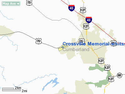
Crossville Memorial-whitson Field Airport |
Location & QuickFacts
| FAA Information Effective: | 2008-09-25 |
| Airport Identifier: | CSV |
| Airport Status: | Operational |
| Longitude/Latitude: | 085-05-05.9214W/35-57-04.6505N
-85.084978/35.951292 (Estimated) |
| Elevation: | 1881 ft / 573.33 m (Surveyed) |
| Land: | 160 acres |
| From nearest city: | 3 nautical miles W of Crossville, TN |
| Location: | Cumberland County, TN |
| Magnetic Variation: | 02W (1990) |
Owner & Manager
| Ownership: | Publicly owned |
| Owner: | City Of Crossville |
| Address: | 99 Municipal Ave
Crossville, TN 38555 |
| Phone number: | 931-484-7060 |
| Manager: | Chris Bennett |
| Address: | 2409 Sparta Hwy
Crossville, TN 38555 |
| Phone number: | 931-484-5016 |
Airport Operations and Facilities
| Airport Use: | Open to public |
| Wind indicator: | Yes |
| Segmented Circle: | Yes |
| Control Tower: | No |
| Lighting Schedule: | DUSK-DAWN
HIRL RY 08/26 PRESET LOW INTENSITY; TO INCREASE INTENSITY ACTIVATE - CTAF |
| Beacon Color: | Clear-Green (lighted land airport) |
| Landing fee charge: | No |
| Sectional chart: | Atlanta |
| Region: | ASO - Southern |
| Boundary ARTCC: | ZTL - Atlanta |
| Tie-in FSS: | BNA - Nashville |
| FSS on Airport: | No |
| FSS Toll Free: | 1-800-WX-BRIEF |
| NOTAMs Facility: | CSV (NOTAM-d service avaliable) |
| Federal Agreements: | NGY |
Airport Communications
| CTAF: | 122.700 |
| Unicom: | 122.700 |
Airport Services
| Fuel available: | 100LLA+ |
| Airframe Repair: | MAJOR |
| Power Plant Repair: | MAJOR |
| Bottled Oxygen: | NONE |
| Bulk Oxygen: | NONE |
Runway Information
Runway 08/26
| Dimension: | 5418 x 100 ft / 1651.4 x 30.5 m |
| Surface: | ASPH, Good Condition |
| Weight Limit: | Single wheel: 33000 lbs.
Dual wheel: 62000 lbs. |
| Edge Lights: | High |
| |
Runway 08 |
Runway 26 |
| Longitude: | 085-05-37.5035W | 085-04-34.3375W |
| Latitude: | 35-56-57.0219N | 35-57-12.2768N |
| Elevation: | 1881.00 ft | 1866.00 ft |
| Alignment: | 73 | 127 |
| ILS Type: | | ILS
|
| Traffic Pattern: | Left | Left |
| Markings: | Precision instrument, Good Condition | Precision instrument, Good Condition |
| Crossing Height: | 50.00 ft | 52.00 ft |
| VASI: | 4-box on right side | 4-light PAPI on left side |
| Visual Glide Angle: | 3.00° | 3.00° |
| Runway End Identifier: | | Yes |
| Obstruction: | 12 ft trees, 321.0 ft from runway, 1 ft right of centerline, 10:1 slope to clear | 19 ft trees, 507.0 ft from runway, 16 ft right of centerline, 16:1 slope to clear |
|
Radio Navigation Aids
| ID |
Type |
Name |
Ch |
Freq |
Var |
Dist |
| HEM | NDB | Huchn | | 233.00 | 02W | 24.5 nm |
| DTE | NDB | Mark Anton | | 394.00 | 02W | 29.2 nm |
| RN | NDB | Warri | | 209.00 | 02W | 35.2 nm |
| SKN | NDB | Hurricane | | 256.00 | 02W | 35.2 nm |
| MNV | NDB | Madisonville | | 361.00 | 04W | 42.1 nm |
| MMI | NDB | Mc Minn County | | 242.00 | 03W | 42.1 nm |
| BPO | NDB | Piney Grove | | 403.00 | 05W | 46.1 nm |
| CQN | NDB | Daisy | | 341.00 | 02W | 47.3 nm |
| HDI | NDB | Hardwick | | 369.00 | 01W | 48.7 nm |
| HCH | VORTAC | Hinch Mountain | 123X | 117.60 | 02W | 11.5 nm |
| LVT | VORTAC | Livingston | 021X | 108.40 | 02W | 38.3 nm |
Images and information placed above are from
http://www.airport-data.com/airport/CSV/
We thank them for the data!
| General Info
|
| Country |
United States
|
| State |
TENNESSEE
|
| FAA ID |
CSV
|
| Latitude |
35-57-04.651N
|
| Longitude |
085-05-05.921W
|
| Elevation |
1881 feet
|
| Near City |
CROSSVILLE
|
We don't guarantee the information is fresh and accurate. The data may
be wrong or outdated.
For more up-to-date information please refer to other sources.
|
|


