 |
|
Location & QuickFacts
| FAA Information Effective: | 2008-09-25 |
| Airport Identifier: | TN71 |
| Airport Status: | Operational |
| Longitude/Latitude: | 084-20-29.7240W/35-47-40.2750N
-84.341590/35.794521 (Estimated) |
| Elevation: | 1000 ft / 304.80 m (Estimated) |
| Land: | 61 acres |
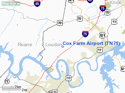
| From nearest city: | 9 nautical miles NW of Lenoir City, TN |
| Location: | Loudon County, TN |
| Magnetic Variation: | 03W (1985) |
Owner & Manager
| Ownership: | Privately owned |
| Owner: | David R Cox |
| Address: | Po Box 11665
Knoxville, TN 37939 |
| Phone number: | 865-588-2448 |
| Address: |
|
| Phone number: | 865-803-9282 |
Airport Operations and Facilities
| Airport Use: | Private |
| Wind indicator: | Yes |
| Segmented Circle: | No |
| Control Tower: | No |
| Landing fee charge: | No |
| Sectional chart: | Atlanta |
| Region: | ASO - Southern |
| Boundary ARTCC: | ZTL - Atlanta |
| Tie-in FSS: | BNA - Nashville |
| FSS on Airport: | No |
| FSS Toll Free: | 1-800-WX-BRIEF |
Runway Information
Runway 06/24
| Dimension: | 1600 x 100 ft / 487.7 x 30.5 m |
| Surface: | TURF, |
| |
Runway 06 |
Runway 24 |
| Traffic Pattern: | Left | Left |
|
Radio Navigation Aids
| ID |
Type |
Name |
Ch |
Freq |
Var |
Dist |
| MNV | NDB | Madisonville | | 361.00 | 04W | 15.1 nm |
| MMI | NDB | Mc Minn County | | 242.00 | 03W | 26.3 nm |
| JAU | NDB | Jacksboro | | 204.00 | 03W | 33.8 nm |
| DTE | NDB | Mark Anton | | 394.00 | 02W | 34.4 nm |
| TTQ | NDB | Tomotla | | 335.00 | 01W | 44.9 nm |
| BPO | NDB | Piney Grove | | 403.00 | 05W | 45.2 nm |
| JXT | NDB | Jefferson | | 346.00 | 04W | 46.2 nm |
| HDI | NDB | Hardwick | | 369.00 | 01W | 47.4 nm |
| VXV | VORTAC | Volunteer | 111X | 116.40 | 03W | 22.8 nm |
| HCH | VORTAC | Hinch Mountain | 123X | 117.60 | 02W | 31.1 nm |
| TYS | VOT | Knoxville | | 112.00 | | 17.0 nm |
Remarks
- OWNER DESIRES ARPT NOT BE CHARTED.
- VFR; PVT USE.
Images and information placed above are from
http://www.airport-data.com/airport/TN71/
We thank them for the data!
| General Info
|
| Country |
United States
|
| State |
TENNESSEE
|
| FAA ID |
TN71
|
| Latitude |
35-47-40.275N
|
| Longitude |
084-20-29.724W
|
| Elevation |
1000 feet
|
| Near City |
LENOIR CITY
|
We don't guarantee the information is fresh and accurate. The data may
be wrong or outdated.
For more up-to-date information please refer to other sources.
|
|


