 |
|
Coordinates: 35°35′00″N 089°35′14″W / 35.5833333°N 89.58722°W / 35.5833333; -89.58722
| Covington Municipal Airport |
| IATA: none – ICAO: none – FAA LID: M04 |
| Summary |
| Airport type |
Public |
| Owner |
City of Covington |
| Serves |
Covington, Tennessee |
| Elevation AMSL |
280 ft / 85 m |
| Runways |
| Direction |
Length |
Surface |
| ft |
m |
| 1/19 |
5,004 |
1,525 |
Asphalt |
| Statistics (1998) |
| Aircraft operations |
24,500 |
| Based aircraft |
44 |
| Source: Federal Aviation Administration |
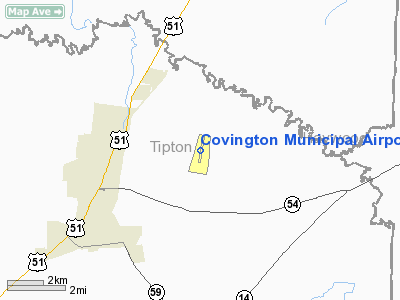
Covington Municipal Airport (FAA LID: M04) is a city-owned public-use airport located three miles (5 km) northeast of the central business district of Covington, a city in Tipton County, Tennessee, United States.
Facilities and aircraft
Covington Municipal Airport covers an area of 569 acres (230 ha) and contains one asphalt paved runway designated 1/19 which measures 5,004 x 100 ft (1,525 x 30 m). For the 12-month period ending February 20, 1998, the airport had 24,500 aircraft operations, an average of 67 per day: 96% general aviation, 4% air taxi and <1% military. At that time there were 44 aircraft based at this airport: 98% single-engine and 2% multi-engine.
The above content comes from Wikipedia and is published under free licenses – click here to read more.
Location & QuickFacts
| FAA Information Effective: | 2008-09-25 |
| Airport Identifier: | M04 |
| Airport Status: | Operational |
| Longitude/Latitude: | 089-35-13.9980W/35-35-00.1140N
-89.587222/35.583365 (Estimated) |
| Elevation: | 280 ft / 85.34 m (Surveyed) |
| Land: | 569 acres |
| From nearest city: | 3 nautical miles NE of Covington, TN |
| Location: | Tipton County, TN |
| Magnetic Variation: | 02E (1985) |
Owner & Manager
| Ownership: | Publicly owned |
| Owner: | City Of Covington |
| Address: | City Hall 133 E Pleasant
Covington, TN 38019 |
| Phone number: | 901-476-9613 |
| Manager: | Robin Anderson |
| Address: | 169 Airport Parkway Dr
Covington, TN 38019 |
| Phone number: | 901-476-1392 |
Airport Operations and Facilities
| Airport Use: | Open to public |
| Wind indicator: | Yes |
| Segmented Circle: | Yes |
| Control Tower: | No |
| Lighting Schedule: | DUSK-DAWN
MIRL RY 01/19 PRESET LOW INTST; TO INCR INTST ACTVT - CTAF. |
| Beacon Color: | Clear-Green (lighted land airport) |
| Landing fee charge: | No |
| Sectional chart: | Memphis |
| Region: | ASO - Southern |
| Boundary ARTCC: | ZME - Memphis |
| Tie-in FSS: | MKL - Jackson |
| FSS on Airport: | No |
| FSS Toll Free: | 1-800-WX-BRIEF |
| NOTAMs Facility: | MKL (NOTAM-d service avaliable) |
| Federal Agreements: | NGY |
Airport Communications
| CTAF: | 123.000 |
| Unicom: | 123.000 |
Airport Services
| Fuel available: | 100LLA |
| Bottled Oxygen: | NONE |
| Bulk Oxygen: | NONE |
Runway Information
Runway 01/19
| Dimension: | 5004 x 100 ft / 1525.2 x 30.5 m |
| Surface: | ASPH, Good Condition |
| Weight Limit: | Single wheel: 15000 lbs. |
| Edge Lights: | Medium |
| |
Runway 01 |
Runway 19 |
| Longitude: | 089-35-18.7720W | 089-35-09.2440W |
| Latitude: | 35-34-35.6780N | 35-35-24.5500N |
| Elevation: | 280.00 ft | 272.00 ft |
| Alignment: | 9 | 127 |
| Traffic Pattern: | Left | Left |
| Markings: | Non-precision instrument, Good Condition | Non-precision instrument, Good Condition |
| Crossing Height: | 21.00 ft | 0.00 ft |
| VASI: | 4-light PAPI on left side | 4-light PAPI on left side
RY 19 PAPI OTS INDEFLY. |
| Visual Glide Angle: | 3.00° | 0.00° |
| Runway End Identifier: | Yes | Yes |
| Obstruction: | 83 ft tree, 1688.0 ft from runway, 15 ft right of centerline, 17:1 slope to clear | 68 ft tree, 2499.0 ft from runway, 346 ft right of centerline, 33:1 slope to clear |
|
Radio Navigation Aids
| ID |
Type |
Name |
Ch |
Freq |
Var |
Dist |
| COO | NDB | Covington | | 326.00 | 02E | 0.4 nm |
| BPW | NDB | Osceola | | 239.00 | 02E | 21.8 nm |
| IUI | NDB | Hicks | | 350.00 | 01E | 24.5 nm |
| FYE | NDB | Somerville | | 255.00 | 00E | 24.6 nm |
| MIG | NDB | Millington | | 232.00 | 04E | 24.9 nm |
| DNT | NDB | Nally Dunston | | 343.00 | 01W | 26.3 nm |
| SPQ | NDB | Spain | | 414.00 | 04E | 32.3 nm |
| MXA | NDB | Manila | | 282.00 | 01E | 33.4 nm |
| BAV | NDB | Hardeman | | 404.00 | 01E | 34.7 nm |
| OLV | NDB | Olive Branch | | 275.00 | 01E | 37.6 nm |
| ME | NDB | Elvis | | 287.00 | 01E | 39.4 nm |
| AWM | NDB | West Memphis | | 362.00 | 01E | 41.4 nm |
| TGC | NDB | Gibson | | 378.00 | 01E | 41.7 nm |
| TKX | NDB | Kennett | | 358.00 | 00E | 44.6 nm |
| GOJ | VOR | Gosnell | | 111.80 | 01E | 28.0 nm |
| MKL | VOR/DME | Mc Kellar | 057X | 112.00 | 02E | 33.1 nm |
| GQE | VOR/DME | Gilmore | 077X | 113.00 | 04E | 45.9 nm |
| DYR | VORTAC | Dyersburg | 115X | 116.80 | 03E | 29.3 nm |
| MEM | VORTAC | Memphis | 122X | 117.50 | 01E | 39.3 nm |
| HLI | VORTAC | Holly Springs | 071X | 112.40 | 03E | 49.1 nm |
| MEM | VOT | Memphis Metropolitn | | 111.00 | | 37.4 nm |
Remarks
- NUMEROUS AGRICULTURAL ACFT OPNS CONDUCTED ON & INVOF ARPT MAY 1 - OCT 31.
Images and information placed above are from
http://www.airport-data.com/airport/M04/
We thank them for the data!
| General Info
|
| Country |
United States
|
| State |
TENNESSEE
|
| FAA ID |
M04
|
| Latitude |
35-35-00.114N
|
| Longitude |
089-35-13.998W
|
| Elevation |
280 feet
|
| Near City |
COVINGTON
|
We don't guarantee the information is fresh and accurate. The data may
be wrong or outdated.
For more up-to-date information please refer to other sources.
|
|


