 |
|
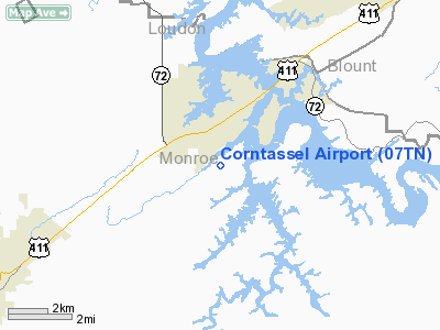
Location & QuickFacts
| FAA Information Effective: | 2008-09-25 |
| Airport Identifier: | 07TN |
| Airport Status: | Operational |
| Longitude/Latitude: | 084-14-28.0000W/35-34-07.0000N
-84.241111/35.568611 (Estimated) |
| Elevation: | 970 ft / 295.66 m (Estimated) |
| Land: | 0 acres |
| From nearest city: | 5 nautical miles S of Vonore, TN |
| Location: | Monroe County, TN |
| Magnetic Variation: | 04W (2000) |
Owner & Manager
| Ownership: | Privately owned |
| Owner: | Mike Swafford |
| Address: | 288 Chota View
Vonore, TN 37885 |
| Phone number: | 423-884-6218 |
| Manager: | Jerry Frank |
| Address: | 261 Mountain View Dr
Vonore, TN 37885 |
| Phone number: | 423-884-6948 |
Airport Operations and Facilities
| Airport Use: | Private |
| Wind indicator: | Yes |
| Segmented Circle: | No |
| Control Tower: | No |
| Sectional chart: | Atlanta |
| Region: | ASO - Southern |
| Boundary ARTCC: | ZTL - Atlanta |
| Tie-in FSS: | BNA - Nashville |
| FSS Toll Free: | 1-800-WX-BRIEF |
Runway Information
Runway 07/25
| Dimension: | 1800 x 75 ft / 548.6 x 22.9 m |
| Surface: | TURF, |
| |
Runway 07 |
Runway 25 |
| Traffic Pattern: | Left | Left |
| Displaced threshold: | 0.00 ft | 200.00 ft |
| Obstruction: | | 75 ft trees, 75.0 ft from runway |
|
Radio Navigation Aids
| ID |
Type |
Name |
Ch |
Freq |
Var |
Dist |
| MNV | NDB | Madisonville | | 361.00 | 04W | 7.1 nm |
| MMI | NDB | Mc Minn County | | 242.00 | 03W | 18.9 nm |
| TTQ | NDB | Tomotla | | 335.00 | 01W | 30.5 nm |
| DTE | NDB | Mark Anton | | 394.00 | 02W | 34.1 nm |
| HDI | NDB | Hardwick | | 369.00 | 01W | 41.0 nm |
| JAU | NDB | Jacksboro | | 204.00 | 03W | 46.4 nm |
| JXT | NDB | Jefferson | | 346.00 | 04W | 49.5 nm |
| VXV | VORTAC | Volunteer | 111X | 116.40 | 03W | 26.3 nm |
| HCH | VORTAC | Hinch Mountain | 123X | 117.60 | 02W | 38.2 nm |
| HRS | VORTAC | Harris | 035X | 109.80 | 00E | 40.9 nm |
| TYS | VOT | Knoxville | | 112.00 | | 19.0 nm |
Remarks
- PROVIDED VFR, PRIVATE USE.
Images and information placed above are from
http://www.airport-data.com/airport/07TN/
We thank them for the data!
| General Info
|
| Country |
United States
|
| State |
TENNESSEE
|
| FAA ID |
07TN
|
| Latitude |
35-34-07.000N
|
| Longitude |
084-14-28.000W
|
| Elevation |
970 feet
|
| Near City |
VONORE
|
We don't guarantee the information is fresh and accurate. The data may
be wrong or outdated.
For more up-to-date information please refer to other sources.
|
|


