 |
|
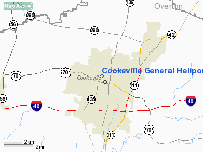
Cookeville General Heliport |
Location & QuickFacts
| FAA Information Effective: | 2008-09-25 |
| Airport Identifier: | TN31 |
| Airport Status: | Operational |
| Longitude/Latitude: | 085-30-29.9120W/36-10-12.2190N
-85.508309/36.170061 (Estimated) |
| Elevation: | 1140 ft / 347.47 m (Estimated) |
| Land: | 0 acres |
| From nearest city: | 0 nautical miles W of Cookeville, TN |
| Location: | Putnam County, TN |
| Magnetic Variation: | 01W (1985) |
Owner & Manager
| Ownership: | Privately owned |
| Owner: | Cookeville Regional Medical Center |
| Address: | 142 West 5th Street
Cookeville, TN 38501 |
| Phone number: | 931-528-2541 |
| Manager: | Joe Iwanyszyh |
| Address: | 142 West 5th St
Cookeville, TN 38501 |
| Phone number: | 931-528-2541
EXT 2588 |
Airport Operations and Facilities
| Airport Use: | Private
MEDICAL USE. |
| Wind indicator: | Yes |
| Segmented Circle: | No |
| Control Tower: | No |
| Sectional chart: | Memphis |
| Region: | ASO - Southern |
| Boundary ARTCC: | ZME - Memphis |
| Tie-in FSS: | BNA - Nashville |
| FSS Toll Free: | 1-800-WX-BRIEF |
Runway Information
Helipad H1
| Dimension: | 40 x 40 ft / 12.2 x 12.2 m |
| Surface: | CONC, |
| |
Runway H1 |
Runway |
| Traffic Pattern: | Left | Left |
|
Radio Navigation Aids
| ID |
Type |
Name |
Ch |
Freq |
Var |
Dist |
| HEM | NDB | Huchn | | 233.00 | 02W | 11.6 nm |
| SKN | NDB | Hurricane | | 256.00 | 02W | 18.4 nm |
| RN | NDB | Warri | | 209.00 | 02W | 28.0 nm |
| LFB | NDB | Lafayette | | 245.00 | 02W | 33.9 nm |
| JUE | NDB | Lebanon | | 414.00 | 02W | 39.1 nm |
| FQW | NDB | Walter Hill | | 371.00 | 02W | 43.8 nm |
| SWZ | NDB | Sewart | | 391.00 | 02W | 48.2 nm |
| LVT | VORTAC | Livingston | 021X | 108.40 | 02W | 29.9 nm |
| HCH | VORTAC | Hinch Mountain | 123X | 117.60 | 02W | 34.8 nm |
| MQY | VOT | Smyrna | | 110.20 | | 49.6 nm |
Remarks
- VFR PVT USE; APP/DEP ROUTES BE ON THE 80 DEG RAD; AREA IS MARKED; WIND INDIC IS MAINTAINED; NO NIGHT OPNS.
Images and information placed above are from
http://www.airport-data.com/airport/TN31/
We thank them for the data!
| General Info
|
| Country |
United States
|
| State |
TENNESSEE
|
| FAA ID |
TN31
|
| Latitude |
36-10-12.219N
|
| Longitude |
085-30-29.912W
|
| Elevation |
1140 feet
|
| Near City |
COOKEVILLE
|
We don't guarantee the information is fresh and accurate. The data may
be wrong or outdated.
For more up-to-date information please refer to other sources.
|
|


