 |
|
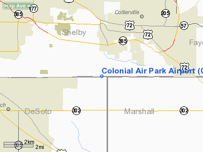
Colonial Air Park Airport |
Location & QuickFacts
| FAA Information Effective: | 2008-09-25 |
| Airport Identifier: | 01TN |
| Airport Status: | Operational |
| Longitude/Latitude: | 089-43-50.3040W/34-59-45.3340N
-89.730640/34.995926 (Estimated) |
| Elevation: | 370 ft / 112.78 m (Estimated) |
| Land: | 0 acres |
| From nearest city: | 4 nautical miles SW of Collierville, TN |
| Location: | Shelby County, TN |
| Magnetic Variation: | 02E (1985) |
Owner & Manager
| Ownership: | Privately owned |
| Owner: | State Line Properties Llc |
| Address: | C/o Bill Barnett Jr, Po Box 27441
Memphis, TN 38127 |
| Phone number: | 901-357-0373 |
| Manager: | Bill Barnett Jr |
| Address: | Po Box 27441
Memphis, TN 38127 |
| Phone number: | 901-357-0373 |
Airport Operations and Facilities
| Airport Use: | Private |
| Wind indicator: | Yes |
| Segmented Circle: | No |
| Control Tower: | No |
| Landing fee charge: | No |
| Sectional chart: | Memphis |
| Region: | ASO - Southern |
| Boundary ARTCC: | ZME - Memphis |
| Tie-in FSS: | MKL - Jackson |
| FSS on Airport: | No |
| FSS Toll Free: | 1-800-WX-BRIEF |
Airport Services
| Airframe Repair: | NONE |
| Power Plant Repair: | NONE |
Runway Information
Runway 18/36
| Dimension: | 2700 x 100 ft / 823.0 x 30.5 m |
| Surface: | TURF, |
| |
Runway 18 |
Runway 36 |
| Traffic Pattern: | Left | Right |
|
Radio Navigation Aids
| ID |
Type |
Name |
Ch |
Freq |
Var |
Dist |
| OLV | NDB | Olive Branch | | 275.00 | 01E | 3.0 nm |
| ME | NDB | Elvis | | 287.00 | 01E | 17.2 nm |
| MIG | NDB | Millington | | 232.00 | 04E | 19.7 nm |
| SPQ | NDB | Spain | | 414.00 | 04E | 20.0 nm |
| FYE | NDB | Somerville | | 255.00 | 00E | 20.9 nm |
| AWM | NDB | West Memphis | | 362.00 | 01E | 26.2 nm |
| BAV | NDB | Hardeman | | 404.00 | 01E | 36.3 nm |
| COO | NDB | Covington | | 326.00 | 02E | 36.4 nm |
| BPW | NDB | Osceola | | 239.00 | 02E | 44.1 nm |
| GQE | VOR/DME | Gilmore | 077X | 113.00 | 04E | 42.4 nm |
| MEM | VORTAC | Memphis | 122X | 117.50 | 01E | 12.5 nm |
| HLI | VORTAC | Holly Springs | 071X | 112.40 | 03E | 17.8 nm |
| MEM | VOT | Memphis Metropolitn | | 111.00 | | 12.6 nm |
Remarks
- 25' POLE (MRKD & LGTD) 150' WEST OF RWY.
- VFR ONLY, TRAFFIC PATTERNS TO EAST OF FIELD ONLY
Images and information placed above are from
http://www.airport-data.com/airport/01TN/
We thank them for the data!
| General Info
|
| Country |
United States
|
| State |
TENNESSEE
|
| FAA ID |
01TN
|
| Latitude |
34-59-45.334N
|
| Longitude |
089-43-50.304W
|
| Elevation |
370 feet
|
| Near City |
COLLIERVILLE
|
We don't guarantee the information is fresh and accurate. The data may
be wrong or outdated.
For more up-to-date information please refer to other sources.
|
|


