 |
|
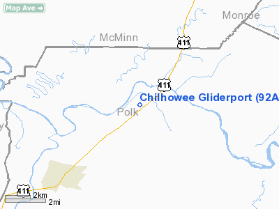
Chilhowee Gliderport Airport |
Location & QuickFacts
| FAA Information Effective: | 2008-09-25 |
| Airport Identifier: | 92A |
| Airport Status: | Operational |
| Longitude/Latitude: | 084-35-05.7580W/35-13-35.2640N
-84.584933/35.226462 (Estimated) |
| Elevation: | 770 ft / 234.70 m (Estimated) |
| Land: | 0 acres |
| From nearest city: | 4 nautical miles NE of Benton, TN |
| Location: | Polk County, TN |
| Magnetic Variation: | 02W (1985) |
Owner & Manager
| Ownership: | Privately owned |
| Owner: | Helen Reisman |
| Address: | 15 Fairhills Dr
Chattanooga, TN 37415 |
| Phone number: | 423-266-1767 |
| Manager: | Will Reisman |
| Address: | 15 Fairhills Dr
Chattanooga, TN 37415 |
| Phone number: | 423-338-2000 |
Airport Operations and Facilities
| Airport Use: | Open to public |
| Wind indicator: | Yes |
| Segmented Circle: | Yes |
| Control Tower: | No |
| Landing fee charge: | No |
| Sectional chart: | Atlanta |
| Region: | ASO - Southern |
| Boundary ARTCC: | ZTL - Atlanta |
| Tie-in FSS: | BNA - Nashville |
| FSS on Airport: | No |
| FSS Toll Free: | 1-800-WX-BRIEF |
| NOTAMs Facility: | BNA (NOTAM-d service avaliable) |
Airport Communications
Airport Services
| Airframe Repair: | NONE |
| Power Plant Repair: | NONE |
Runway Information
Runway 03/21
| Dimension: | 2600 x 200 ft / 792.5 x 61.0 m
CENTER 50 FT PORTION ONLY MARKED WITH IN-GROUND WHITE PAINTED MARKERS. |
| Surface: | TURF, Good Condition
SFC UNEVEN. |
| |
Runway 03 |
Runway 21 |
| Traffic Pattern: | Left | Right |
| Displaced threshold: | 400.00 ft
03/21 DSPLCD THLDS MARKED WITH IN-GROUND WHITE PAINTED MARKERS; FADED IN SEVERAL SPOTS. | 200.00 ft |
| Obstruction: | 22 ft pole, 400.0 ft from runway, 60 ft right of centerline, 18:1 slope to clear
APCH RATIO 36:1 TO DSPLCD THLD. | 47 ft tree, 585.0 ft from runway, 14 ft left of centerline, 12:1 slope to clear
APCH RATIO 19:1 TO DSPLCD THLD. |
|
Radio Navigation Aids
| ID |
Type |
Name |
Ch |
Freq |
Var |
Dist |
| MMI | NDB | Mc Minn County | | 242.00 | 03W | 10.2 nm |
| HDI | NDB | Hardwick | | 369.00 | 01W | 16.4 nm |
| MNV | NDB | Madisonville | | 361.00 | 04W | 21.6 nm |
| DTE | NDB | Mark Anton | | 394.00 | 02W | 22.9 nm |
| CQN | NDB | Daisy | | 341.00 | 02W | 28.3 nm |
| TTQ | NDB | Tomotla | | 335.00 | 01W | 31.6 nm |
| UWI | NDB | Whitfield | | 400.00 | 03W | 31.7 nm |
| JZP | NDB | Pickens County | | 285.00 | 04W | 46.7 nm |
| GQO | VORTAC | Choo Choo | 105X | 115.80 | 01E | 32.2 nm |
| HRS | VORTAC | Harris | 035X | 109.80 | 00E | 37.1 nm |
| HCH | VORTAC | Hinch Mountain | 123X | 117.60 | 02W | 38.5 nm |
| TYS | VOT | Knoxville | | 112.00 | | 45.6 nm |
Remarks
- EXTENSIVE GLIDER ACTVTY ON GOOD VFR DAYS.
- VFR ONLY.
Images and information placed above are from
http://www.airport-data.com/airport/92A/
We thank them for the data!
| General Info
|
| Country |
United States
|
| State |
TENNESSEE
|
| FAA ID |
92A
|
| Latitude |
35-13-35.264N
|
| Longitude |
084-35-05.758W
|
| Elevation |
770 feet
|
| Near City |
BENTON
|
We don't guarantee the information is fresh and accurate. The data may
be wrong or outdated.
For more up-to-date information please refer to other sources.
|
|


