 |
|
Coordinates: 35°50′15″N 087°26′43″W / 35.8375°N 87.44528°W / 35.8375; -87.44528
| Centerville Municipal Airport |
| IATA: GHM – ICAO: KGHM – FAA LID: GHM |
| Summary |
| Airport type |
Public |
| Owner |
City of Centerville |
| Serves |
Centerville, Tennessee |
| Elevation AMSL |
768 ft / 234 m |
| Runways |
| Direction |
Length |
Surface |
| ft |
m |
| 2/20 |
4,002 |
1,220 |
Asphalt |
| Statistics (2004) |
| Aircraft operations |
6,350 |
| Based aircraft |
14 |
| Source: Federal Aviation Administration |
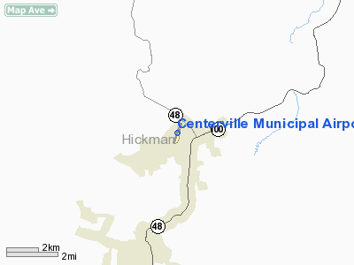
Centerville Municipal Airport (IATA: GHM, ICAO: KGHM, FAA LID: GHM) is a city-owned public-use airport located three miles (5 km) north of the central business district of Centerville, a city in Hickman County, Tennessee, United States.
Facilities and aircraft
Centerville Municipal Airport covers an area of 100 acres (40 ha) and contains one asphalt paved runway designated 2/20 which measures 4,002 x 75 ft (1,220 x 23 m). For the 12-month period ending December 31, 2004, the airport had 6,350 aircraft operations, an average of 17 per day: 99% general aviation and 1% military. There are 14 aircraft based at this airport: 64% single-engine and 36% multi-engine.
The above content comes from Wikipedia and is published under free licenses – click here to read more.
Location & QuickFacts
| FAA Information Effective: | 2008-09-25 |
| Airport Identifier: | GHM |
| Airport Status: | Operational |
| Longitude/Latitude: | 087-26-43.3500W/35-50-14.7380N
-87.445375/35.837427 (Estimated) |
| Elevation: | 768 ft / 234.09 m (Surveyed) |
| Land: | 100 acres |
| From nearest city: | 3 nautical miles N of Centerville, TN |
| Location: | Hickman County, TN |
| Magnetic Variation: | 00E (1985) |
Owner & Manager
| Ownership: | Publicly owned |
| Owner: | City Of Centerville |
| Address: | 102 East Swain
Centerville, TN 37033 |
| Phone number: | 931-729-4246 |
| Manager: | Arnold Blankenship |
| Address: | 2650 Airport Rd
Centerville, TN 37033 |
| Phone number: | 931-729-0007 |
Airport Operations and Facilities
| Airport Use: | Open to public |
| Wind indicator: | Yes |
| Segmented Circle: | No |
| Control Tower: | No |
| Lighting Schedule: | DUSK-DAWN
MIRL RY 02/20 PRESET LOW INTST; TO INCREASE INTST ACTVT - CTAF. |
| Beacon Color: | Clear-Green (lighted land airport) |
| Landing fee charge: | No |
| Sectional chart: | Atlanta |
| Region: | ASO - Southern |
| Boundary ARTCC: | ZME - Memphis |
| Tie-in FSS: | MKL - Jackson |
| FSS on Airport: | No |
| FSS Toll Free: | 1-800-WX-BRIEF |
| NOTAMs Facility: | MKL (NOTAM-d service avaliable) |
| Federal Agreements: | N |
Airport Communications
| CTAF: | 122.800 |
| Unicom: | 122.800 |
Airport Services
| Fuel available: | 100LL |
| Bottled Oxygen: | NONE |
| Bulk Oxygen: | NONE |
Runway Information
Runway 02/20
| Dimension: | 4002 x 75 ft / 1219.8 x 22.9 m |
| Surface: | ASPH, Good Condition |
| Weight Limit: | Single wheel: 21000 lbs.
Dual wheel: 31000 lbs. |
| Edge Lights: | Medium |
| |
Runway 02 |
Runway 20 |
| Longitude: | 087-26-50.9350W | 087-26-35.7700W |
| Latitude: | 35-49-55.9040N | 35-50-33.5100N |
| Elevation: | 764.00 ft | 763.00 ft |
| Alignment: | 18 | 127 |
| Traffic Pattern: | Left | Left |
| Markings: | Non-precision instrument, Good Condition | Non-precision instrument, Good Condition |
| Crossing Height: | 26.00 ft | 0.00 ft |
| Displaced threshold: | 0.00 ft | 250.00 ft |
| VASI: | 2-box SAVASI on left side | 2-box SAVASI on left side |
| Visual Glide Angle: | 4.00° | 0.00° |
| Runway End Identifier: | | Yes |
| Obstruction: | 40 ft trees, 990.0 ft from runway, 47 ft right of centerline, 20:1 slope to clear
ROAD IN PRIMARY SURFACE AREA PARALLEL TO RY ON WEST SIDE. | 36 ft trees, 822.0 ft from runway, 90 ft right of centerline, 17:1 slope to clear
APCH RATIO 15:1 AT DSPLCD THLD.. |
|
Radio Navigation Aids
| ID |
Type |
Name |
Ch |
Freq |
Var |
Dist |
| DMZ | NDB | Dickson | | 203.00 | 01W | 17.4 nm |
| AEY | NDB | Waverly | | 329.00 | 00E | 22.1 nm |
| PBC | NDB | Maury County | | 365.00 | 01W | 22.1 nm |
| JHG | NDB | Hohenwald | | 257.00 | 01W | 24.3 nm |
| LUG | NDB | Verona | | 251.00 | 00W | 37.1 nm |
| LRT | NDB | Lawrenceburg | | 269.00 | 00E | 37.3 nm |
| ON | NDB | Music | | 279.00 | 03W | 42.8 nm |
| VI | NDB | Opery | | 344.00 | 02W | 44.4 nm |
| GZS | NDB | Giles/dcmsnd | | 375.00 | 00E | 45.4 nm |
| SWZ | NDB | Sewart | | 391.00 | 02W | 48.3 nm |
| PED | NDB | Needmore | | 221.00 | 01W | 49.2 nm |
| JKS | VOR/DME | Jacks Creek | 031X | 109.40 | 02E | 46.8 nm |
| CKV | VOR/DME | Clarksville | 043X | 110.60 | 01W | 47.2 nm |
| GHM | VORTAC | Graham | 053X | 111.60 | 03E | 0.4 nm |
| BNA | VORTAC | Nashville | 088X | 114.10 | 02W | 41.1 nm |
| BNA | VOT | Nashville Metropoln | | 108.60 | | 41.0 nm |
| MQY | VOT | Smyrna | | 110.20 | | 46.7 nm |
Images and information placed above are from
http://www.airport-data.com/airport/GHM/
We thank them for the data!
| General Info
|
| Country |
United States
|
| State |
TENNESSEE
|
| FAA ID |
GHM
|
| Latitude |
35-50-14.738N
|
| Longitude |
087-26-43.350W
|
| Elevation |
768 feet
|
| Near City |
CENTERVILLE
|
We don't guarantee the information is fresh and accurate. The data may
be wrong or outdated.
For more up-to-date information please refer to other sources.
|
|


