 |
|
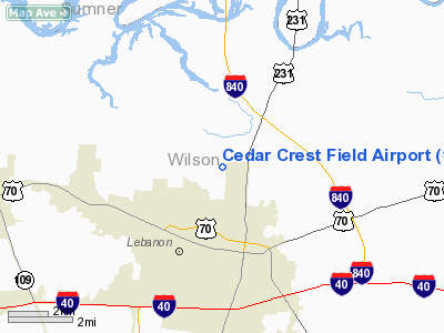
Cedar Crest Field Airport |
Location & QuickFacts
| FAA Information Effective: | 2008-09-25 |
| Airport Identifier: | 1TN0 |
| Airport Status: | Operational |
| Longitude/Latitude: | 086-18-10.0000W/36-14-47.0000N
-86.302778/36.246389 (Estimated) |
| Elevation: | 540 ft / 164.59 m (Estimated) |
| Land: | 280 acres |
| From nearest city: | 2 nautical miles N of Lebanon, TN |
| Location: | Wilson County, TN |
| Magnetic Variation: | 01W (1980) |
Owner & Manager
| Ownership: | Privately owned |
| Owner: | Kevin Heronimus |
| Address: | 511 Walker Ln
Lebanon, TN 37087 |
| Phone number: | 615-444-5641 |
| Manager: | Kevin Heronimus |
| Address: | 511 Walker Ln
Lebanon, TN 37087 |
| Phone number: | 615-444-5641 |
Airport Operations and Facilities
| Airport Use: | Private |
| Wind indicator: | Yes |
| Segmented Circle: | No |
| Control Tower: | No |
| Sectional chart: | Atlanta |
| Region: | ASO - Southern |
| Boundary ARTCC: | ZME - Memphis |
| Tie-in FSS: | BNA - Nashville |
| FSS on Airport: | No |
| FSS Toll Free: | 1-800-WX-BRIEF |
Runway Information
Runway 18/36
| Dimension: | 2600 x 75 ft / 792.5 x 22.9 m |
| Surface: | TURF, Good Condition |
| |
Runway 18 |
Runway 36 |
| Traffic Pattern: | Left | Left |
| Obstruction: | 50 ft trees, 400.0 ft from runway | 50 ft trees, 600.0 ft from runway |
|
Radio Navigation Aids
| ID |
Type |
Name |
Ch |
Freq |
Var |
Dist |
| SYI | FAN MARKER | Bomar | | | 01W | 46.5 nm |
| JUE | NDB | Lebanon | | 414.00 | 02W | 3.3 nm |
| VI | NDB | Opery | | 344.00 | 02W | 17.2 nm |
| FQW | NDB | Walter Hill | | 371.00 | 02W | 17.5 nm |
| SWZ | NDB | Sewart | | 391.00 | 02W | 19.1 nm |
| LFB | NDB | Lafayette | | 245.00 | 02W | 19.9 nm |
| SKN | NDB | Hurricane | | 256.00 | 02W | 28.7 nm |
| PED | NDB | Needmore | | 221.00 | 01W | 34.5 nm |
| ON | NDB | Music | | 279.00 | 03W | 35.6 nm |
| HEM | NDB | Huchn | | 233.00 | 02W | 38.1 nm |
| RN | NDB | Warri | | 209.00 | 02W | 39.6 nm |
| ULH | NDB | Burwi | | 332.00 | 03W | 47.3 nm |
| BVQ | NDB | Beaver Creek | | 260.00 | 02W | 48.5 nm |
| SYI | VOR/DME | Shelbyville | 027X | 109.00 | 01W | 41.7 nm |
| BNA | VORTAC | Nashville | 088X | 114.10 | 02W | 19.7 nm |
| BWG | VORTAC | Bowling Green | 126X | 117.90 | 02E | 41.6 nm |
| MQY | VOT | Smyrna | | 110.20 | | 17.5 nm |
| BNA | VOT | Nashville Metropoln | | 108.60 | | 19.8 nm |
Remarks
Images and information placed above are from
http://www.airport-data.com/airport/1TN0/
We thank them for the data!
| General Info
|
| Country |
United States
|
| State |
TENNESSEE
|
| FAA ID |
1TN0
|
| Latitude |
36-14-47.000N
|
| Longitude |
086-18-10.000W
|
| Elevation |
570 feet
|
| Near City |
LEBANON
|
We don't guarantee the information is fresh and accurate. The data may
be wrong or outdated.
For more up-to-date information please refer to other sources.
|
|


