 |
|
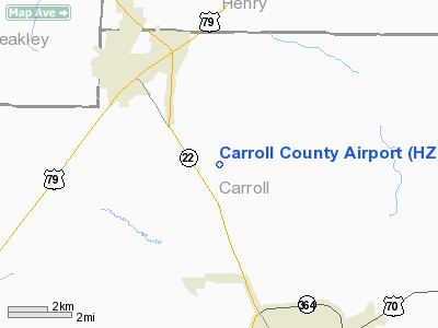
Location & QuickFacts
| FAA Information Effective: | 2008-09-25 |
| Airport Identifier: | HZD |
| Airport Status: | Operational |
| Longitude/Latitude: | 088-27-47.8756W/36-05-21.4705N
-88.463299/36.089297 (Estimated) |
| Elevation: | 497 ft / 151.49 m (Surveyed) |
| Land: | 196 acres |
| From nearest city: | 4 nautical miles NW of Huntingdon, TN |
| Location: | Carroll County, TN |
| Magnetic Variation: | 00E (1990) |
Owner & Manager
| Ownership: | Publicly owned |
| Owner: | Carroll County, Tennessee |
| Address: | Po Box 29
Huntingdon, TN 38344 |
| Phone number: | 731-986-3762 |
| Manager: | Tommy Swor |
| Address: | 535 Airport Lane
Mc Kenie, TN 38201 |
| Phone number: | 731-352-7278 |
Airport Operations and Facilities
| Airport Use: | Open to public |
| Wind indicator: | Yes |
| Segmented Circle: | Yes |
| Control Tower: | No |
| Lighting Schedule: | DUSK-DAWN
MIRL RY 01/19 PRESET MED INTST; TO INCREASE INTST & ACTVT REIL RYS 01 & 19 - CTAF. |
| Beacon Color: | Clear-Green (lighted land airport) |
| Sectional chart: | Memphis |
| Region: | ASO - Southern |
| Boundary ARTCC: | ZME - Memphis |
| Tie-in FSS: | MKL - Jackson |
| FSS Toll Free: | 1-800-WX-BRIEF |
| NOTAMs Facility: | MKL (NOTAM-d service avaliable) |
| Federal Agreements: | N |
Airport Communications
| CTAF: | 122.800 |
| Unicom: | 122.800 |
Airport Services
| Fuel available: | 100LLA |
| Airframe Repair: | MAJOR |
| Power Plant Repair: | MAJOR |
Runway Information
Runway 01/19
| Dimension: | 5507 x 100 ft / 1678.5 x 30.5 m |
| Surface: | ASPH, Good Condition |
| Weight Limit: | Single wheel: 25000 lbs.
Dual wheel: 37000 lbs. |
| Edge Lights: | Medium |
| |
Runway 01 |
Runway 19 |
| Longitude: | 088-27-54.9776W | 088-27-40.7735W |
| Latitude: | 36-04-54.8574N | 36-05-48.0836N |
| Elevation: | 495.00 ft | 497.00 ft |
| Alignment: | 12 | 127 |
| Traffic Pattern: | Left | Left |
| Markings: | Basic, Good Condition | Basic, Good Condition |
| Crossing Height: | 35.00 ft | 35.00 ft |
| VASI: | 4-light PAPI on left side | 4-light PAPI on left side |
| Visual Glide Angle: | 3.00° | 3.00° |
| Runway End Identifier: | Yes | Yes |
| Obstruction: | 15 ft road, 720.0 ft from runway, 34:1 slope to clear | 75 ft trees, 1722.0 ft from runway, 223 ft left of centerline, 20:1 slope to clear |
|
Radio Navigation Aids
| ID |
Type |
Name |
Ch |
Freq |
Var |
Dist |
| HZD | NDB | Huntingdon | | 217.00 | 00E | 0.2 nm |
| TIQ | NDB | Trainer | | 410.00 | 00E | 9.9 nm |
| TGC | NDB | Gibson | | 378.00 | 01E | 21.0 nm |
| UC | NDB | Obion | | 212.00 | 00E | 28.7 nm |
| AEY | NDB | Waverly | | 329.00 | 00E | 35.1 nm |
| GGK | NDB | Mayfield | | 401.00 | 00E | 36.7 nm |
| DNT | NDB | Nally Dunston | | 343.00 | 01W | 46.2 nm |
| JKS | VOR/DME | Jacks Creek | 031X | 109.40 | 02E | 29.9 nm |
| MKL | VOR/DME | Mc Kellar | 057X | 112.00 | 02E | 36.4 nm |
| DYR | VORTAC | Dyersburg | 115X | 116.80 | 03E | 41.7 nm |
Remarks
- SERVICE AFTER HOURS 731-641-0123.
- PRVDD VFR ONLY.
Images and information placed above are from
http://www.airport-data.com/airport/HZD/
We thank them for the data!
| General Info
|
| Country |
United States
|
| State |
TENNESSEE
|
| FAA ID |
HZD
|
| Latitude |
36-05-21.506N
|
| Longitude |
088-27-47.872W
|
| Elevation |
496 feet
|
| Near City |
HUNTINGDON
|
We don't guarantee the information is fresh and accurate. The data may
be wrong or outdated.
For more up-to-date information please refer to other sources.
|
|


