 |
|
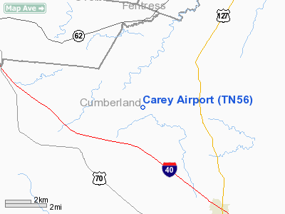
Location & QuickFacts
| FAA Information Effective: | 2008-09-25 |
| Airport Identifier: | TN56 |
| Airport Status: | Operational |
| Longitude/Latitude: | 085-06-49.8620W/36-04-20.2390N
-85.113851/36.072289 (Estimated) |
| Elevation: | 1960 ft / 597.41 m (Estimated) |
| Land: | 15 acres |
| From nearest city: | 4 nautical miles NE of Mayland, TN |
| Location: | Cumberland County, TN |
| Magnetic Variation: | 02W (1985) |
Owner & Manager
| Ownership: | Privately owned |
| Owner: | Kenneth B. Carey |
| Address: | 4811 Plateau Rd
Crossville, TN 38555 |
| Phone number: | 615-277-3753 |
| Manager: | Kenneth Carey |
| Address: | 4811 Plateau Rd
Crossville, TN 38555 |
| Phone number: | 615-277-3753 |
Airport Operations and Facilities
| Airport Use: | Private |
| Wind indicator: | Yes |
| Segmented Circle: | No |
| Control Tower: | No |
| Landing fee charge: | No |
| Sectional chart: | St Louis |
| Region: | ASO - Southern |
| Boundary ARTCC: | ZTL - Atlanta |
| Tie-in FSS: | BNA - Nashville |
| FSS on Airport: | No |
| FSS Toll Free: | 1-800-WX-BRIEF |
Airport Services
| Airframe Repair: | NONE |
| Power Plant Repair: | NONE |
Runway Information
Runway 06/24
| Dimension: | 1700 x 75 ft / 518.2 x 22.9 m |
| Surface: | TURF, |
| |
Runway 06 |
Runway 24 |
| Traffic Pattern: | Left | Left |
| Obstruction: | 100 ft trees, 600.0 ft from runway, 6:1 slope to clear | , 50:1 slope to clear |
|
Radio Navigation Aids
| ID |
Type |
Name |
Ch |
Freq |
Var |
Dist |
| HEM | NDB | Huchn | | 233.00 | 02W | 23.5 nm |
| SKN | NDB | Hurricane | | 256.00 | 02W | 34.2 nm |
| DTE | NDB | Mark Anton | | 394.00 | 02W | 36.6 nm |
| RN | NDB | Warri | | 209.00 | 02W | 37.0 nm |
| BPO | NDB | Piney Grove | | 403.00 | 05W | 41.8 nm |
| MNV | NDB | Madisonville | | 361.00 | 04W | 47.7 nm |
| EKQ | NDB | Elk Spring | | 290.00 | 03W | 48.8 nm |
| MMI | NDB | Mc Minn County | | 242.00 | 03W | 48.8 nm |
| JAU | NDB | Jacksboro | | 204.00 | 03W | 48.9 nm |
| HCH | VORTAC | Hinch Mountain | 123X | 117.60 | 02W | 18.7 nm |
| LVT | VORTAC | Livingston | 021X | 108.40 | 02W | 30.9 nm |
Images and information placed above are from
http://www.airport-data.com/airport/TN56/
We thank them for the data!
| General Info
|
| Country |
United States
|
| State |
TENNESSEE
|
| FAA ID |
TN56
|
| Latitude |
36-04-20.239N
|
| Longitude |
085-06-49.862W
|
| Elevation |
1960 feet
|
| Near City |
MAYLAND
|
We don't guarantee the information is fresh and accurate. The data may
be wrong or outdated.
For more up-to-date information please refer to other sources.
|
|


