 |
|
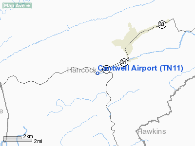
Location & QuickFacts
| FAA Information Effective: | 2008-09-25 |
| Airport Identifier: | TN11 |
| Airport Status: | Operational |
| Longitude/Latitude: | 083-15-19.6340W/36-30-05.3160N
-83.255454/36.501477 (Estimated) |
| Elevation: | 1150 ft / 350.52 m (Estimated) |
| Land: | 0 acres |
| From nearest city: | 3 nautical miles SW of Sneedville, TN |
| Location: | Hancock County, TN |
| Magnetic Variation: | 04W (1985) |
Owner & Manager
| Ownership: | Privately owned |
| Owner: | Kenneth W. Cantwell |
| Address: | 2606 Tazewell Highway
Sneedville, TN 37869 |
| Phone number: | 423-773-4911 |
| Manager: | Mike Pallos |
| Address: | 2606 Tazewell Highway
Sneedville, TN 37869 |
| Phone number: | 423-733-4911 |
Airport Operations and Facilities
| Airport Use: | Private |
| Wind indicator: | No |
| Segmented Circle: | No |
| Control Tower: | No |
| Sectional chart: | Cincinnati |
| Region: | ASO - Southern |
| Boundary ARTCC: | ZTL - Atlanta |
| Tie-in FSS: | BNA - Nashville |
| FSS on Airport: | No |
| FSS Toll Free: | 1-800-WX-BRIEF |
Airport Services
| Airframe Repair: | NONE |
| Power Plant Repair: | NONE |
Runway Information
Runway 06/24
| Dimension: | 2500 x 40 ft / 762.0 x 12.2 m |
| Surface: | TURF, |
| |
Runway 06 |
Runway 24 |
| Traffic Pattern: | Left | Left |
|
Radio Navigation Aids
| ID |
Type |
Name |
Ch |
Freq |
Var |
Dist |
| LQV | NDB | Long Hollow | | 252.00 | 03W | 15.1 nm |
| RVN | NDB | Rogersville | | 329.00 | 04W | 18.1 nm |
| JXT | NDB | Jefferson | | 346.00 | 04W | 25.8 nm |
| DYQ | NDB | Dulaney | | 263.00 | 04W | 28.2 nm |
| BO | NDB | Booie | | 221.00 | 04W | 37.2 nm |
| JAU | NDB | Jacksboro | | 204.00 | 03W | 44.9 nm |
| EZT | NDB | Elizabethton | | 275.00 | 02W | 48.9 nm |
| SOT | VORTAC | Snowbird | 025X | 108.80 | 04W | 43.9 nm |
| VXV | VORTAC | Volunteer | 111X | 116.40 | 03W | 47.4 nm |
Remarks
- MOUNTAINS ALL DIRECTIONS - TURBULENT IN WINDY CONDITIONS.
- RWY SOFT WINTER MONTHS.
- PLINE PARALLEL NW.
Images and information placed above are from
http://www.airport-data.com/airport/TN11/
We thank them for the data!
| General Info
|
| Country |
United States
|
| State |
TENNESSEE
|
| FAA ID |
TN11
|
| Latitude |
36-30-05.316N
|
| Longitude |
083-15-19.634W
|
| Elevation |
1150 feet
|
| Near City |
SNEEDVILLE
|
We don't guarantee the information is fresh and accurate. The data may
be wrong or outdated.
For more up-to-date information please refer to other sources.
|
|


