 |
|
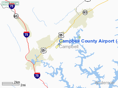
Location & QuickFacts
| FAA Information Effective: | 2008-09-25 |
| Airport Identifier: | JAU |
| Airport Status: | Operational |
| Longitude/Latitude: | 084-09-46.6750W/36-20-02.7200N
-84.162965/36.334089 (Estimated) |
| Elevation: | 1180 ft / 359.66 m (Surveyed) |
| Land: | 84 acres |
| From nearest city: | 1 nautical miles E of Jacksboro, TN |
| Location: | Campbell County, TN |
| Magnetic Variation: | 03W (1990) |
Owner & Manager
| Ownership: | Publicly owned |
| Owner: | Campbell County |
| Address: | County Courthouse
Jacksboro, TN 37757 |
| Phone number: | 423-562-2526 |
| Manager: | Bert Loupe |
| Address: | 610 Memorial Lane
Lafollette, TN 37766 |
| Phone number: | 423-562-9966 |
Airport Operations and Facilities
| Airport Use: | Open to public |
| Wind indicator: | Yes |
| Segmented Circle: | Yes |
| Control Tower: | No |
| Lighting Schedule: | DUSK-DAWN |
| Beacon Color: | Clear-Green (lighted land airport) |
| Landing fee charge: | No |
| Sectional chart: | Cincinnati |
| Region: | ASO - Southern |
| Boundary ARTCC: | ZTL - Atlanta |
| Tie-in FSS: | BNA - Nashville |
| FSS on Airport: | No |
| FSS Toll Free: | 1-800-WX-BRIEF |
| NOTAMs Facility: | BNA (NOTAM-d service avaliable) |
| Federal Agreements: | N1 |
Airport Communications
| CTAF: | 122.800 |
| Unicom: | 122.800 |
Airport Services
| Fuel available: | 100LL |
| Bottled Oxygen: | NONE |
| Bulk Oxygen: | NONE |
Runway Information
Runway 05/23
| Dimension: | 4000 x 75 ft / 1219.2 x 22.9 m |
| Surface: | ASPH, Good Condition |
| Weight Limit: | Single wheel: 25000 lbs. |
| Edge Lights: | Medium |
| |
Runway 05 |
Runway 23 |
| Longitude: | 084-10-04.1800W | 084-09-29.1700W |
| Latitude: | 36-19-48.8900N | 36-20-16.5500N |
| Elevation: | 1134.00 ft | 1180.00 ft |
| Alignment: | 46 | 127 |
| Traffic Pattern: | Left | Left |
| Markings: | Basic, Fair Condition | Basic, Fair Condition |
| Crossing Height: | 26.00 ft | 30.00 ft |
| VASI: | 2-light PAPI on left side | 2-light PAPI on left side |
| Visual Glide Angle: | 3.25° | 3.75° |
| Runway End Identifier: | Yes | Yes |
| Centerline Lights: | No | No |
| Touchdown Lights: | No | No |
| Obstruction: | 44 ft trees, 620.0 ft from runway, 241 ft left of centerline, 9:1 slope to clear | 102 ft trees, 2250.0 ft from runway, 132 ft right of centerline, 20:1 slope to clear |
|
Radio Navigation Aids
| ID |
Type |
Name |
Ch |
Freq |
Var |
Dist |
| JAU | NDB | Jacksboro | | 204.00 | 03W | 0.2 nm |
| BPO | NDB | Piney Grove | | 403.00 | 05W | 19.5 nm |
| JXT | NDB | Jefferson | | 346.00 | 04W | 35.9 nm |
| EKQ | NDB | Elk Spring | | 290.00 | 03W | 45.8 nm |
| CDX | NDB | Cumberland River | | 388.00 | 05E | 47.0 nm |
| MNV | NDB | Madisonville | | 361.00 | 04W | 48.6 nm |
| VXV | VORTAC | Volunteer | 111X | 116.40 | 03W | 28.9 nm |
| LOZ | VORTAC | London | 108X | 116.10 | 03W | 42.1 nm |
| TYS | VOT | Knoxville | | 112.00 | | 32.4 nm |
Remarks
- NOTICEABLE RY GRADIENT.
- HIGH TERRAIN SOUTH THRU NORTHEAST.
- GCO AVBL ON FREQ 121.725 THRU FLIGHT SERVICES.
Images and information placed above are from
http://www.airport-data.com/airport/JAU/
We thank them for the data!
| General Info
|
| Country |
United States
|
| State |
TENNESSEE
|
| FAA ID |
JAU
|
| Latitude |
36-20-04.465N
|
| Longitude |
084-09-44.425W
|
| Elevation |
1180 feet
|
| Near City |
JACKSBORO
|
We don't guarantee the information is fresh and accurate. The data may
be wrong or outdated.
For more up-to-date information please refer to other sources.
|
|


