 |
|
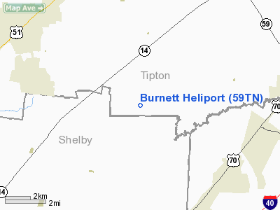
Location & QuickFacts
| FAA Information Effective: | 2008-09-25 |
| Airport Identifier: | 59TN |
| Airport Status: | Operational |
| Longitude/Latitude: | 089-40-33.0000W/35-23-46.0000N
-89.675833/35.396111 (Estimated) |
| Elevation: | 320 ft / 97.54 m (Estimated) |
| Land: | 31 acres |
| From nearest city: | 7 nautical miles NW of Atoka, TN |
| Location: | Tipton County, TN |
| Magnetic Variation: | () |
Owner & Manager
| Ownership: | Privately owned |
| Owner: | Allen W. Burnett |
| Address: | 590 Hughes Road
Brighton, TN 38011 |
| Phone number: | 901-475-2924 |
| Manager: | Allen W. Burnett |
| Address: | 590 Hughes Road
Brighton, TN 38011 |
| Phone number: | 901-475-2924 |
Airport Operations and Facilities
| Airport Use: | Private |
| Wind indicator: | Yes |
| Control Tower: | No |
| Sectional chart: | Memphis |
| Region: | ASO - Southern |
| Boundary ARTCC: | ZME - Memphis |
| Tie-in FSS: | MKL - Jackson |
| FSS Toll Free: | 1-800-WX-BRIEF |
Runway Information
Helipad H1
| Dimension: | 100 x 100 ft / 30.5 x 30.5 m |
| Surface: | TURF, |
| |
Runway H1 |
Runway |
| Traffic Pattern: | Left | Left |
|
Radio Navigation Aids
| ID |
Type |
Name |
Ch |
Freq |
Var |
Dist |
| COO | NDB | Covington | | 326.00 | 02E | 12.4 nm |
| MIG | NDB | Millington | | 232.00 | 04E | 14.5 nm |
| FYE | NDB | Somerville | | 255.00 | 00E | 18.0 nm |
| SPQ | NDB | Spain | | 414.00 | 04E | 21.8 nm |
| BPW | NDB | Osceola | | 239.00 | 02E | 24.3 nm |
| OLV | NDB | Olive Branch | | 275.00 | 01E | 25.6 nm |
| ME | NDB | Elvis | | 287.00 | 01E | 28.0 nm |
| AWM | NDB | West Memphis | | 362.00 | 01E | 31.4 nm |
| BAV | NDB | Hardeman | | 404.00 | 01E | 32.9 nm |
| IUI | NDB | Hicks | | 350.00 | 01E | 33.5 nm |
| MXA | NDB | Manila | | 282.00 | 01E | 37.9 nm |
| DNT | NDB | Nally Dunston | | 343.00 | 01W | 38.3 nm |
| GOJ | VOR | Gosnell | | 111.80 | 01E | 35.8 nm |
| GQE | VOR/DME | Gilmore | 077X | 113.00 | 04E | 39.4 nm |
| MKL | VOR/DME | Mc Kellar | 057X | 112.00 | 02E | 39.5 nm |
| MEM | VORTAC | Memphis | 122X | 117.50 | 01E | 27.4 nm |
| HLI | VORTAC | Holly Springs | 071X | 112.40 | 03E | 38.6 nm |
| DYR | VORTAC | Dyersburg | 115X | 116.80 | 03E | 41.3 nm |
| MEM | VOT | Memphis Metropolitn | | 111.00 | | 25.6 nm |
Remarks
- PRVDD VFR OPNS, PVT USE, AREA IS MARKED, WIND INDICATOR IS MAINTAINED AND ALL APCH/DEP FROM 090-270.
Images and information placed above are from
http://www.airport-data.com/airport/59TN/
We thank them for the data!
|
|


