 |
|
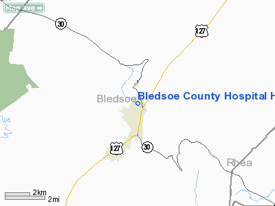
Bledsoe County Hospital Heliport |
Location & QuickFacts
| FAA Information Effective: | 2008-09-25 |
| Airport Identifier: | 29TN |
| Airport Status: | Operational |
| Longitude/Latitude: | 085-11-27.1500W/35-37-12.5400N
-85.190875/35.620150 (Estimated) |
| Elevation: | 957 ft / 291.69 m () |
| Land: | 0 acres |
| From nearest city: | 1 nautical miles S of Pikeville, TN |
| Location: | Bledsoe County, TN |
| Magnetic Variation: | () |
Owner & Manager
| Ownership: | Privately owned |
| Owner: | Erlanger Health System |
| Address: | 975 East Third Street
Chattanooga, TN 37421 |
| Phone number: | 423-778-5423 |
| Manager: | Steve Straughen |
| Address: | 975 East Third Street
Chattanooga, TN 37421 |
| Phone number: | 423-778-5423 |
Airport Operations and Facilities
| Airport Use: | Private |
| Control Tower: | No |
| Region: | ASO - Southern |
| Boundary ARTCC: | ZME - Memphis |
| Tie-in FSS: | BNA - Nashville |
| FSS Toll Free: | 1-800-WX-BRIEF |
Runway Information
Helipad H1
| Dimension: | 50 x 50 ft / 15.2 x 15.2 m |
| Surface: | CONC, |
| |
Runway H1 |
Runway |
| Traffic Pattern: | Left | Left |
|
Radio Navigation Aids
| ID |
Type |
Name |
Ch |
Freq |
Var |
Dist |
| DTE | NDB | Mark Anton | | 394.00 | 02W | 15.2 nm |
| CQN | NDB | Daisy | | 341.00 | 02W | 27.3 nm |
| RN | NDB | Warri | | 209.00 | 02W | 29.1 nm |
| HEM | NDB | Huchn | | 233.00 | 02W | 29.3 nm |
| HDI | NDB | Hardwick | | 369.00 | 01W | 31.3 nm |
| MMI | NDB | Mc Minn County | | 242.00 | 03W | 33.6 nm |
| SKN | NDB | Hurricane | | 256.00 | 02W | 37.2 nm |
| APT | NDB | Jasper | | 382.00 | 02W | 38.8 nm |
| MNV | NDB | Madisonville | | 361.00 | 04W | 39.7 nm |
| UOS | NDB | Sewanee | | 275.00 | 02E | 42.6 nm |
| HCH | VORTAC | Hinch Mountain | 123X | 117.60 | 02W | 14.2 nm |
| GQO | VORTAC | Choo Choo | 105X | 115.80 | 01E | 39.6 nm |
Images and information placed above are from
http://www.airport-data.com/airport/29TN/
We thank them for the data!
|
|


