 |
|
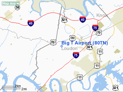
Location & QuickFacts
| FAA Information Effective: | 2008-09-25 |
| Airport Identifier: | 80TN |
| Airport Status: | Operational |
| Longitude/Latitude: | 084-19-48.0000W/35-49-36.0000N
-84.330000/35.826667 (Estimated) |
| Elevation: | 900 ft / 274.32 m (Estimated) |
| Land: | 0 acres |
| From nearest city: | 4 nautical miles NW of Lenoir City, TN |
| Location: | Loudon County, TN |
| Magnetic Variation: | () |
Owner & Manager
| Ownership: | Privately owned |
| Owner: | John Tuck |
| Address: | 804 Hwy 321 North, Suite 100
Lenoir City, TN 37771 |
| Phone number: | 865-986-4002 |
| Manager: | John Tuck |
| Address: | 804 Hwy 321 North, Suite 100
Lenoir City, TN 37771 |
| Phone number: | 865-986-4002 |
Airport Operations and Facilities
| Airport Use: | Private |
| Control Tower: | No |
| Sectional chart: | Atlanta |
| Region: | ASO - Southern |
| Boundary ARTCC: | ZTL - Atlanta |
| Tie-in FSS: | BNA - Nashville |
| FSS Toll Free: | 1-800-WX-BRIEF |
Runway Information
Runway 05/23
| Dimension: | 1700 x 100 ft / 518.2 x 30.5 m |
| Surface: | TURF, |
| |
Runway 05 |
Runway 23 |
| Traffic Pattern: | Left | Left |
|
Radio Navigation Aids
| ID |
Type |
Name |
Ch |
Freq |
Var |
Dist |
| MNV | NDB | Madisonville | | 361.00 | 04W | 17.1 nm |
| MMI | NDB | Mc Minn County | | 242.00 | 03W | 28.3 nm |
| JAU | NDB | Jacksboro | | 204.00 | 03W | 31.8 nm |
| DTE | NDB | Mark Anton | | 394.00 | 02W | 35.9 nm |
| BPO | NDB | Piney Grove | | 403.00 | 05W | 43.4 nm |
| JXT | NDB | Jefferson | | 346.00 | 04W | 44.9 nm |
| TTQ | NDB | Tomotla | | 335.00 | 01W | 46.4 nm |
| HDI | NDB | Hardwick | | 369.00 | 01W | 49.3 nm |
| VXV | VORTAC | Volunteer | 111X | 116.40 | 03W | 21.7 nm |
| HCH | VORTAC | Hinch Mountain | 123X | 117.60 | 02W | 31.7 nm |
| TYS | VOT | Knoxville | | 112.00 | | 16.5 nm |
Remarks
- 629 FT LGTD TWR 1 NM NORTH OF ARPT.
- PRVDD VFR OPNS & PVT USE.
Images and information placed above are from
http://www.airport-data.com/airport/80TN/
We thank them for the data!
|
|


