 |
|
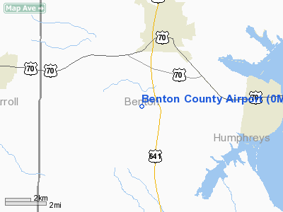
Location & QuickFacts
| FAA Information Effective: | 2008-09-25 |
| Airport Identifier: | 0M4 |
| Airport Status: | Operational |
| Longitude/Latitude: | 088-07-29.0200W/36-00-34.3500N
-88.124728/36.009542 (Estimated) |
| Elevation: | 468 ft / 142.65 m (Surveyed) |
| Land: | 123 acres |
| From nearest city: | 3 nautical miles S of Camden, TN |
| Location: | Benton County, TN |
| Magnetic Variation: | 01E (1985) |
Owner & Manager
| Ownership: | Publicly owned |
| Owner: | Benton County |
| Address: | Po Box 298
Camden, TN 38320 |
| Phone number: | 731-584-6011 |
| Manager: | Sparky Hightower |
| Address: | 275 Airport Dr
Camden, TN 38320 |
| Phone number: | 731-584-5343 |
Airport Operations and Facilities
| Airport Use: | Open to public |
| Wind indicator: | Yes |
| Segmented Circle: | Yes |
| Control Tower: | No |
| Lighting Schedule: | DUSK-DAWN |
| Beacon Color: | Clear-Green (lighted land airport) |
| Landing fee charge: | No |
| Sectional chart: | St Louis |
| Region: | ASO - Southern |
| Boundary ARTCC: | ZME - Memphis |
| Tie-in FSS: | MKL - Jackson |
| FSS on Airport: | No |
| FSS Toll Free: | 1-800-WX-BRIEF |
| NOTAMs Facility: | MKL (NOTAM-d service avaliable) |
| Federal Agreements: | NGY |
Airport Communications
| CTAF: | 122.800 |
| Unicom: | 122.800 |
Airport Services
| Fuel available: | 100LLA |
| Airframe Repair: | MAJOR |
| Power Plant Repair: | MAJOR |
| Bottled Oxygen: | NONE |
| Bulk Oxygen: | NONE |
Runway Information
Runway 04/22
| Dimension: | 5001 x 75 ft / 1524.3 x 22.9 m |
| Surface: | ASPH, Good Condition |
| Weight Limit: | Single wheel: 30000 lbs. |
| Edge Lights: | Medium |
| |
Runway 04 |
Runway 22 |
| Longitude: | 088-07-46.3900W | 088-07-11.6500W |
| Latitude: | 36-00-14.0400N | 36-00-54.6600N |
| Elevation: | 468.00 ft | 465.00 ft |
| Alignment: | 35 | 127 |
| Traffic Pattern: | Left | Left |
| Markings: | Non-precision instrument, Good Condition | Non-precision instrument, Good Condition |
| VASI: | 2-light PAPI on right side | 2-light PAPI on left side |
| Runway End Identifier: | Yes
REIL OTS INDEFLY. | Yes |
| Obstruction: | 43 ft trees, 1122.0 ft from runway, 59 ft left of centerline, 21:1 slope to clear | 64 ft trees, 1557.0 ft from runway, 134 ft right of centerline, 21:1 slope to clear |
|
Radio Navigation Aids
| ID |
Type |
Name |
Ch |
Freq |
Var |
Dist |
| HZD | NDB | Huntingdon | | 217.00 | 00E | 17.3 nm |
| AEY | NDB | Waverly | | 329.00 | 00E | 19.7 nm |
| TIQ | NDB | Trainer | | 410.00 | 00E | 20.2 nm |
| DMZ | NDB | Dickson | | 203.00 | 01W | 34.4 nm |
| TGC | NDB | Gibson | | 378.00 | 01E | 35.6 nm |
| JHG | NDB | Hohenwald | | 257.00 | 01W | 40.8 nm |
| HHY | NDB | Pinhook | | 346.00 | 01W | 45.6 nm |
| UC | NDB | Obion | | 212.00 | 00E | 45.6 nm |
| GGK | NDB | Mayfield | | 401.00 | 00E | 46.8 nm |
| JKS | VOR/DME | Jacks Creek | 031X | 109.40 | 02E | 27.2 nm |
| MKL | VOR/DME | Mc Kellar | 057X | 112.00 | 02E | 45.4 nm |
| GHM | VORTAC | Graham | 053X | 111.60 | 03E | 34.4 nm |
Remarks
- ARPT UNATNDD THANKSGIVING; CHRISTMAS & NEW YEAR'S DAY.
Images and information placed above are from
http://www.airport-data.com/airport/0M4/
We thank them for the data!
| General Info
|
| Country |
United States
|
| State |
TENNESSEE
|
| FAA ID |
0M4
|
| Latitude |
36-00-40.417N
|
| Longitude |
088-07-23.838W
|
| Elevation |
468 feet
|
| Near City |
CAMDEN
|
We don't guarantee the information is fresh and accurate. The data may
be wrong or outdated.
For more up-to-date information please refer to other sources.
|
|


