|
|
 |
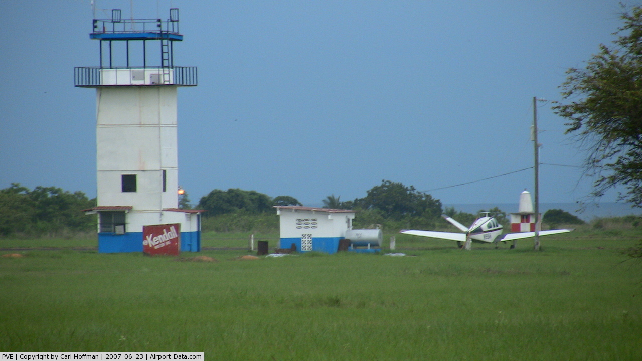
(Click on the photo to enlarge) |
Location & QuickFacts
| FAA Information Effective: | 2008-09-25 |
| Airport Identifier: | PVE |
| Airport Status: | Operational |
| Longitude/Latitude: | 088-11-43.2682W/35-39-22.9021N
-88.195352/35.656362 (Estimated) |
| Elevation: | 488 ft / 148.74 m (Surveyed) |
| Land: | 408 acres |
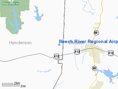
| From nearest city: | 5 nautical miles NW of Lexington-parsons, TN |
| Location: | Henderson County, TN |
| Magnetic Variation: | 01W (2005) |
Owner & Manager
| Ownership: | Publicly owned |
| Owner: | Beech River Regional Arpt Authority |
| Address: | 1600 Mt Ararat Road
Darden, TN 38328 |
| Phone number: | 731-968-0122 |
| Manager: | Beech River Regional Arpt Authority |
| Address: | 1600 Mt Ararat Road
Darden, TN 32328 |
Airport Operations and Facilities
| Airport Use: | Open to public |
| Wind indicator: | Yes |
| Segmented Circle: | Yes |
| Control Tower: | No |
| Lighting Schedule: | DUSK-DAWN |
| Beacon Color: | Clear-Green (lighted land airport) |
| Sectional chart: | Memphis |
| Region: | ASO - Southern |
| Boundary ARTCC: | ZME - Memphis |
| Tie-in FSS: | MKL - Jackson |
| FSS Toll Free: | 1-800-WX-BRIEF |
| NOTAMs Facility: | MKL (NOTAM-d service avaliable) |
Airport Communications
| CTAF: | 123.000 |
| Unicom: | 123.000 |
Airport Services
Runway Information
Runway 01/19
| Dimension: | 6000 x 100 ft / 1828.8 x 30.5 m |
| Surface: | CONC, Good Condition |
| Weight Limit: | Single wheel: 45000 lbs.
Dual wheel: 60000 lbs. |
| Edge Lights: | Medium |
| |
Runway 01 |
Runway 19 |
| Longitude: | 088-11-50.7485W | 088-11-35.7881W |
| Latitude: | 35-38-53.8678N | 35-39-51.9364N |
| Elevation: | 446.00 ft | 488.00 ft |
| Alignment: | 12 | 127 |
| Traffic Pattern: | Left | Left |
| Markings: | Non-precision instrument, Good Condition | Non-precision instrument, Good Condition |
| Crossing Height: | 40.00 ft | 40.00 ft |
| VASI: | 2-light PAPI on left side | 2-light PAPI on left side |
| Visual Glide Angle: | 3.00° | 3.00° |
| Runway End Identifier: | Yes | Yes |
| Centerline Lights: | | No |
|
Radio Navigation Aids
| ID |
Type |
Name |
Ch |
Freq |
Var |
Dist |
| HHY | NDB | Pinhook | | 346.00 | 01W | 24.2 nm |
| HZD | NDB | Huntingdon | | 217.00 | 00E | 29.1 nm |
| SZY | NDB | Sibley | | 386.00 | 01E | 29.7 nm |
| JHG | NDB | Hohenwald | | 257.00 | 01W | 30.0 nm |
| AEY | NDB | Waverly | | 329.00 | 00E | 35.4 nm |
| TGC | NDB | Gibson | | 378.00 | 01E | 36.1 nm |
| TIQ | NDB | Trainer | | 410.00 | 00E | 37.2 nm |
| DMZ | NDB | Dickson | | 203.00 | 01W | 46.7 nm |
| BAV | NDB | Hardeman | | 404.00 | 01E | 49.3 nm |
| JKS | VOR/DME | Jacks Creek | 031X | 109.40 | 02E | 8.7 nm |
| MKL | VOR/DME | Mc Kellar | 057X | 112.00 | 02E | 35.1 nm |
| GHM | VORTAC | Graham | 053X | 111.60 | 03E | 37.8 nm |
Images and information placed above are from
http://www.airport-data.com/airport/PVE/
We thank them for the data!
| General Info
|
| Country |
United States
|
| State |
TENNESSEE
|
| FAA ID |
PVE
|
| Latitude |
35.656361
35° 39' 22.90" N
|
| Longitude |
-88.195353
088° 11' 43.27" W
|
| Elevation |
488 feet
149 meters
|
| Magnetic Variation |
001° W (06/06)
|
| Beacon |
Yes
|
| Operating Agency |
U.S.CIVIL AIRPORT WHEREIN PERMIT COVERS USE BY TRANSIT MILITARY AIRCRAFT
|
We don't guarantee the information is fresh and accurate. The data may
be wrong or outdated.
For more up-to-date information please refer to other sources.
|
|