 |
|
Location & QuickFacts
| FAA Information Effective: | 2008-09-25 |
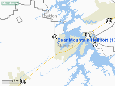
| Airport Identifier: | 13TN |
| Airport Status: | Operational |
| Longitude/Latitude: | 084-16-03.0000W/35-35-54.0000N
-84.267500/35.598333 (Estimated) |
| Elevation: | 930 ft / 283.46 m (Estimated) |
| Land: | 4 acres |
| From nearest city: | 1 nautical miles SE of Vonore, TN |
| Location: | Monroe County, TN |
| Magnetic Variation: | 04W (2000) |
Owner & Manager
| Ownership: | Privately owned |
| Owner: | Burch Properties Llc |
| Address: | 139 Grand Vista
Vonore, TN 37885 |
| Phone number: | 423-884-3400 |
| Manager: | Gary L Burch |
| Address: | 144 Hunyu Trail
Vonore, TN 37885 |
| Phone number: | 423-884-2437 |
Airport Operations and Facilities
| Airport Use: | Private |
| Wind indicator: | Yes |
| Segmented Circle: | No |
| Control Tower: | No |
| Sectional chart: | Atlanta |
| Region: | ASO - Southern |
| Boundary ARTCC: | ZTL - Atlanta |
| Tie-in FSS: | BNA - Nashville |
| FSS Toll Free: | 1-800-WX-BRIEF |
Airport Services
Runway Information
Helipad H1
| Dimension: | 37 x 37 ft / 11.3 x 11.3 m |
| Surface: | CONC, |
| |
Runway H1 |
Runway |
| Traffic Pattern: | Left | Left |
|
Radio Navigation Aids
| ID |
Type |
Name |
Ch |
Freq |
Var |
Dist |
| MNV | NDB | Madisonville | | 361.00 | 04W | 6.5 nm |
| MMI | NDB | Mc Minn County | | 242.00 | 03W | 18.9 nm |
| TTQ | NDB | Tomotla | | 335.00 | 01W | 32.7 nm |
| DTE | NDB | Mark Anton | | 394.00 | 02W | 33.2 nm |
| HDI | NDB | Hardwick | | 369.00 | 01W | 41.1 nm |
| JAU | NDB | Jacksboro | | 204.00 | 03W | 44.8 nm |
| JXT | NDB | Jefferson | | 346.00 | 04W | 49.4 nm |
| VXV | VORTAC | Volunteer | 111X | 116.40 | 03W | 25.9 nm |
| HCH | VORTAC | Hinch Mountain | 123X | 117.60 | 02W | 36.4 nm |
| HRS | VORTAC | Harris | 035X | 109.80 | 00E | 43.0 nm |
| TYS | VOT | Knoxville | | 112.00 | | 18.6 nm |
Remarks
- PROVIDED APCH/DEP FROM 280 DEGS TO 360 DEGS AND FROM 090 DEGS TO 140 DEGS; THE AREA IS MARKED; AND WIND INDICATOR IS MAINTAINED.
Images and information placed above are from
http://www.airport-data.com/airport/13TN/
We thank them for the data!
| General Info
|
| Country |
United States
|
| State |
TENNESSEE
|
| FAA ID |
13TN
|
| Latitude |
35-35-54.000N
|
| Longitude |
084-16-03.000W
|
| Elevation |
930 feet
|
| Near City |
VONORE
|
We don't guarantee the information is fresh and accurate. The data may
be wrong or outdated.
For more up-to-date information please refer to other sources.
|
|


