 |
|
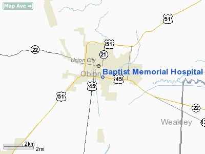
Baptist Memorial Hospital Heliport |
Location & QuickFacts
| FAA Information Effective: | 2008-09-25 |
| Airport Identifier: | 2TN9 |
| Airport Status: | Operational |
| Longitude/Latitude: | 089-02-48.2340W/36-24-50.2290N
-89.046732/36.413953 (Estimated) |
| Elevation: | 360 ft / 109.73 m (Estimated) |
| Land: | 1 acres |
| From nearest city: | 10 nautical miles W of Union City, TN |
| Location: | Obion County, TN |
| Magnetic Variation: | 01E (1985) |
Owner & Manager
| Ownership: | Privately owned |
| Owner: | Baptist Memorial Hospital |
| Address: | 1201 Bishop St
Union City, TN 38261 |
| Phone number: | 901-885-2410 |
| Manager: | Donald H. Hutson |
| Address: | 1201 Bishop St
Union City, TN 38261 |
| Phone number: | 901-885-2410 |
Airport Operations and Facilities
| Airport Use: | Private
MEDICAL. |
| Wind indicator: | Yes |
| Segmented Circle: | No |
| Control Tower: | No |
| Lighting Schedule: | PHONE REQ
FOR PERIMETER LGTS CALL 901-885-2410. |
| Sectional chart: | St Louis |
| Region: | ASO - Southern |
| Boundary ARTCC: | ZME - Memphis |
| Tie-in FSS: | MKL - Jackson |
| FSS Toll Free: | 1-800-WX-BRIEF |
Runway Information
Helipad H1
| Dimension: | 50 x 50 ft / 15.2 x 15.2 m |
| Surface: | CONC, |
| |
Runway H1 |
Runway |
| Traffic Pattern: | Left | Left |
|
Radio Navigation Aids
| ID |
Type |
Name |
Ch |
Freq |
Var |
Dist |
| UC | NDB | Obion | | 212.00 | 00E | 7.4 nm |
| GGK | NDB | Mayfield | | 401.00 | 00E | 27.5 nm |
| CHQ | NDB | Charleston | | 208.00 | 01E | 29.9 nm |
| TGC | NDB | Gibson | | 378.00 | 01E | 30.4 nm |
| DNT | NDB | Nally Dunston | | 343.00 | 01W | 30.6 nm |
| TIQ | NDB | Trainer | | 410.00 | 00E | 32.1 nm |
| HZD | NDB | Huntingdon | | 217.00 | 00E | 34.2 nm |
| CIR | NDB | Cairo | | 397.00 | 00E | 39.9 nm |
| BDD | NDB | Bellgrade | | 254.00 | 00E | 47.6 nm |
| IUI | NDB | Hicks | | 350.00 | 01E | 47.7 nm |
| DXE | NDB | Dexter | | 423.00 | 00E | 48.6 nm |
| TKX | NDB | Kennett | | 358.00 | 00E | 49.3 nm |
| MKL | VOR/DME | Mc Kellar | 057X | 112.00 | 02E | 49.2 nm |
| DYR | VORTAC | Dyersburg | 115X | 116.80 | 03E | 27.2 nm |
| CNG | VORTAC | Cunningham | 078X | 113.10 | 03E | 37.1 nm |
| MAW | VORTAC | Malden | 049X | 111.20 | 03E | 42.6 nm |
Remarks
Images and information placed above are from
http://www.airport-data.com/airport/2TN9/
We thank them for the data!
| General Info
|
| Country |
United States
|
| State |
TENNESSEE
|
| FAA ID |
2TN1
|
| Latitude |
35-44-35.000N
|
| Longitude |
089-32-22.000W
|
| Elevation |
415 feet
|
| Near City |
RIPLEY
|
We don't guarantee the information is fresh and accurate. The data may
be wrong or outdated.
For more up-to-date information please refer to other sources.
|
|


