 |
|
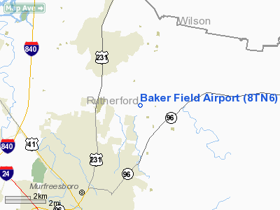
Location & QuickFacts
| FAA Information Effective: | 2008-09-25 |
| Airport Identifier: | 8TN6 |
| Airport Status: | Operational |
| Longitude/Latitude: | 086-20-41.0000W/35-55-16.0000N
-86.344722/35.921111 (Estimated) |
| Elevation: | 560 ft / 170.69 m (Estimated) |
| Land: | 0 acres |
| From nearest city: | 7 nautical miles NE of Murfreesboro, TN |
| Location: | Rutherford County, TN |
| Magnetic Variation: | 02W (1995) |
Owner & Manager
| Ownership: | Privately owned |
| Owner: | Mark L. Baker |
| Address: | 3895 Betty Ford Road
Murfeesboro, TN |
| Phone number: | 615-895-5529 |
| Manager: | Mark L. Baker |
| Address: | 3895 Betty Ford Road
Murfeesboro, TN |
| Phone number: | 615-895-5529 |
Airport Operations and Facilities
| Airport Use: | Private |
| Wind indicator: | Yes |
| Segmented Circle: | No |
| Control Tower: | No |
| Sectional chart: | Atlanta |
| Region: | ASO - Southern |
| Boundary ARTCC: | ZME - Memphis |
| Tie-in FSS: | BNA - Nashville |
| FSS on Airport: | No |
| FSS Toll Free: | 1-800-WX-BRIEF |
Runway Information
Runway 18/36
| Dimension: | 2000 x 75 ft / 609.6 x 22.9 m |
| Surface: | TURF, |
| |
Runway 18 |
Runway 36 |
| Traffic Pattern: | Left | Left |
| Obstruction: | 100 ft trees, 500.0 ft from runway | |
|
Radio Navigation Aids
| ID |
Type |
Name |
Ch |
Freq |
Var |
Dist |
| SYI | FAN MARKER | Bomar | | | 01W | 26.9 nm |
| FQW | NDB | Walter Hill | | 371.00 | 02W | 2.7 nm |
| SWZ | NDB | Sewart | | 391.00 | 02W | 6.2 nm |
| JUE | NDB | Lebanon | | 414.00 | 02W | 16.4 nm |
| VI | NDB | Opery | | 344.00 | 02W | 22.7 nm |
| SKN | NDB | Hurricane | | 256.00 | 02W | 26.4 nm |
| ULH | NDB | Burwi | | 332.00 | 03W | 28.1 nm |
| RN | NDB | Warri | | 209.00 | 02W | 30.1 nm |
| LUG | NDB | Verona | | 251.00 | 00W | 34.0 nm |
| HEM | NDB | Huchn | | 233.00 | 02W | 37.1 nm |
| LFB | NDB | Lafayette | | 245.00 | 02W | 38.3 nm |
| PBC | NDB | Maury County | | 365.00 | 01W | 41.0 nm |
| ON | NDB | Music | | 279.00 | 03W | 44.7 nm |
| PED | NDB | Needmore | | 221.00 | 01W | 46.3 nm |
| BGF | NDB | Boiling Fork | | 263.00 | 02W | 46.7 nm |
| TNY | NDB | Kelso | | 358.00 | 01W | 48.3 nm |
| UOS | NDB | Sewanee | | 275.00 | 02E | 48.4 nm |
| UXM | VOR | Tullahoma Regional | | 109.65 | 03W | 32.9 nm |
| SYI | VOR/DME | Shelbyville | 027X | 109.00 | 01W | 22.1 nm |
| BNA | VORTAC | Nashville | 088X | 114.10 | 02W | 21.0 nm |
| MQY | VOT | Smyrna | | 110.20 | | 9.5 nm |
| BNA | VOT | Nashville Metropoln | | 108.60 | | 20.5 nm |
Remarks
- PRVDD VFR/PVT USE; LETTER OF AGREEMENT BETWEEN MURFEESBORO MUNI & BAKER FIELD.
Images and information placed above are from
http://www.airport-data.com/airport/8TN6/
We thank them for the data!
| General Info
|
| Country |
United States
|
| State |
TENNESSEE
|
| FAA ID |
8TN6
|
| Latitude |
35-55-16.000N
|
| Longitude |
086-20-41.000W
|
| Elevation |
560 feet
|
| Near City |
MURFREESBORO
|
We don't guarantee the information is fresh and accurate. The data may
be wrong or outdated.
For more up-to-date information please refer to other sources.
|
|


