 |
|
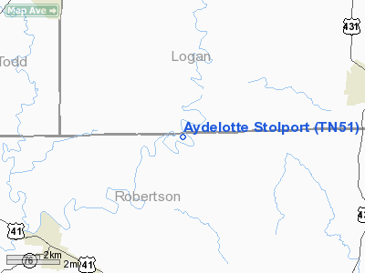
Aydelotte Stolport Airport |
Location & QuickFacts
| FAA Information Effective: | 2008-09-25 |
| Airport Identifier: | TN51 |
| Airport Status: | Operational |
| Longitude/Latitude: | 086-58-35.0000W/36-38-34.0000N
-86.976389/36.642778 (Estimated) |
| Elevation: | 545 ft / 166.12 m (Estimated) |
| Land: | 0 acres |
| From nearest city: | 9 nautical miles NW of Springfield, TN |
| Location: | Robertson County, TN |
| Magnetic Variation: | 00W (1985) |
Owner & Manager
| Ownership: | Privately owned |
| Owner: | Robert Rains Bruce |
| Address: | 6737 Highway 161
Springfield, TN 37172 |
| Phone number: | 615-696-2887 |
| Address: |
|
Airport Operations and Facilities
| Airport Use: | Private |
| Wind indicator: | Yes |
| Segmented Circle: | No |
| Control Tower: | No |
| Lighting Schedule: | PHONE REQ
FOR RWY LIGHTS CALL 615-696-2881. |
| Landing fee charge: | No |
| Sectional chart: | St Louis |
| Region: | ASO - Southern |
| Boundary ARTCC: | ZME - Memphis |
| Tie-in FSS: | BNA - Nashville |
| FSS on Airport: | No |
| FSS Toll Free: | 1-800-WX-BRIEF |
Airport Services
Runway Information
Runway 13/31
| Dimension: | 2200 x 75 ft / 670.6 x 22.9 m |
| Surface: | ASPH-TURF,
ASPH 1500 X 12 FT WITHIN 2200 X 75 FT TURF AREA. |
| |
Runway 13 |
Runway 31 |
| Traffic Pattern: | Left | Left |
|
Radio Navigation Aids
| ID |
Type |
Name |
Ch |
Freq |
Var |
Dist |
| PED | NDB | Needmore | | 221.00 | 01W | 7.0 nm |
| ON | NDB | Music | | 279.00 | 03W | 11.7 nm |
| FK | NDB | Airbe | | 273.00 | 01W | 21.8 nm |
| HIX | NDB | Honey Grove | | 356.00 | 01W | 22.5 nm |
| VI | NDB | Opery | | 344.00 | 02W | 30.7 nm |
| GMH | NDB | Muhlenberg | | 362.00 | 01E | 36.2 nm |
| DMZ | NDB | Dickson | | 203.00 | 01W | 38.0 nm |
| JUE | NDB | Lebanon | | 414.00 | 02W | 42.0 nm |
| LFB | NDB | Lafayette | | 245.00 | 02W | 44.8 nm |
| SWZ | NDB | Sewart | | 391.00 | 02W | 48.1 nm |
| AEY | NDB | Waverly | | 329.00 | 00E | 48.7 nm |
| HXW | TACAN | Screaming Eagle | 096X | | 01W | 25.1 nm |
| CKV | VOR/DME | Clarksville | 043X | 110.60 | 01W | 21.1 nm |
| BWG | VORTAC | Bowling Green | 126X | 117.90 | 02E | 30.9 nm |
| BNA | VORTAC | Nashville | 088X | 114.10 | 02W | 33.5 nm |
| CCT | VORTAC | Central City | 035X | 109.80 | 01W | 46.5 nm |
| BNA | VOT | Nashville Metropoln | | 108.60 | | 34.1 nm |
| MQY | VOT | Smyrna | | 110.20 | | 44.4 nm |
Remarks
- VFR OPERATIONS/PRIVATE USE. USERS ARE AWARE THAT AIRPORT IS 2.5 MILES WEST OF MILITARY TRAINING ROUTES SR-61 AND SR-62.
Images and information placed above are from
http://www.airport-data.com/airport/TN51/
We thank them for the data!
| General Info
|
| Country |
United States
|
| State |
TENNESSEE
|
| FAA ID |
TN51
|
| Latitude |
36-38-34.000N
|
| Longitude |
086-58-35.000W
|
| Elevation |
545 feet
|
| Near City |
SPRINGFIELD
|
We don't guarantee the information is fresh and accurate. The data may
be wrong or outdated.
For more up-to-date information please refer to other sources.
|
|


